Tell es-Sultan (Arabic: تل السلطان, lit. Sultan's Hill), also known as Tel Jericho or Ancient Jericho, is an archaeological site and a UNESCO World Heritage Site in Palestine, in the city of Jericho, consisting of the remains of the oldest fortified city in the world.
It is located adjacent to the Ein es-Sultan refugee camp, two kilometres north of the centre of the Palestinian city of Jericho. The tell was inhabited from the 10th millennium BCE, which makes Jericho among the oldest continually inhabited cities in the world. The site is notable for its role in the history of Levantine archaeology.
The area was first identified as the site of ancient Jericho in modern times by Charles Warren in 1868, on the basis of its proximity to the large spring of Ein es-Sultan, that had been proposed as the spring of Elisha by Edward Robinson three decades earlier.
The droughts and cold of the Younger Dryas came to an end around 9600 BCE, ushering in the Holocene epoch and the Epipaleolithic period of human history. The resulting warmer climate made it possible for Natufian groups to extend the duration of their stay, eventually leading to year-round habitation and permanent settlement. The first permanent settlement at Tell es-Sultan—marked by the construction of Natufian structures—developed between 10,000 and 9000 BCE,[1][2] which appears to predate the invention of agriculture.[3] Tell es-Sultan was a popular camping ground for Natufian hunter-gatherer groups due to the nearby Ein as-Sultan spring; these hunter-gatherers left a scattering of crescent-shaped microlith tools behind.[4]
Pre-Pottery Neolithic A (PPNA)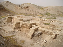 Dwelling foundations unearthed at Tell es-Sultan in Jericho
 Ancestor statue, Jericho, from c. 9000 years ago. Rockefeller Archeological Museum, Jerusalem.
The Pre-Pottery Neolithic A phase at Tell es-Sultan (c. 8500–7500 BCE)[5] saw the emergence of one of the world's first major proto-cities. As the world warmed up, a new culture based on agriculture and sedentary dwelling emerged, which archaeologists have termed "Pre-Pottery Neolithic A" (abbreviated as PPNA), sometimes called the Sultanian era after the town. PPNA villages are characterized by small circular dwellings, burial of the dead under the floor of buildings, reliance on hunting wild game, the cultivation of wild or domestic cereals, and no use of pottery yet.
The PPNA-era town, a settlement of around 40,000 square metres (430,000 sq ft), contained round mud-brick houses, yet no street planning.[6] Circular dwellings were built of clay and straw bricks left to dry in the sun, which were plastered together with a mud mortar. Each house measured about 5 metres (16 ft) across, and was roofed with mud-smeared brush. Hearths were located within and outside the homes.[7]
The identity and number of the inhabitants of Jericho during the PPNA period is still under debate, with estimates going as high as 2000–3000, and as low as 200–300.[8][9] It is known that this population had cultivated emmer wheat, barley and pulses and hunted wild animals.
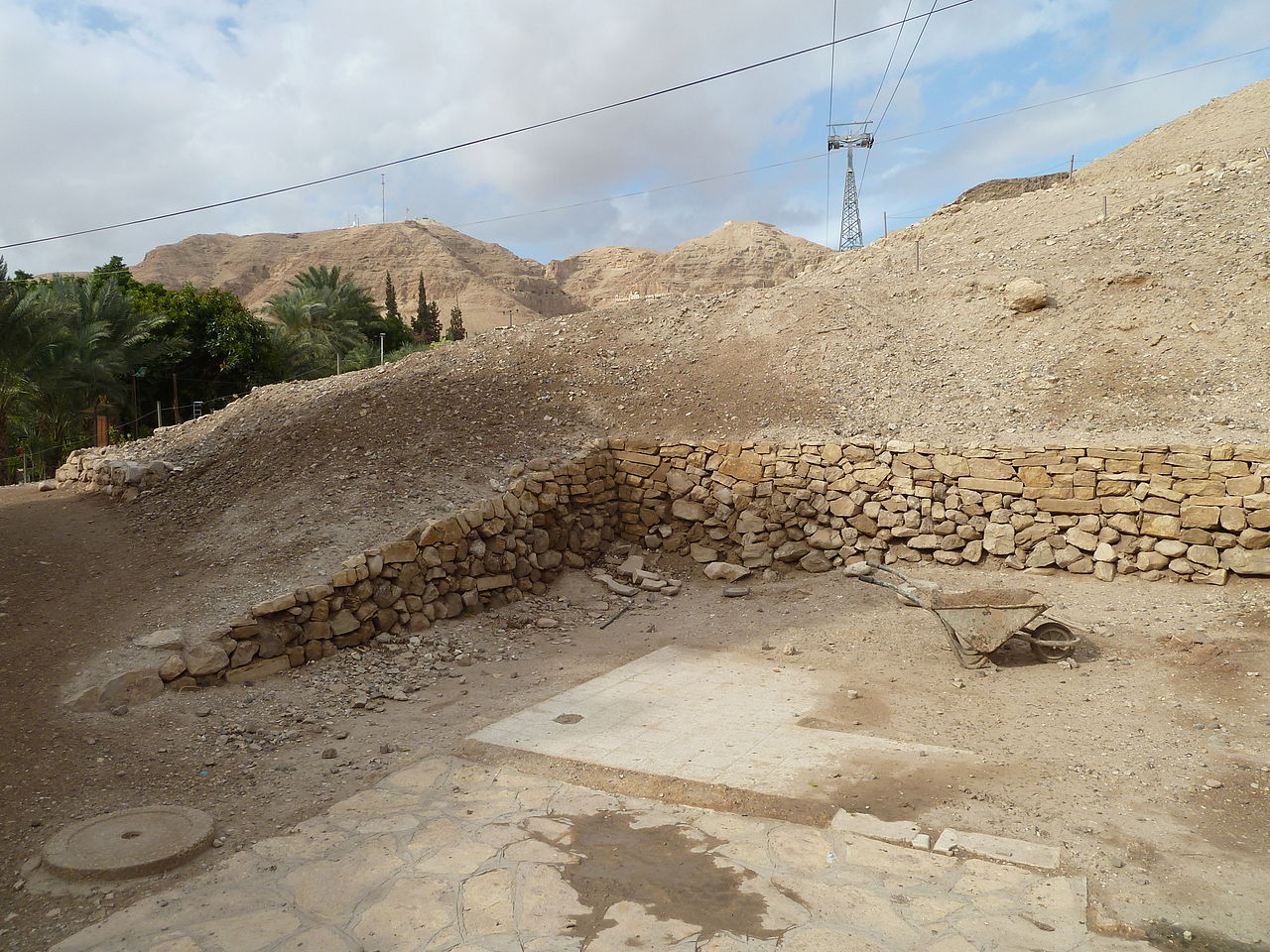
The town was surrounded by a massive stone defensive wall over 3.6 metres (12 ft) high and 1.8 metres (6 ft) wide at the base, inside of which stood a stone tower, placed in the centre of the west side of the tell.[10] This tower was the tallest structure in the world until the Pyramid of Djoser, and the second-oldest tower after the one at Tell Qaramel.[11][12] The wall and tower were built around 8000 BCE.[13][14] For the tower carbon dates published in 1981 and 1983 indicate that it was built around 8300 BCE and stayed in use until c. 7800 BCE.[10] The wall and tower would have taken a hundred men more than a hundred days to construct,[9] thus suggesting some kind of social organization and division of labour.
The major structures highlight the importance of the Tell for the understanding of settlement patterns in the Sultanian period in the southern Levant.[15]
Pre-Pottery Neolithic B (PPNB)After a few centuries, the first settlement was abandoned. After the PPNA settlement phase, there was a settlement hiatus of several centuries, then the Pre-Pottery Neolithic B settlement was founded on the eroded surface of the tell. This second settlement, established in 6800 BCE, perhaps represents the work of an invading people who absorbed the original inhabitants into their dominant culture. Artifacts dating from this period include ten plastered human skulls, painted so as to reconstitute the individuals' features.[16] These represent either teraphim or an early example of portraiture in art history, and it is thought that they were kept in people's homes while the bodies were buried.[3][17]
The architecture consisted of rectilinear buildings made of mudbricks on stone foundations. The mudbricks were loaf-shaped with deep thumbprints to facilitate bonding. No building has been excavated in its entirety. Normally, several rooms cluster around a central courtyard. There is one big room (6.5 m × 4 m (21 ft × 13 ft)) and a second slightly smaller room (7 m × 3 m (23 ft × 10 ft)) containing internal divisions. The remaining areas are small, and presumably used for storage. The rooms have red or pinkish terrazzo-floors made of lime. Some impressions of mats made of reeds or rushes have been preserved. The courtyards have clay floors.
Kathleen Kenyon interpreted one building as a shrine. It contained a niche in the wall. A chipped pillar of volcanic stone that was found nearby might have fit into this niche.
The dead were buried under the floors or in the rubble fill of abandoned buildings. There are several collective burials. Not all the skeletons are completely articulated, which may point to a time of exposure before burial. A skull cache contained seven human skulls. The jaws were removed and the faces covered with plaster; cowries were used as eyes. A total of ten skulls were found. Modeled skulls were found in Tell Ramad and Beisamoun as well.
Other finds included flints, such as arrowheads (tanged or side-notched), finely denticulated sickle-blades, burins, scrapers, a few tranchet axes, obsidian, and green obsidian from an unknown source. There were also querns, hammerstones, and a few ground-stone axes made of greenstone. Other items discovered included dishes and bowls carved from soft limestone, spindle whorls made of stone and possible loom weights, spatulae and drills, stylised anthropomorphic plaster figures, almost life-size, anthropomorphic and theriomorphic clay figurines, as well as shell and malachite beads.
A succession of settlements followed from 4500 BCE onward, the largest constructed in the Early Bronze Age, around 2600 BCE.[16] Tell es-Sultan has been occupied, destroyed, and abandoned many times, as evidenced by its many destruction layers.
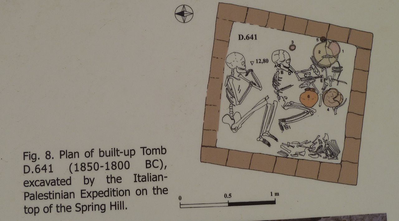
The site appears to have been continuously occupied from the Early Bronze Age into the early part of the Middle Bronze Age. [18] Radiocarbon dating suggests the city was destroyed and abandoned around 2000/1950 BCE.[19] The city was subsequently reconstructed, reaching its greatest extent in the period from 1700 to 1550 BCE. At that time, it was a small but important city of the Canaan region which reflected the greater urbanization in the area. The city has been linked to the rise of the Maryannu, a class of chariot-using aristocrats linked to the rise of the Mitannite state to the north. It was surrounded by extensive defensive walls strengthened with rectangular towers, and possessed an extensive cemetery with vertical shaft-tombs and underground burial chambers; the elaborate funeral offerings in some of these may reflect the emergence of local kings.[18] Kathleen Kenyon reported "the Middle Bronze Age is perhaps the most prosperous in the whole history of Kna'an. ... The defenses ... belong to a fairly advanced date in that period" and there was "a massive stone revetment;... part of a complex system" of defenses (pp. 213–218).[20]
The city was destroyed again in the 16th century at the end of the Middle Bronze Age. The calibrated carbon remains from its City-IV destruction layer date to 1617–1530 BCE, which confirms the accuracy of Kenyon's stratigraphical dating. The current consensus among scholars is that the site was uninhabited from the late 15th century until the 10th/9th centuries BCE,[21] although this has been questioned by recent excavations.[22] Specifically, archaeological excavations have failed to find evidence that the city was inhabited at the time of the Battle of Jericho, as described in the Book of Joshua.[23]
Iron AgeTell es-Sultan remained unoccupied from the end of the 15th to the 10th–9th centuries BCE when the city was rebuilt.[21] Of this new city not much more remains than a four-room house on the eastern slope.[24] By the 7th century Jericho had become an extensive town, but this settlement was destroyed in the Babylonian conquest of Judah in the early 6th century.[21]
Abandonment of the tellIn response to Judah's revolts against Babylon, Jericho was destroyed by the Babylonians in 587/586 BCE.[21] The city was rebuilt during the Persian period after the Jews were freed from the Babylonian captivity. There are very few remains from this period, and the site was abandoned as a place of settlement not long after this period.[24]


![[node:title]](/sites/default/files/styles/640x320/public/default_images/default_0.JPG.webp?itok=aqV9zhFR)


 - Public domain")


Add new comment