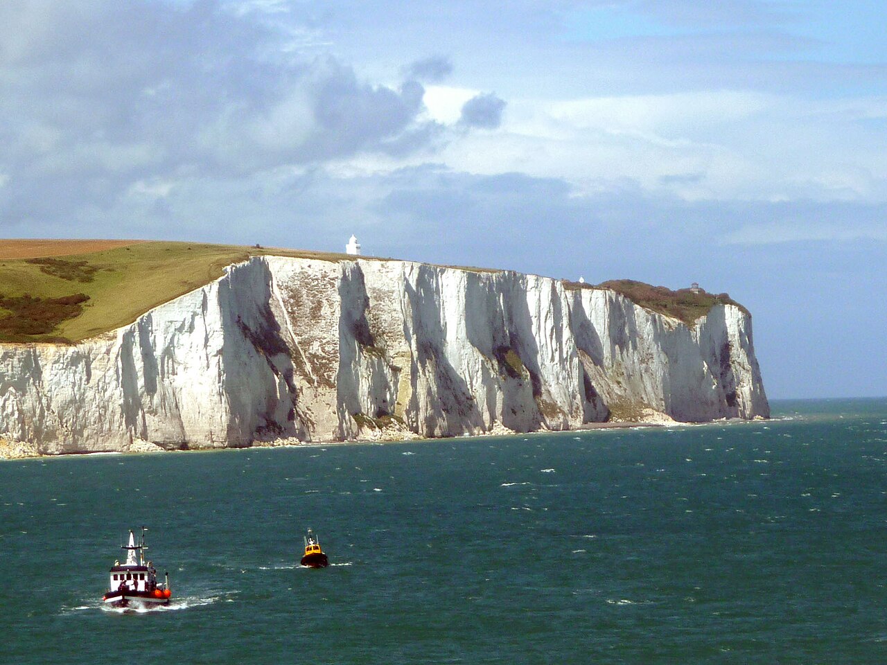
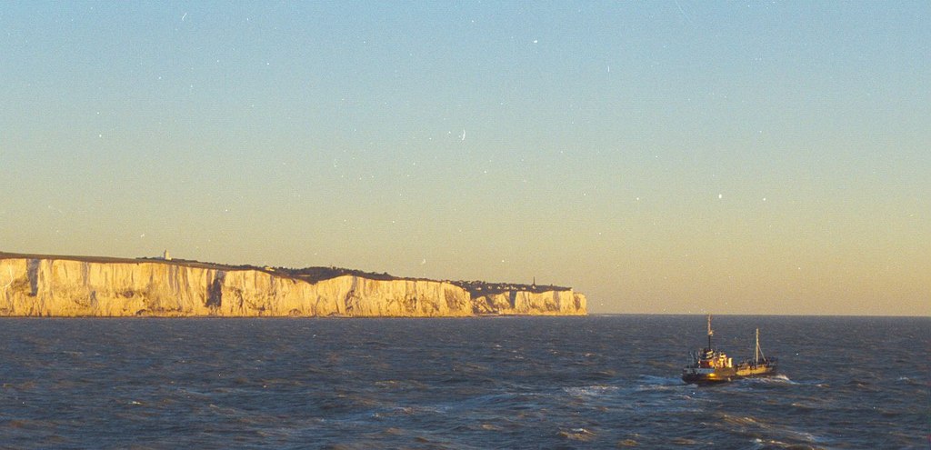
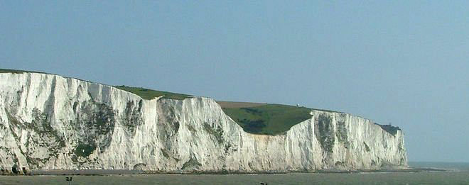
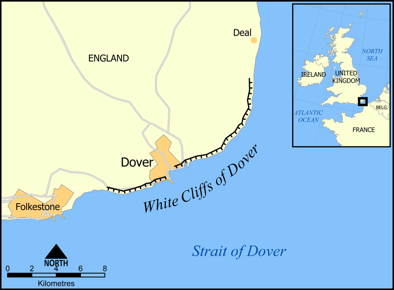
The White Cliffs of Dover are the region of English coastline facing the Strait of Dover and France. The cliff face, which reaches a height of 350 feet (110 m), owes its striking appearance to its composition of chalk accented by streaks of black flint, deposited during the Late Cretaceous. The cliffs, on both sides of the town of Dover in Kent, stretch for eight miles (13 km). The White Cliffs of Dover form part of the North Downs. A section of coastline encompassing the cliffs was purchased by the National Trust in 2016.
The cliffs are part of the Dover to Kingsdown Cliffs Site of Special Scientific Interest and Special Area of Conservation. The point where Great Britain is closest to continental Europe, on a clear day the cliffs are visible from France, approximately 20 miles (32 km) away. A celebrated UK landmark, the cliffs have featured on commemorative postage stamps issued by the Royal Mail, including in their British coastline s...Read more
The White Cliffs of Dover are the region of English coastline facing the Strait of Dover and France. The cliff face, which reaches a height of 350 feet (110 m), owes its striking appearance to its composition of chalk accented by streaks of black flint, deposited during the Late Cretaceous. The cliffs, on both sides of the town of Dover in Kent, stretch for eight miles (13 km). The White Cliffs of Dover form part of the North Downs. A section of coastline encompassing the cliffs was purchased by the National Trust in 2016.
The cliffs are part of the Dover to Kingsdown Cliffs Site of Special Scientific Interest and Special Area of Conservation. The point where Great Britain is closest to continental Europe, on a clear day the cliffs are visible from France, approximately 20 miles (32 km) away. A celebrated UK landmark, the cliffs have featured on commemorative postage stamps issued by the Royal Mail, including in their British coastline series in 2002 and UK A-Z series in 2012.


![[node:title]](/sites/default/files/styles/640x320/public/default_images/default_0.JPG.webp?itok=aqV9zhFR)


. - CC BY-SA 3.0")


Add new comment