Stuðlagil
PeterThoeny
PeterThoeny
herbraab
PeterThoeny
herbraab
herbraab
herbraab
herbraab
herbraab
herbraab
herbraab
bonacherajf
herbraab
bonacherajf
mzagerp
herbraab
bonacherajf
bonacherajf
bonacherajf
bonacherajf
bonacherajf
herbraab
bonacherajf
mzagerp
bonacherajf
bonacherajf
bonacherajf
dtpancio
travelourplanet.com
dtpancio
dtpancio
dtpancio
travelourplanet.com
bonacherajf
mauro gambini
mauro gambini
travelourplanet.com
travelourplanet.com
travelourplanet.com
travelourplanet.com
travelourplanet.com
travelourplanet.com
travelourplanet.com
travelourplanet.com
MarclArt
travelourplanet.com
Bodoluy
travelourplanet.com
herbraab
travelourplanet.com
PeterThoeny
PeterThoeny
herbraab
PeterThoeny
herbraab
herbraab
herbraab
herbraab
herbraab
herbraab
herbraab
bonacherajf
mzagerp
herbraab
herbraab
bonacherajf
herbraab
bonacherajf
bonacherajf
bonacherajf
bonacherajf
bonacherajf
herbraab
bonacherajf
mzagerp
bonacherajf
bonacherajf
bonacherajf
dtpancio
travelourplanet.com
dtpancio
dtpancio
dtpancio
travelourplanet.com
bonacherajf
mauro gambini
mauro gambini
travelourplanet.com
travelourplanet.com
travelourplanet.com
travelourplanet.com
travelourplanet.com
travelourplanet.com
travelourplanet.com
travelourplanet.com
travelourplanet.com
MarclArt
travelourplanet.com
Bodoluy
travelourplanet.com
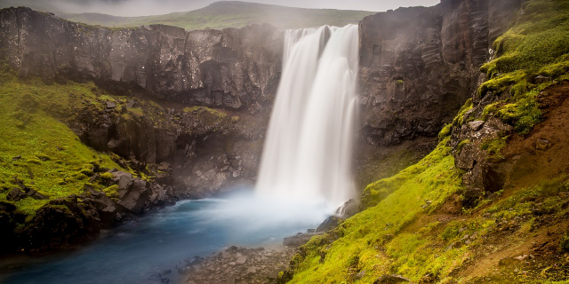
Stuðlagil (Icelandic pronunciation: [ˈstʏðlaˌcɪːl̥]; also transliterated as Studlagil) is a ravine in Jökuldalur [ˈjœːkʏlˌtaːlʏr̥] in the municipality of Múlaþing, in the Eastern Region of Iceland. It is known for its columnar basalt rock formations and the blue-green water that runs through it. It became an unexpected tourist sensation after being shown in a WOW air brochure in 2017. The rock formation is 30 meters (98 ft) tall.
The river Jökla runs through the ravine. The water level decreased by 7 to 8 meters (23 to 26 ft) after the opening of the Kárahnjúkar Hydropower Plant in 2009.
Photographies by:
Zones
Statistics: Position (field_position)
1521
Statistics: Rank (field_order)
79643
Add new comment