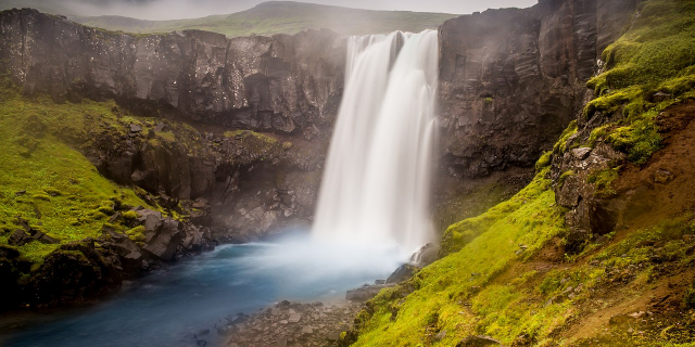
Seyðisfjörður (Icelandic pronunciation: [ˈseiːðɪsˌfjœrðʏr̥] ) is a town in the Eastern Region of Iceland at the innermost point of the fjord of the same name. The town is located in the municipality of Múlaþing.
A road over Fjarðarheiði mountain pass (elevation 600 m or 2,000 ft) connects Seyðisfjörður to the rest of Iceland; 27 kilometres (17 miles) to the ring road and Egilsstaðir. Seyðisfjörður is surrounded by mountains with the most prominent Mt. Bjólfur to the west (1085 m) and Strandartindur (1010 m) to the east. The fjord itself is accessible on each side from the town, by following the main road that leads through the town. Further out the fjord is fairly remote but rich with natural interests including puffin colonies and ruins of former activity such as nearby Vestdalseyri [ˈvɛstˌtalsˌeiːrɪ], from where the local church was transported.
Settlement in Seyðisfjörður traces back to the early period of settlement in Iceland. The first settler was Bjólfur, who occupied the entire fjord. The ruin of a burned-down stave church at Þórunnarstaðir [ˈθouːrˌʏnːarˌstaːðɪr̥] was excavated in 1998-1999 and carbon-dated to the 11th century.[1]
The town settlement in the Seyðisfjörður area started in 1848. The town was settled by Norwegian fishermen. These settlers also built some of the wooden buildings which still exist in the town. Another now-deserted settlement nearby in the fjord, Vestdalseyri was the site for the world's first modern industrialized whaling station. It was established in 1864 by American whaler Thomas Welcome Roys and run by him and his workforce until 1866. Both settlements served primarily as fishing and trading posts. The first telegraph cable connecting Iceland to Europe made landfall in Seyðisfjörður in 1906, making it a hub for international telecommunications well past the middle of last century. In 1913, a dam was made in the main river, harnessing power for the country's first high-voltage AC power plant together with a distribution network for street lighting and home use,[2] also the first of its kind in Iceland. Seyðisfjörður was used as a base for British/American forces during World War II and remnants of this activity are visible throughout the fjord, including a landing strip no longer in use and an oil tanker SS El Grillo that was bombed and sunk. It remains a divers' wreck at the bottom of the fjord.
With the recent demise of the local fish-processing plant, the village has shifted its economy to tourism. It still remains a significant fishing port on the east coast of Iceland, with harbours, ship construction facilities and a slip.
In December 2020, a series of mudflows hit the town after days of heavy raining, destroying several houses.[3] After 10 houses where damaged on 18 December, including the headquarters of the local SAR team,[4] a complete evacuation of the town was ordered.[5][6][7] A month after the mudflow had hit the town, the damage was fully estimated. In all, 39 houses had been damaged, twelve of which being completely destroyed and five more significantly damaged. The total damage was estimated by the Government of Iceland at over 1 billion Icelandic Króna (US$7.5m).[8] Residents were allowed to return to their homes (if not destroyed) in October 2021 after protections were installed.[9]


Add new comment