port prinsesa
( Puerto Princesa )
Puerto Princesa, officially the City of Puerto Princesa (Cuyonon: Siyudad i'ang Puerto Princesa; Filipino: Lungsod ng Puerto Princesa), is a 1st class highly urbanized city in the Mimaropa region of the Philippines. According to the 2020 census, it has a population of 307,079 people.
It is a city located in the western Philippine province of Palawan and is the westernmost city in the Philippines. Though the seat of government and capital for the province, the city itself is one of 38 independent cities within the Philippines not controlled by the province in which it is geographically located and is therefore an independent area located within Palawan.
It is the least densely populated city in the Philippines with 110 inhabitants per square kilometre (280/square mile). In terms of land area, the city is the second largest geographically after Davao City with an area of 2,381.02 square kilometres (919...Read more
Puerto Princesa, officially the City of Puerto Princesa (Cuyonon: Siyudad i'ang Puerto Princesa; Filipino: Lungsod ng Puerto Princesa), is a 1st class highly urbanized city in the Mimaropa region of the Philippines. According to the 2020 census, it has a population of 307,079 people.
It is a city located in the western Philippine province of Palawan and is the westernmost city in the Philippines. Though the seat of government and capital for the province, the city itself is one of 38 independent cities within the Philippines not controlled by the province in which it is geographically located and is therefore an independent area located within Palawan.
It is the least densely populated city in the Philippines with 110 inhabitants per square kilometre (280/square mile). In terms of land area, the city is the second largest geographically after Davao City with an area of 2,381.02 square kilometres (919.32 sq mi). Puerto Princesa is the location of the Philippines' Western Command headquarters.
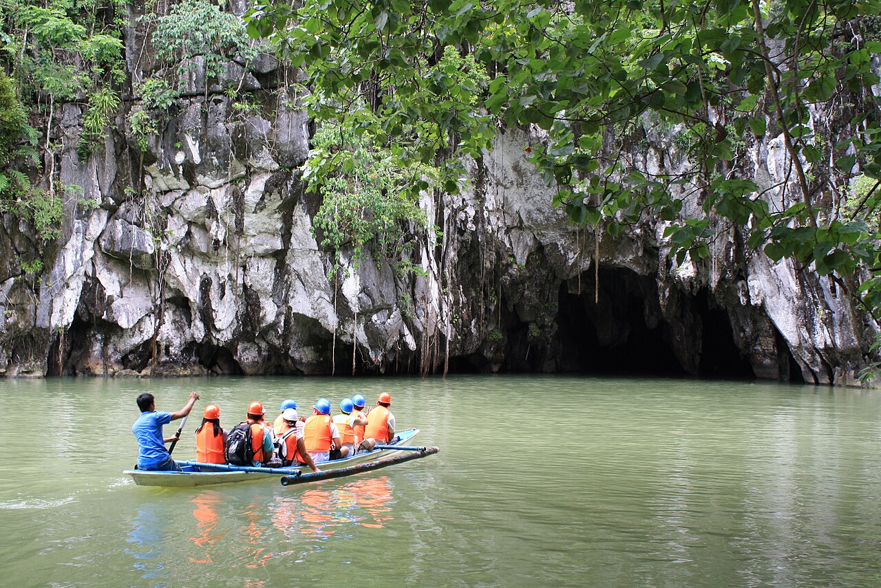
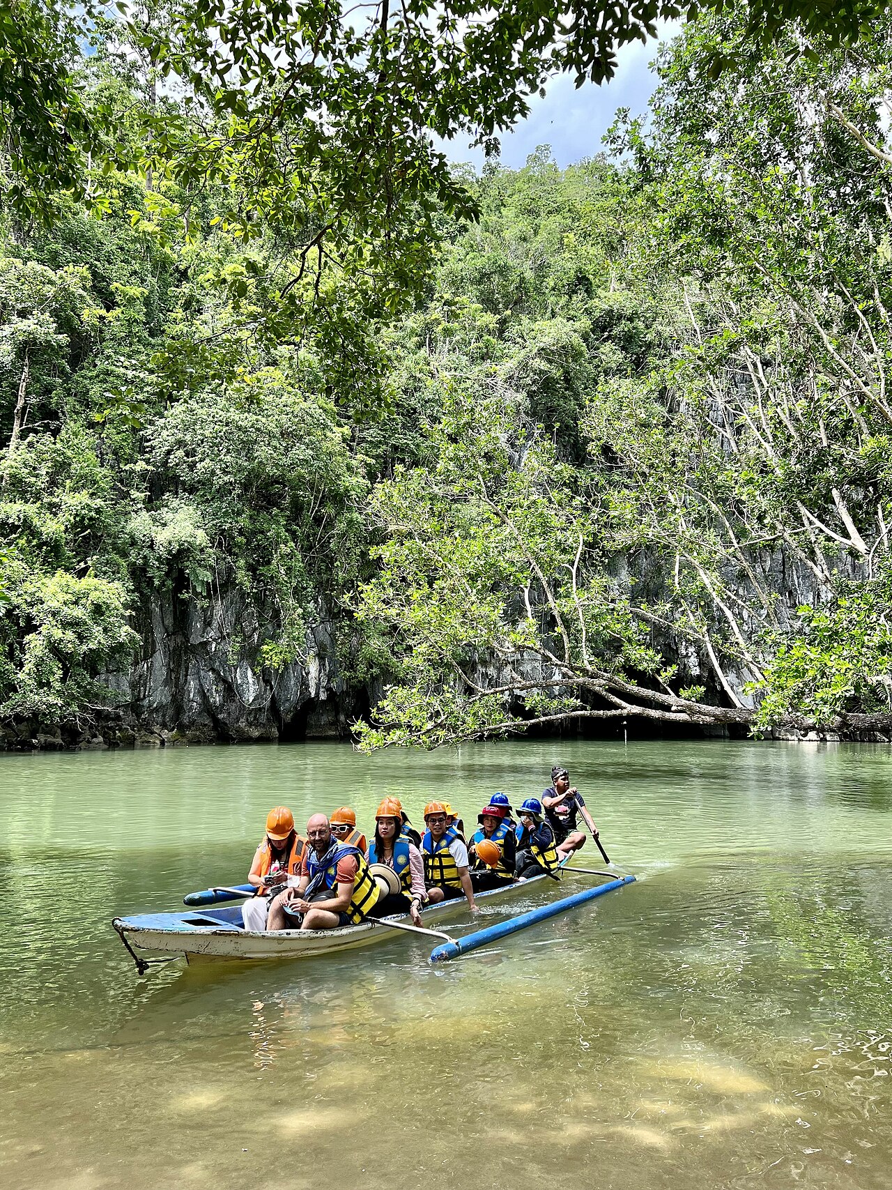
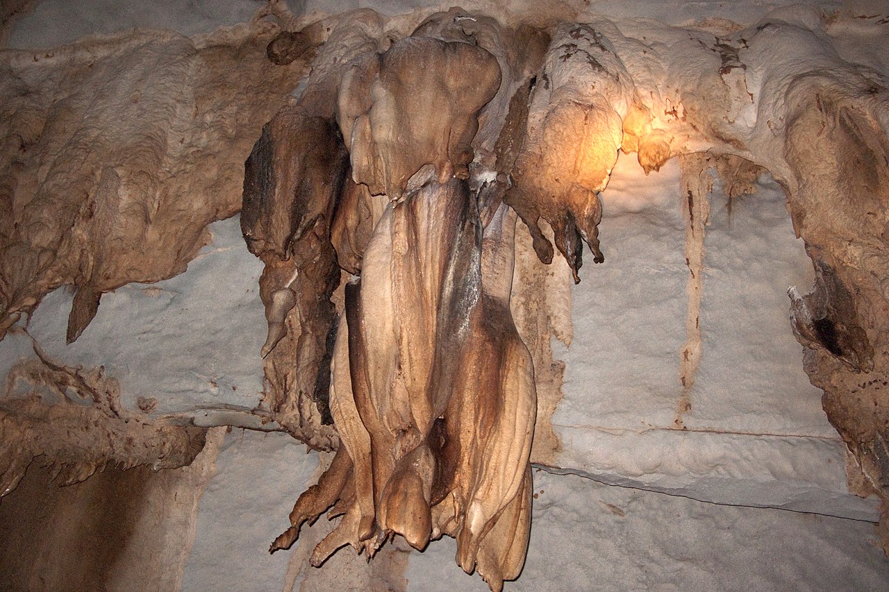
Today, Puerto Princesa is a tourist city with many beach resorts and seafood restaurants. It has been acclaimed several times as the cleanest and greenest city in the Philippines.

Spanish colonizers founded the settlement on March 4, 1872, in the course of their exploration of the province. As they scanned the Palawan shoreline for a capital site, they came upon a hill with steep declivity. Rowing to shore, they surveyed the hill and discovered an extensive plateau which they decided as ideal for settlement.
Soon after, Fr. Antonio Muro levelled a portion of the hill to make way for a chapel (that section is now occupied by the Roman Catholic Cathedral, the P.C. Barracks and the Rizal Park, the Old Municipal Building used to be there, as well as an Elementary School). The first mass celebrated in Puerto Princesa took place at a site where a marker now stands.
In May 1872, the Port of Puerto Princesa became the center of Spanish Naval Operations in the area because the Bay met all the Navy's requirements. Royal Decrees later provided incentives to settlers, and by 1883 the settlement had flourished into a town of twelve roads, a hospital and well-built port.
In 1894, Puerto Princesa was recognized by government authorities as one of the most beautiful towns in the country by virtue of the orderly distribution of streets, buildings and houses as well as the cleanliness of the community.[citation needed]
American period and World War II
In 1911, the New American Administration made Puerto Princesa the seat of the Palawan Provincial Government with Major John Brown as Lieutenant Governor.
In the year 1936, Governor Heginio Mendoza made a directive on the transfer of the Palawan High School (currently Palawan National School) from the island municipality of Cuyo to the central place of the province, which was the Municipality of Puerto Princesa.[1]
During WWII and the Japanese occupation, the village was largely abandoned. On May 18, 1942, Japanese troops landed and occupied Puerto Princesa City.[2]
The Filipino Constabulary barracks was the scene of the Palawan Massacre, just before liberation with the allied Invasion of Palawan.[3]
Post-World War IIIn 1951, the barrios of Tinitian, Caramay, Rizal, Del Pilar, Malcampo, Tumarbong, Taradungan, Ilian, and Capayas were separated to form the town of Roxas.[4]
In 1955, the sitios of Materingen, Tandayag, Nasedoc, and Panlawagan were separated from the barrio of Maroyogon and elevated into a barrio.[5]
In 1956, the sitios of Calagbenguen, Tarabanan, Bendoyan, Talabigan, Tagbuan, and Langogan were constituted into the barrio of Concepcion.[6]
In 1957, the barrio of Tapul was renamed to Salvacion.[7]
CityhoodThe town was converted into a city on January 1, 1970, under Republic Act 5906 as amended by P.D. 437,[8][9] through the effort of then Congressman Ramon Mitra, Jr. Feliberto R. Oliveros, Jr., who then became the first City Mayor.
Highly urbanized cityOn March 26, 2007, Proclamation No. 1264, converting the city of Puerto Princesa into a highly urbanized city, was signed by President Gloria Macapagal Arroyo. The plebiscite was held along with Lapu-Lapu City in Cebu on July 21, 2007. The majority of voters voted to accept the conversion into a HUC. Puerto Princesa became the 31st highly urbanized city in the Philippines. Meanwhile, the "Yes" votes won in Lapu-Lapu City, making the city as the 32nd highly urbanized city in the country.
ContemporaryIn May 2001, Abu Sayyaf gunmen entered the luxury Dos Palmas Resort in Honda Bay just off the coast of Puerto Princesa and kidnapped 20 people from the resort, including four resort staff and three Americans.[10]
Since its foundation, Puerto Princesa has been the nerve center of activities in Palawan. Aside from being the seat of public administration, it is the heart of trade, commerce, service, and industry in the province.
Add new comment