El Nido, Palawan

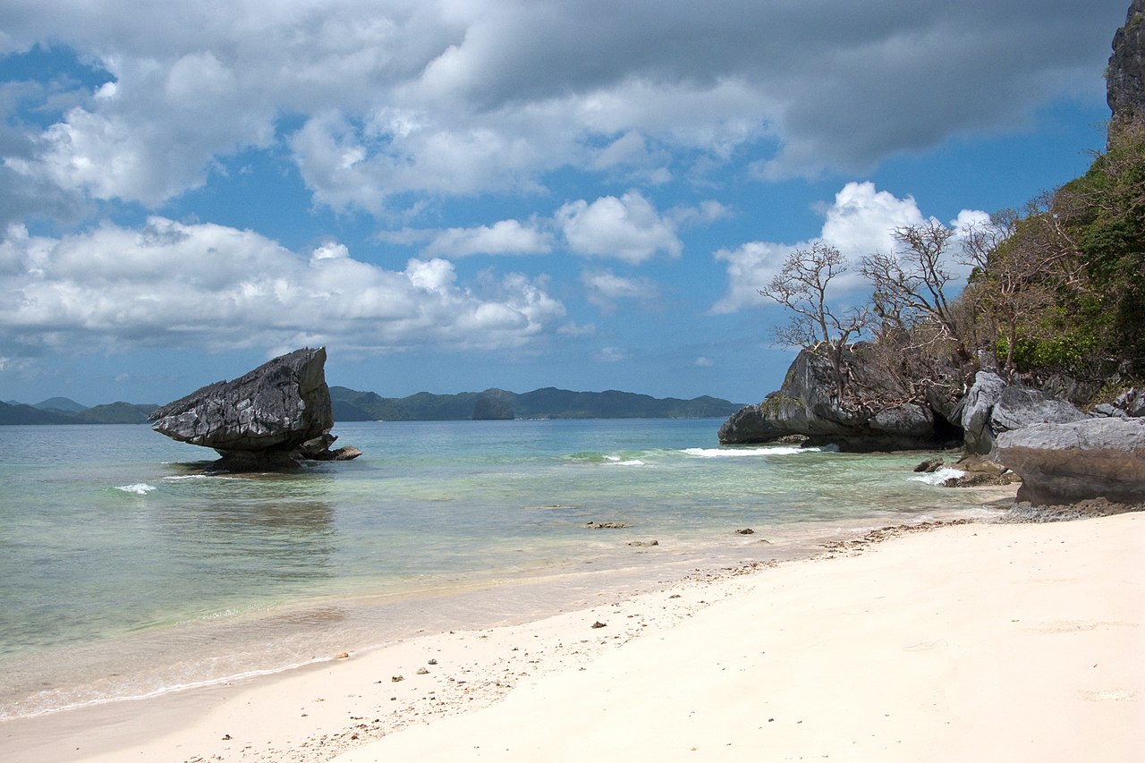
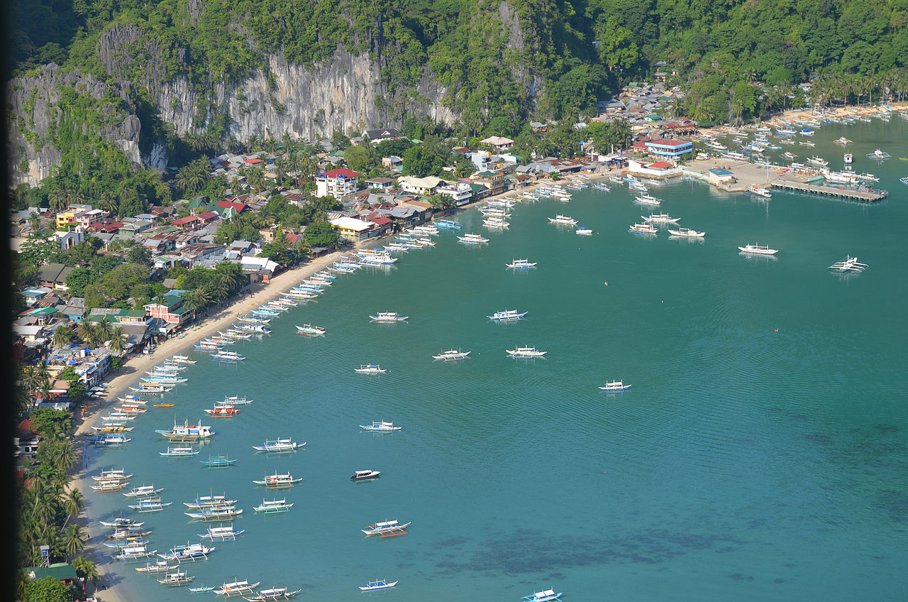
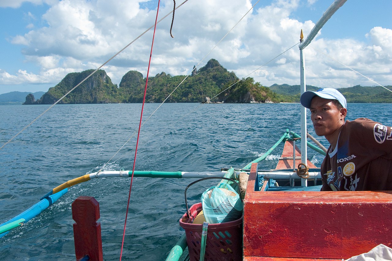
El Nido, officially the Municipality of El Nido (Cuyonon: Banwa i'ang El Nido, Tagalog: Bayan ng El Nido), is a 1st class municipality in the province of Palawan, Philippines. According to the 2020 census, it has a population of 50,494 people.

Situated about 420 kilometres (260 mi) south-west of Manila, and 269 kilometres (167 mi) north-east of Puerto Princesa, the capital of Palawan. A managed resource protected area, it is renowned for its white-sand beaches, coral reefs, and limestone cliffs, as well as for being the gateway to the Bacuit archipelago.

El Nido, also known as Bacuit, has been inhabited by humans since at least 2680 BC, possibly as early as 22,000 years ago.[1] This was confirmed by fossils and burial sites dating back to the Late Neolithic Age that can be found in many caves and excavation sites surrounding the municipality, particularly in Dewil Valley's Ille Cave in New Ibajay. Chinese traders regularly visited the area of Palawan for its edible birds' nests during the Song dynasty (960–1279). The island was mentioned in Chinese records of 1225. Chau Ju-Kua, a trade commissioner of the port of Chuan, wrote about the island, Pa-Lao-Yu or Land of Beautiful Harbors, in his book Chu Fan Chi.[2]

The town traces its roots from a small Tagbanwa village called Talindak. Sometime in the 16th century, waves of migrants from Cuyo Islands settled in the area. In the 1800s, the Spaniards arrived, and they moved to the area where the present-day Población and Mabini are located.[2] The first Spanish families were the Canovas, Vázquez, Ríos, and Rey. In 1890, the Spaniards renamed it Bacuit. At the time, the center of the town was Cabigsing, then known as Inventario. Chinese families moved into the area about the same period, first settling in Langeblangeban. The first Chinese settlers were named Lim, Chin, Liao, Edsan, Ambao, Que-Ke, Lim Piao, Yu His, Pe Phan, and Pe Khen.[2]

During the Spanish colonial era, the town was under the jurisdiction of the Municipality of Taytay, which was the capital of the former Province of Calamianes from 1818, and the Province of Castilla, the area of what is now known as northern Palawan, from 1858. It remained part of Taytay until 1916, when it formally became an independent municipality.[2] The new municipality was then known as Bacuit.

On June 17, 1954, Republic Act No. 1140[3] was approved, changing the name of the town from Bacuit to its present name, El Nido, after the edible nests of swiftlets (collocalia fuciphaga) found in the crevices of its limestone cliffs. These nests, nido in Spanish, the main ingredient for the gourmet nido soup, are being sold at approximately US$ 3,000 per kilogram.[4]

In 1957, the following barrios were created:

Villa Paz comprising the sitios of New Igabas, Candolay, Malapaho, Mabeñgeten, Dewel, Nalbekan, and Lapia; Bebeladan comprising the sitios of Mainlong, Bolabod, Balete, Culiong, Codongnon, Vigan, Pagawanen, Langeblangeban, Talulap, Bocboc, Miadiao, Avirawan, Pita, Deboluan, Balay-Bacaco, Kiminawit, Pamontonan, Simpian, Binabanan, Tegas, and Pinacpanacan; Bagong-Bayan comprising the sitios of Manogtog, Cadleman, Pinagtual, Omao, Nami, Tebey, Bato, Tuñgay, Cataaban, and Lomocob; Pasadeña comprising the sitios of Lamoro, Cagbatang, Bulalacao, Pinañganteñgan, Quinawañgan, Nagbaclao, Colantod, Loblob, and Badiang; Sibaltan comprising the sitios of Turatod, Buluang, Santa Monica, Senodioc, Laolao, Caboñgan, Tapic, Panian, Guitan, Loro, and Nagcalasag; Barotuan comprising the sitios of Taberna, Locaroc, Nagpan, Yocoton, Calitang, Wawa, Makinit, Canoling, Mabañgaon, and Mapeldeten; San Fernando comprising the sitios of Panian, Madorianen, Dipnay, Maubog, Guenleng, Palabuayan, Parañgaycayan, San Pablo, and Olac-olacan; and, Villa Libertad comprising the sitios of Calelenday, Taolili, Boloc, Inigtan, Mepague, Matolatolaon, Dao, Batbat, Madacotdacot, Nasigdan, Semenled, Bancalen, and Cagbanaba.[5] In the same year, the barrio of Oton was renamed to Mabini.[6]
^ History of Palawan Archived January 15, 2009, at the Wayback Machine. Campersponit website. Accessed January 26, 2009. ^ a b c d Cite error: The named reference elnidotourism was invoked but never defined (see the help page). ^ "Republic Act no. 1140". Chan Robles Virtual Law Library. Retrieved on October 20, 2010. ^ Cite error: The named reference elnidoresorts_towninfo was invoked but never defined (see the help page). ^ "An Act Creating Certain Barrios in the Municipality of El Nido, Province of Palawan". LawPH.com. Archived from the original on July 11, 2012. Retrieved April 12, 2011. ^ "An Act Changing the Name of Barrio Oton, Municipality of El Nido, Province of Palawan, to Mabini". LawPH.com. Archived from the original on July 13, 2012. Retrieved April 13, 2011.
Photographies by:
nennnn - CC BY 2.0
Statistics: Position
1567
Statistics: Rank
78617

Add new comment

Esta pregunta es para comprobar si usted es un visitante humano y prevenir envíos de spam automatizado.

Security
693152874Click/tap this sequence: 7198

Google street view

Where can you sleep near El Nido, Palawan ?

Booking.com
489.933 visits in total, 9.198 Points of interest, 404 Destinations, 98 visits today.