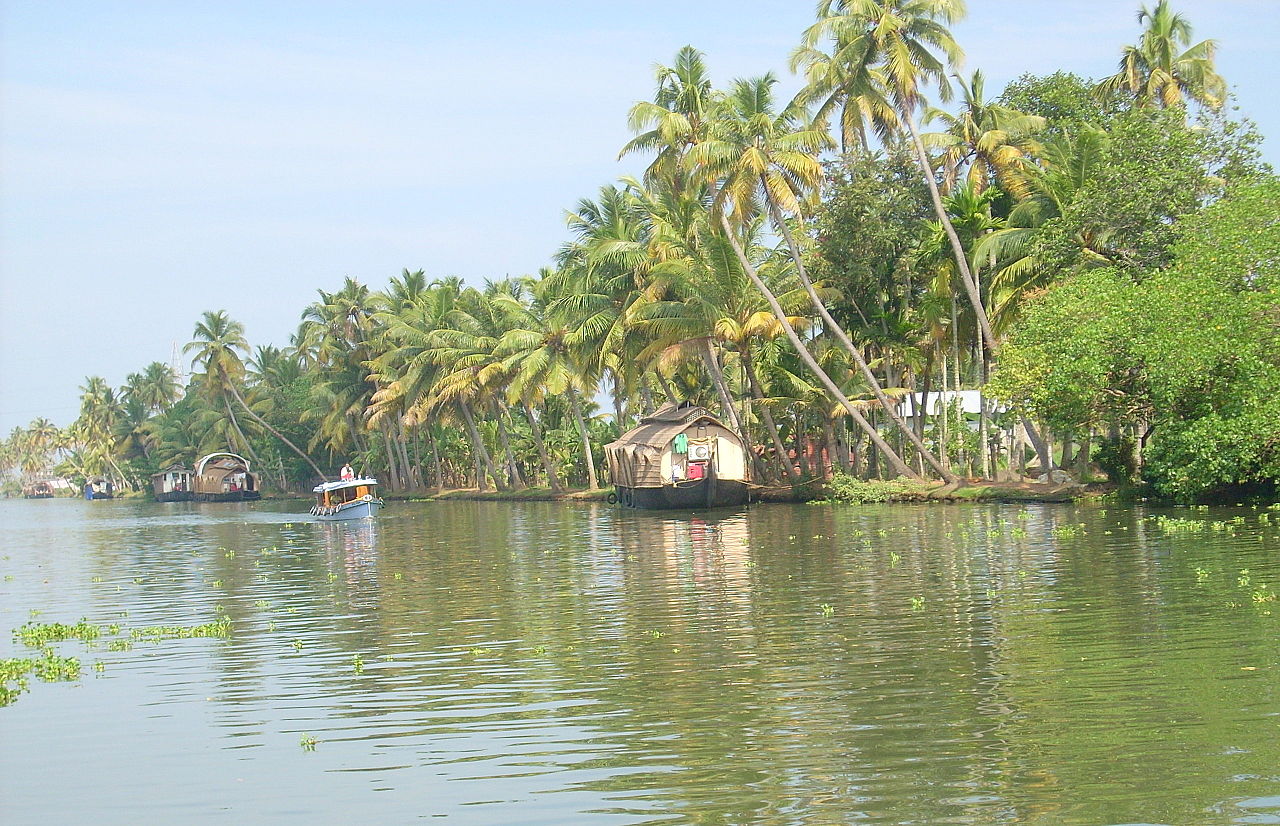
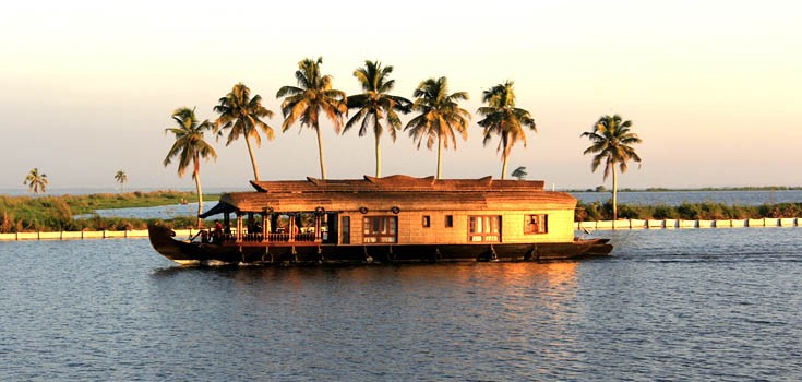
Kuttanad (Malayalam: കുട്ടനാട്‌) is a region covering the Alappuzha, Kottayam and Pathanamthitta Districts, in the state of Kerala, India, well known for its vast paddy fields and geographical peculiarities. The region has the lowest altitude in India, and is one of the few places in the world where farming is carried on around 1.2 to 3.0 metres (4 to 10 ft) below sea level. Kuttanad is historically important in the ancient history of South India and is the major rice producer in the state. Farmers of Kuttanad are famous for Biosaline Farming. Food and Agriculture Organization (FAO) has declared the Kuttanad Farming System as a Globally Important Agricultural Heritage System (GIAHS) in 2013.

Four of Kerala's major rivers, the Pamba, Meenachil, Achankovil and Manimala flow into the region. It is well known for its boat race in the Punnamada Backwaters, known in Malayalam as Vallamkalli.

Kuttanad has no recorde...Read more

Kuttanad (Malayalam: കുട്ടനാട്‌) is a region covering the Alappuzha, Kottayam and Pathanamthitta Districts, in the state of Kerala, India, well known for its vast paddy fields and geographical peculiarities. The region has the lowest altitude in India, and is one of the few places in the world where farming is carried on around 1.2 to 3.0 metres (4 to 10 ft) below sea level. Kuttanad is historically important in the ancient history of South India and is the major rice producer in the state. Farmers of Kuttanad are famous for Biosaline Farming. Food and Agriculture Organization (FAO) has declared the Kuttanad Farming System as a Globally Important Agricultural Heritage System (GIAHS) in 2013.

Four of Kerala's major rivers, the Pamba, Meenachil, Achankovil and Manimala flow into the region. It is well known for its boat race in the Punnamada Backwaters, known in Malayalam as Vallamkalli.

Kuttanad has no recorded history on the origin of the land. But a blend of myths and legends is transferred from generation to generation orally among local people. Kuttanad was once believed to be a wild forest with dense tree growth which was destroyed subsequently by a wild fire. Chuttanad (place of the burnt forest), was eventually called Kuttanad. Until the recent past burned black wooden logs were mined from paddy fields called as ‘Karinilam’(Black paddy fields). This fact substantiates the theory of Chuttanad evolving to Kuttanad. Ramankary, Puthukkary, Amichakary, Oorukkary, Mithrakary, Mampuzhakary, Kainakary, Chathurthiakary and Chennamkary are some familiar place names in Kuttanad.

This section needs additional citations for verification. Please help improve this article by adding citations to reliable sources in this section. Unsourced material may be challenged and removed.
Find sources: "Kuttanad" – news · newspapers · books · scholar · JSTOR
(February 2023) (Learn how and when to remove this template message)

The first recorded history of this land is obtained from the Sangam period literature. According to the Sangam era texts, Uthiyan Cheralatan (Perum Chorru Udiyan Cheralathan, Athan I or Udiyanjeral) is the first recorded Chera dynasty ruler of the Sangam period in ancient Kerala.[1][2]

He had his capital at a place called Kuzhumur in Kuttanad (central Kerala) and expanded the kingdom northward and eastward from his original homeland. His lifetime is broadly determined to be between first century BC and 2nd century AD. His queen was Veliyan Nallini, the daughter of Veliyan Venman.[citation needed]

Uthiyan Cheralathan was a contemporary of the Chola ruler Karikala Chola. He is praised for his elephant corps and cavalry. Present day Changanacherry end of Kuttanad was the capital of the Chera dynasty king Uthiyan Cheralathan.

His descendant was Cenkuttuvan (Chenkuttuvan means "Alluring Kuttuvan" in Malayalam) and his name is carried by the towns of Chenganacherri and Chengana to the present day). The native place of the Kuttuva tribe came to be known as Kuttanadu. According to sangam literature, Uthiyan Cheralathan was defeated in the Battle of Venni against Karikala Chola and the capital was burnt down.[citation needed]

Black wooden logs were mined from paddy fields called as "Karinilam" ("black paddy fields") until the recent past. In Kuttanad most of the place names end in 'kari' (meaning burnt residue or charcoal). Some familiar place names are Ramankary, Puthukkary, Amichakary, Oorukkary, Mithrakary, Mampuzhakary, Kainakary, Kandanakary, Thayamkary, Chathenkary, Chathurthiakary and Chennamkary.[citation needed]

^ Singh, Upinder (2008). A History of Ancient and Early Medieval India: from the Stone Age to the 12th century. New Delhi: Pearson Longman. p. 384. ISBN 978-81-317-1120-0. ^ Sen, Sailendra (2013). A Textbook of Medieval Indian History. Primus Books. pp. 60–61. ISBN 978-9-38060-734-4.
Photographies by:
Achuthan K V - CC BY-SA 4.0
Statistics: Position
8688
Statistics: Rank
3063

Add new comment

Esta pregunta es para comprobar si usted es un visitante humano y prevenir envíos de spam automatizado.

Security
631728549Click/tap this sequence: 5362

Google street view

Where can you sleep near Kuttanad ?

Booking.com
489.805 visits in total, 9.196 Points of interest, 404 Destinations, 56 visits today.