High Line
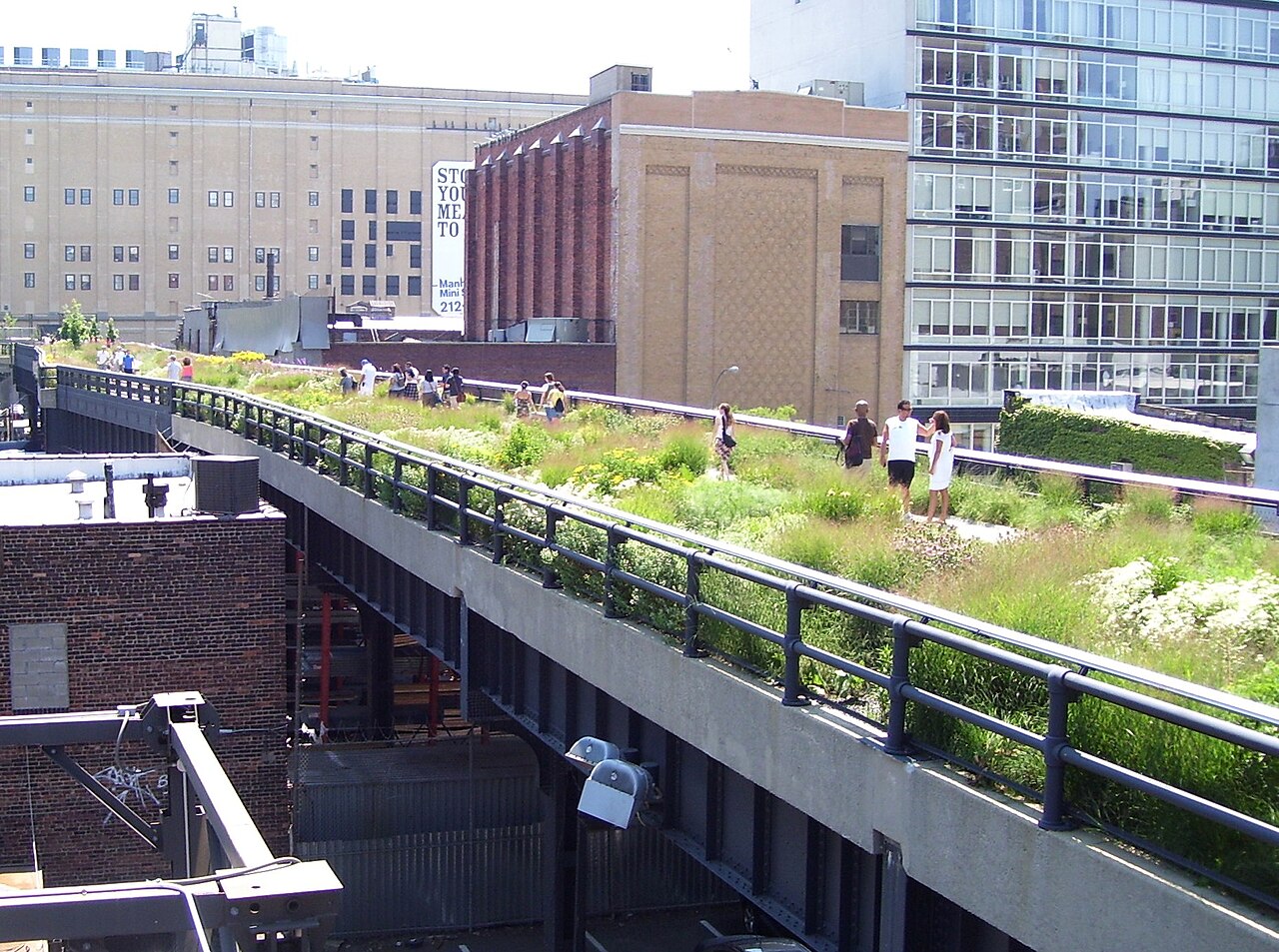
The High Line is a 1.45-mile-long (2.33 km) elevated linear park, greenway, and rail trail created on a former New York Central Railroad spur on the West Side of Manhattan in New York City. The High Line's design is a collaboration between James Corner Field Operations, Diller Scofidio + Renfro, and Piet Oudolf. The abandoned spur has been redesigned as a "living system" drawing from multiple disciplines which include landscape architecture, urban design, and ecology. The High Line was inspired by the 4.7 km (2.9 mi) long Coulée verte (tree-lined walkway), another elevated park in Paris completed in 1993.
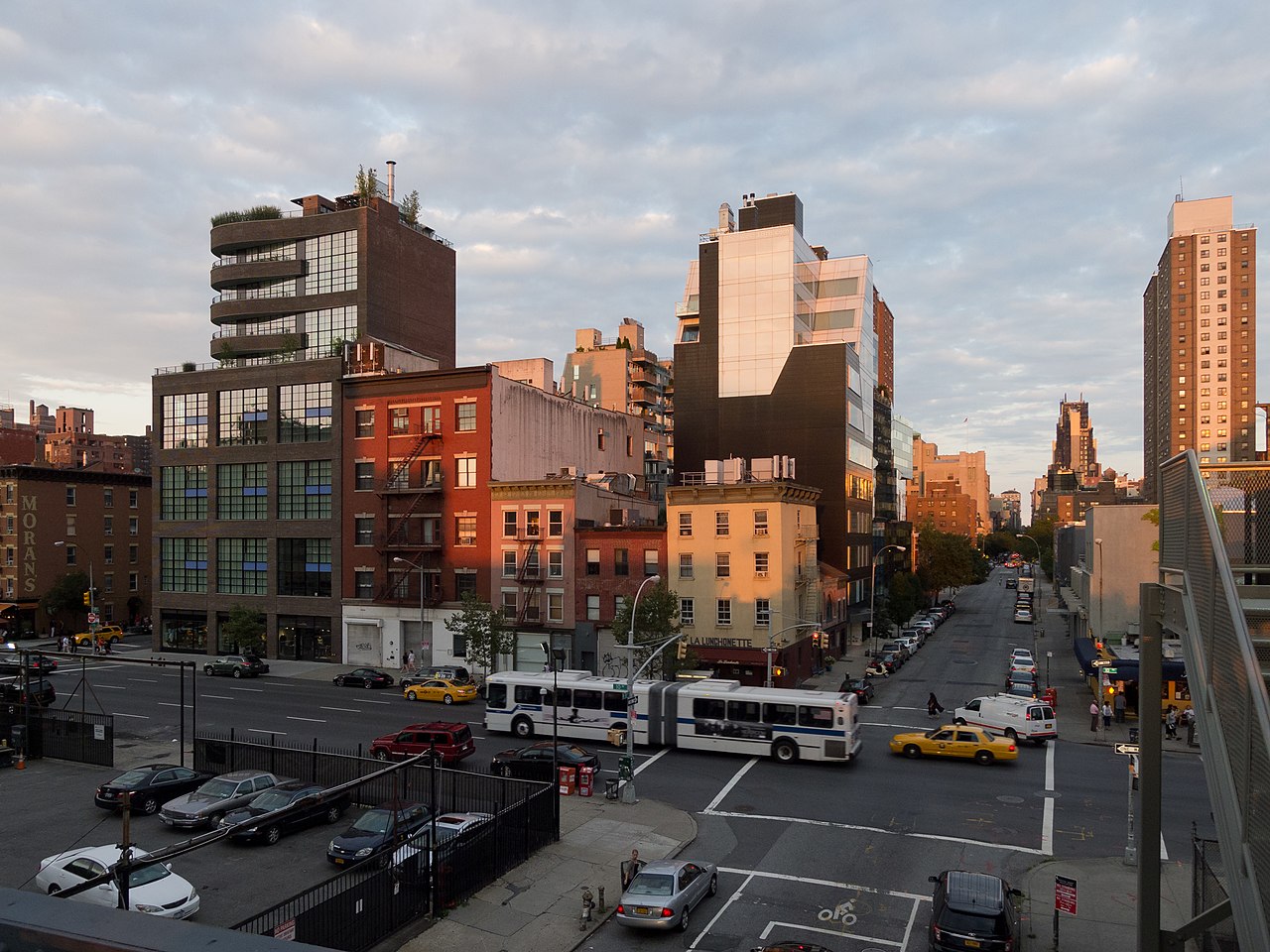
The park is built on an abandoned, southern viaduct section of the New York Central Railroad's West Side Line. Originating in the Meatpacking District, the park runs from Gansevoort Street—three blocks below 14th Street—through Chelsea to the northern edge of the West Side Yar...Read more
The High Line is a 1.45-mile-long (2.33 km) elevated linear park, greenway, and rail trail created on a former New York Central Railroad spur on the West Side of Manhattan in New York City. The High Line's design is a collaboration between James Corner Field Operations, Diller Scofidio + Renfro, and Piet Oudolf. The abandoned spur has been redesigned as a "living system" drawing from multiple disciplines which include landscape architecture, urban design, and ecology. The High Line was inspired by the 4.7 km (2.9 mi) long Coulée verte (tree-lined walkway), another elevated park in Paris completed in 1993.
The park is built on an abandoned, southern viaduct section of the New York Central Railroad's West Side Line. Originating in the Meatpacking District, the park runs from Gansevoort Street—three blocks below 14th Street—through Chelsea to the northern edge of the West Side Yard on 34th Street near the Javits Center. The West Side Line formerly extended south to a railroad terminal at Spring Street, just north of Canal Street, and north to 35th Street at the site of the Javits Center. Due to a decline in rail traffic along the rest of the viaduct, it was effectively abandoned in 1980 when the construction of the Javits Center required the demolition of the viaduct's northernmost portion. The southern portion of the viaduct was demolished in segments during the late 20th century.
A nonprofit organization called Friends of the High Line was formed in 1999 by Joshua David and Robert Hammond, advocating its preservation and reuse as public open space, an elevated park or greenway. Celebrity New Yorkers joined in on fundraising and support for the concept. The administration of Mayor Michael Bloomberg announced plans for a High Line park in 2003. Repurposing the railway into an urban park began in 2006 and opened in phases during 2009, 2011, and 2014. The Spur, an extension of the High Line that originally connected with the Morgan General Mail Facility at Tenth Avenue and 30th Street, opened in 2019. The Moynihan Connector, extending east from the Spur to Moynihan Train Hall, opened in 2023.
Since opening in June 2009, the High Line has become an icon of American contemporary landscape architecture. The High Line's success has inspired cities throughout the United States to redevelop obsolete infrastructure as public space. The park became a tourist attraction and spurred real estate development in adjacent neighborhoods, increasing real-estate values and prices along the route. By September 2014, the park had nearly five million visitors annually, and by 2019, it had eight million visitors per year.


Add new comment