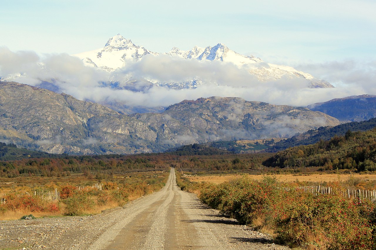
The Carretera Austral (CH-7, in English: Southern Way) is the name given to Chile's Route 7. The highway runs south for about 1,240 kilometers (770 mi) from Puerto Montt to Villa O'Higgins, passing through rural Patagonia.

Carretera Austral provides road access to Chile's Aysén Region and southern parts of Los Lagos Region. These areas are sparsely populated and despite its length, Carretera Austral provides access to only about 100,000 people. The largest city along the entire road is Coyhaique with a population of 44,850 in 2002.

 Sign with its full original name.

Construction of the highway was commenced in 1976[citation needed] under the military dictatorship era in order to connect a number of remote communities. Before that, in the 1950s and 1970s, there had been unsuccessful attempts to build access roads in the region.[1] It is among the most ambitious infrastructure projects developed in Chile during the 20th century. The engineering corps of the Chilean Army used thousands of conscripts from 1975 to 1985 to build the road.[2] Dictator Augusto Pinochet is said to have made annual visits well into the 1990s to follow the progress of the road.[2] General Hernán Abad was for long in charge of its construction.[2]

As it was constructed during the military dictatorship, the Carretera Austral bears the unofficial name of the Augusto Pinochet highway.

Carretera Austral has a strategic meaning due to the difficult access by land to a significant portion of Chile's southern territory. This area is characterized by thick forests, fjords, glaciers, canals and steep mountains. Access by sea and air is also a complex task due to extreme winter weather conditions. For decades, most of the land transportation had to cross the border to Argentina in order to reach again Chile's Patagonia. These difficulties were deepened during the 1970s due to the Beagle Conflict crisis. In order to strengthen the Chilean presence in these isolated territories and ensure the land connection to the rest of the country, the government planned the construction of this road, which was executed by the Chilean Army's Engineering Command. More than 10,000 soldiers worked on its construction.

The highway opened to traffic in 1988, and by 1996 was completed to Puerto Yungay. The last 100 kilometers (62 mi) to Villa O'Higgins were opened in 2000. In 2003, a branch road to Caleta Tortel was finished.[3]

^ "History of the Carretera Austral". TurismoChile.com. Archived from the original on 2008-09-19. Retrieved 2008-08-24. ^ a b c Rojas, Jorge (2013-09-07). "Carretera Austral: La pirámide del dictador". The Clinic. Retrieved 2023-10-04. ^ "Carretera Austral". Aisen Bridges Travel. Archived from the original on 2008-12-23.
Photographies by:
Manxuc - CC BY-SA 4.0
© Romigraphy / Sitio web - CC BY-SA 4.0
Hosteria Outsider (Arvid Puschnig) - CC BY-SA 3.0
Statistics: Position
4480
Statistics: Rank
24504

Add new comment

Esta pregunta es para comprobar si usted es un visitante humano y prevenir envíos de spam automatizado.

Security
962438751Click/tap this sequence: 7927

Google street view

Videos

Where can you sleep near Carretera Austral ?

Booking.com
489.321 visits in total, 9.196 Points of interest, 404 Destinations, 148 visits today.