Blue Ridge Parkway
The Blue Ridge Parkway is a National Parkway and All-American Road in the United States, noted for its scenic beauty. The parkway, which is the longest linear park in the U.S., runs for 469 miles (755 km) through 29 counties in Virginia and North Carolina, linking Shenandoah National Park to Great Smoky Mountains National Park. It runs mostly along the spine of the Blue Ridge, a major mountain chain that is part of the Appalachian Mountains. Its southern terminus is at U.S. Route 441 (US 441) on the boundary between Great Smoky Mountains National Park and the Qualla Boundary of the Eastern Band of Cherokee Indians in North Carolina, from which it travels north to Shenandoah National Park in Virginia. The roadway continues through Shenandoah as Skyline Drive, a similar scenic road which is managed by a different National Park Service unit. Both Skyline Drive and the Virginia portion of the Blue Ridge Parkway are part of Virginia State Route 48 (S...Read more
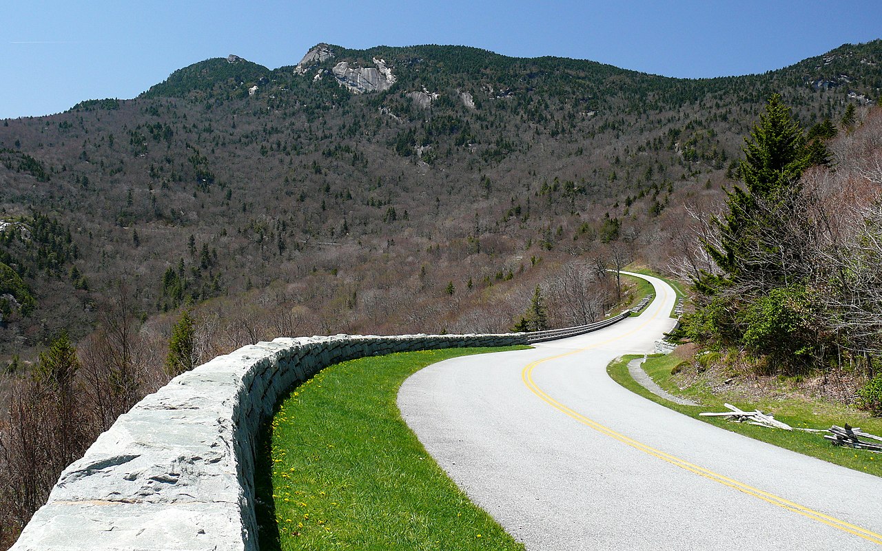
The Blue Ridge Parkway is a National Parkway and All-American Road in the United States, noted for its scenic beauty. The parkway, which is the longest linear park in the U.S., runs for 469 miles (755 km) through 29 counties in Virginia and North Carolina, linking Shenandoah National Park to Great Smoky Mountains National Park. It runs mostly along the spine of the Blue Ridge, a major mountain chain that is part of the Appalachian Mountains. Its southern terminus is at U.S. Route 441 (US 441) on the boundary between Great Smoky Mountains National Park and the Qualla Boundary of the Eastern Band of Cherokee Indians in North Carolina, from which it travels north to Shenandoah National Park in Virginia. The roadway continues through Shenandoah as Skyline Drive, a similar scenic road which is managed by a different National Park Service unit. Both Skyline Drive and the Virginia portion of the Blue Ridge Parkway are part of Virginia State Route 48 (SR 48), though this designation is not signed.
The parkway has been the most visited unit of the National Park System every year since 1946 except four (1949, 2013, 2016 and 2019). Land on either side of the road is owned and maintained by the National Park Service, and in many places parkway land is bordered by United States Forest Service property. There is no fee for using the parkway; however, commercial vehicles are prohibited without approval from the Park Service Headquarters, near Asheville, North Carolina. The roadway is not maintained in the winter, and sections that pass over especially high elevations and through tunnels are often impassable and therefore closed from late fall through early spring. Weather is extremely variable in the mountains, so conditions and closures often change rapidly. The speed limit is never higher than 45 mph (72 km/h) and is lower in some sections.
In addition to the road, the parkway has a folk art center located at mile marker 382 and a visitor center located at mile marker 384, both near Asheville. There are also numerous parking areas at trailheads for the various hiking trails that intersect the parkway, and several campgrounds located along the parkway allow for overnight stays. The Blue Ridge Music Center (also part of the park) is located in Galax, and Mount Mitchell (the highest point in eastern North America) is only accessible via North Carolina Highway 128 (NC 128), which intersects the parkway at milepost 355.4.


 - CC BY-SA 3.0")


![[node:title]](/sites/default/files/styles/640x320/public/default_images/default_0.JPG.webp?itok=aqV9zhFR)


Add new comment