Annapurna Circuit
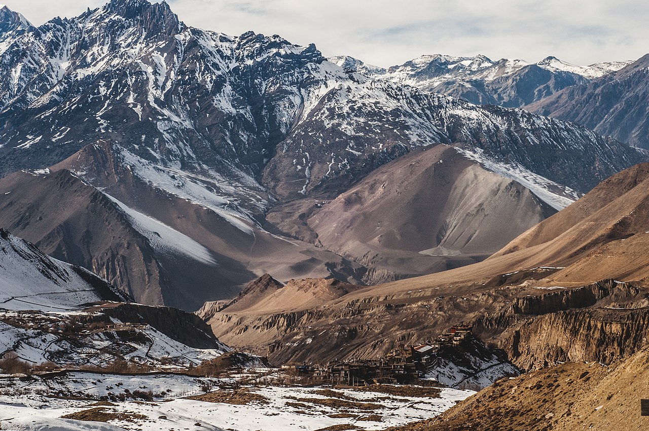
The Annapurna Circuit is a trek within the mountain ranges of central Nepal. The total length of the route varies between 160–230 km (100-145 mi), depending on where motor transportation is used and where the trek is ended. This trek crosses two different river valleys and encircles the Annapurna Massif. The path reaches its highest point at Thorung La pass (5416m/17769 ft), reaching the edge of the Tibetan plateau. Most trekkers hike the route anticlockwise, as this way the daily altitude gain is slower, and crossing the high Thorong La pass is easier and safer.
The mountain scenery, seen at close quarters includes the Annapurna Massif (Annapurna I-IV), Dhaulagiri, Machhapuchhre, Manaslu, Gangapurna, Tilicho Peak, Pisang Peak, and Paungda Danda. Numerous other peaks of 6000-8000m in elevation rise from the Annapurna range.
The trek begins at Besisahar or Bhulbhule in the Marshyangdi river valley and concludes in the Kali Gan...Read more
The Annapurna Circuit is a trek within the mountain ranges of central Nepal. The total length of the route varies between 160–230 km (100-145 mi), depending on where motor transportation is used and where the trek is ended. This trek crosses two different river valleys and encircles the Annapurna Massif. The path reaches its highest point at Thorung La pass (5416m/17769 ft), reaching the edge of the Tibetan plateau. Most trekkers hike the route anticlockwise, as this way the daily altitude gain is slower, and crossing the high Thorong La pass is easier and safer.
The mountain scenery, seen at close quarters includes the Annapurna Massif (Annapurna I-IV), Dhaulagiri, Machhapuchhre, Manaslu, Gangapurna, Tilicho Peak, Pisang Peak, and Paungda Danda. Numerous other peaks of 6000-8000m in elevation rise from the Annapurna range.
The trek begins at Besisahar or Bhulbhule in the Marshyangdi river valley and concludes in the Kali Gandaki Gorge. Besisahar can be reached after a seven-hour drive from Kathmandu. The trail passes along paddy fields and into subtropical forests, past several waterfalls and gigantic cliffs, and through various villages.
Annapurna Circuit has been voted the best long-distance trek in the world, as it combined, in its old full form, a wide variety of climate zones from the tropics at 600 m asl to the Arctic at 5416 m asl at the Thorong La pass and cultural variety from Hindu villages at the low foothills to the Tibetan culture of Manang Valley and lower Mustang. Continuing construction of a road has shortened the trail and changed the villages. The Beisahar-Manag road has been built which passes through the trekking trail much of the time. With the construction of roads, mountain biking is becoming popular, with Mustang, in particular.


 - CC BY 2.5")
Add new comment