Karnak (àrab: الكرنك, al-Karnak, que deriva de l'àrab خورنق, ẖūrnaq, ‘poble fortificat’) és una ciutat d'Egipte a la riba del Nil, a uns 2 km al nord de Luxor, amb la qual, de fet, està unida, que va portar en època faraònica el nom d'Ipet Sut (El lloc més venerat). Era una zona de l'antiga Tebes que albergava el complex religiós més important de l'antic Egipte, el temple de Karnak.

The history of the Karnak complex is largely the history of Thebes and its changing role in the culture. Religious centers varied by region, and when a new capital of the unified culture was established, the religious centers in that area gained prominence. The city of Thebes does not appear to have been of great significance before the Eleventh Dynasty and previous temple building there would have been relatively small, with shrines being dedicated to the early deities of Thebes, the Earth goddess Mut and Montu. Early building was destroyed by invaders. The earliest known artifact found in the area of the temple is a small, eight-sided column from the Eleventh Dynasty, which mentions Amun-Re. Amun (sometimes called Amen) was long the local tutelary deity of Thebes. He was identified with the ram and the goose. The Egyptian meaning of Amun is "hidden" or the "hidden god".[1]

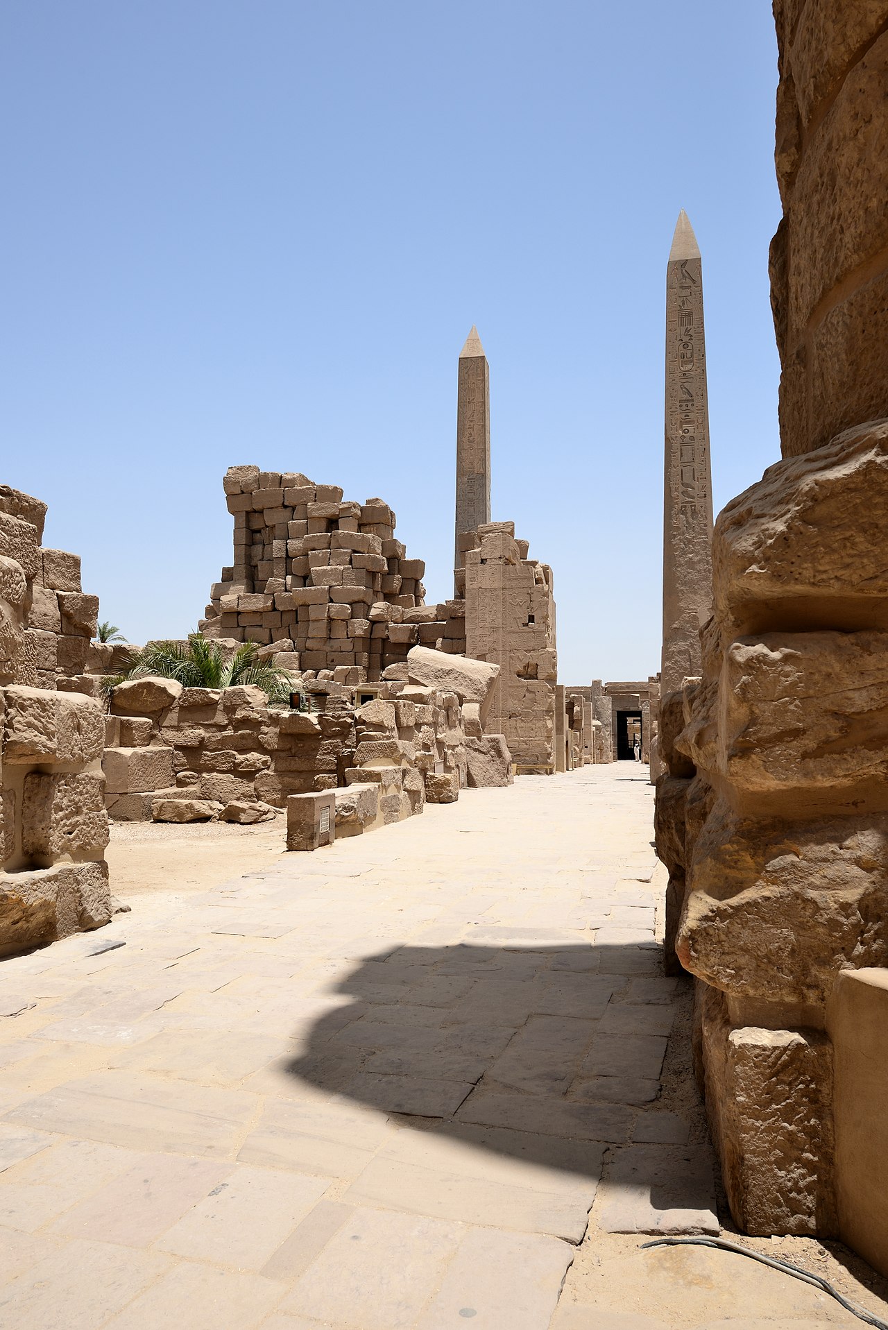
Major construction work in the Precinct of Amun-Re took place during the Eighteenth Dynasty, when Thebes became the capital of the unified Ancient Egypt. Almost every pharaoh of that dynasty added something to the temple site. Thutmose I erected an enclosure wall connecting the Fourth and Fifth pylons, which comprise the earliest part of the temple still standing in situ. Hatshepsut had monuments constructed and also restored the original Precinct of Mut, that had been ravaged by the foreign rulers during the Hyksos occupation. She had twin obelisks, at the time the tallest in the world, erected at the entrance to the temple. One still stands, as the second-tallest ancient obelisk still standing on Earth; the other has broken in two and toppled. Another of her projects at the site, Karnak's Red Chapel or Chapelle Rouge, was intended as a barque shrine and originally may have stood between her two obelisks. She later ordered the construction of two more obelisks to celebrate her sixteenth year as pharaoh; one of the obelisks broke during construction, and thus, a third was constructed to replace it. The broken obelisk was left at its quarrying site in Aswan, where it still remains. Known as the unfinished obelisk, it provides evidence of how obelisks were quarried.[2]

Construction of the Great Hypostyle Hall also may have begun during the Eighteenth Dynasty (although most new building was undertaken under Seti I and Ramesses II in the Nineteenth). Merneptah, also of the Nineteenth Dynasty, commemorated his victories over the Sea Peoples on the walls of the Cachette Court, the start of the processional route (also known as the Avenue of Sphinxes) to the Luxor Temple. The last major change to the Precinct of Amun-Re's layout was the addition of the First Pylon and the massive enclosure walls that surround the whole precinct, both constructed by Nectanebo I of the Thirtieth Dynasty.
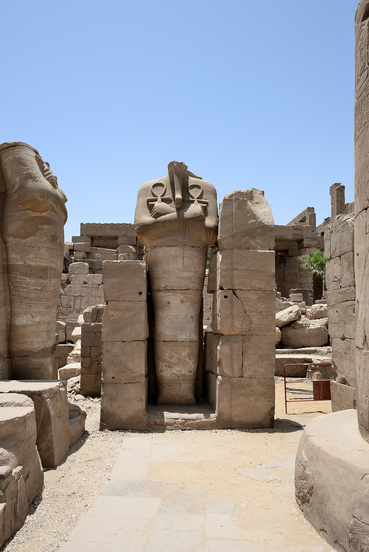
In 323 AD, Roman emperor Constantine the Great recognised the Christian religion, and in 356 Constantius II ordered the closing of pagan temples throughout the Roman empire, into which Egypt had been annexed in 30 BC. Karnak was by this time mostly abandoned, and Christian churches were founded among the ruins, the most famous example of this is the reuse of the Festival Hall of Thutmose III's central hall, where painted decorations of saints and Coptic inscriptions can still be seen.
European knowledge of KarnakThebes' exact placement was unknown in medieval Europe, though both Herodotus and Strabo give the exact location of Thebes and how long up the Nile one must travel to reach it. Maps of Egypt, based on the 2nd century Claudius Ptolemaeus' mammoth work Geographia, had been circulating in Europe since the late 14th century, all of them showing Thebes' (Diospolis) location. Despite this, several European authors of the 15th and 16th centuries who visited only Lower Egypt and published their travel accounts, such as Joos van Ghistele and André Thévet, put Thebes in or close to Memphis.

The Karnak temple complex is first described by an unknown Venetian in 1589, although his account gives no name for the complex. This account, housed in the Biblioteca Nazionale Centrale di Firenze, is the first known European mention, since ancient Greek and Roman writers, about a whole range of monuments in Upper Egypt and Nubia, including Karnak, Luxor temple, the Colossi of Memnon, Esna, Edfu, Kom Ombo, Philae, and others.
Karnak ("Carnac") as a village name, and name of the complex, is first attested in 1668, when two capuchin missionary brothers, Protais and Charles François d'Orléans, travelled though the area. Protais' writing about their travel was published by Melchisédech Thévenot (Relations de divers voyages curieux, 1670s–1696 editions) and Johann Michael Vansleb (The Present State of Egypt, 1678).

The first drawing of Karnak is found in Paul Lucas' travel account of 1704, (Voyage du Sieur Paul Lucas au Levant). It is rather inaccurate, and can be quite confusing to modern eyes. Lucas travelled in Egypt during 1699–1703. The drawing shows a mixture of the Precinct of Amun-Re and the Precinct of Montu, based on a complex confined by the three huge Ptolemaic gateways of Ptolemy III Euergetes / Ptolemy IV Philopator, and the massive 113 m long, 43 m high and 15 m thick, First Pylon of the Precinct of Amun-Re.
Karnak was visited and described in succession by Claude Sicard and his travel companion Pierre Laurent Pincia (1718 and 1720–21), Granger (1731), Frederick Louis Norden (1737–38), Richard Pococke (1738), James Bruce (1769), Charles-Nicolas-Sigisbert Sonnini de Manoncourt (1777), William George Browne (1792–93), and finally by a number of scientists of the Napoleon expedition, including Vivant Denon, during 1798–1799. Claude-Étienne Savary describes the complex in rather great detail in his work of 1785; especially in light of the fact that it is a fictional account of a pretend journey to Upper Egypt, composed out of information from other travellers. Savary did visit Lower Egypt in 1777–78, and published a work about that too.


Afegeix un nou comentari