Naranjo de Bulnes
The Naranjo de Bulnes (known as Picu Urriellu in Asturian) is a limestone peak dating from the paleozoic era, located in the Macizo Central region of the Picos de Europa, Asturias (Spain). Its name Picu Urriellu is believed to be derived from the term Los Urrieles which is used to describe the Macizo Central. Naranjo de Bulnes is part of the Cabrales region of Asturias, and lies within the Picos de Europa National Park.
The first written reference to "Picu Urriellu" as "Naranjo de Bulnes" is credited to the German geologist and engineer, Wilhelm Schulz, who, in 1855, published the first topographic and geological map of Asturias. As far as is known the etymology of this name is not clear, because, historically, the local inhabitants always referred to the mountain as "Picu Urriellu". It has been suggested that the name can be attributed to the orange hue of the limestone from which the peak is formed. The local residents of Bulnes have a saying con...Lees meer
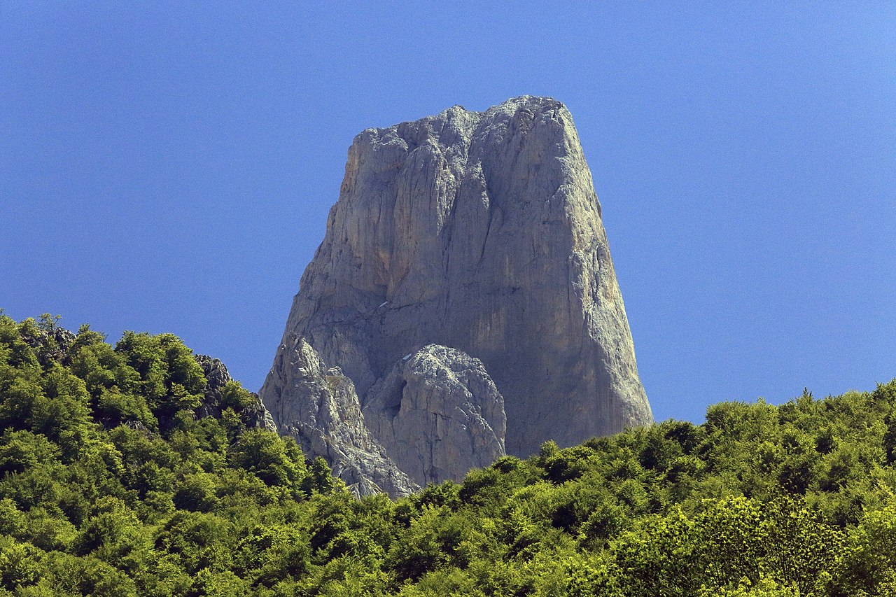
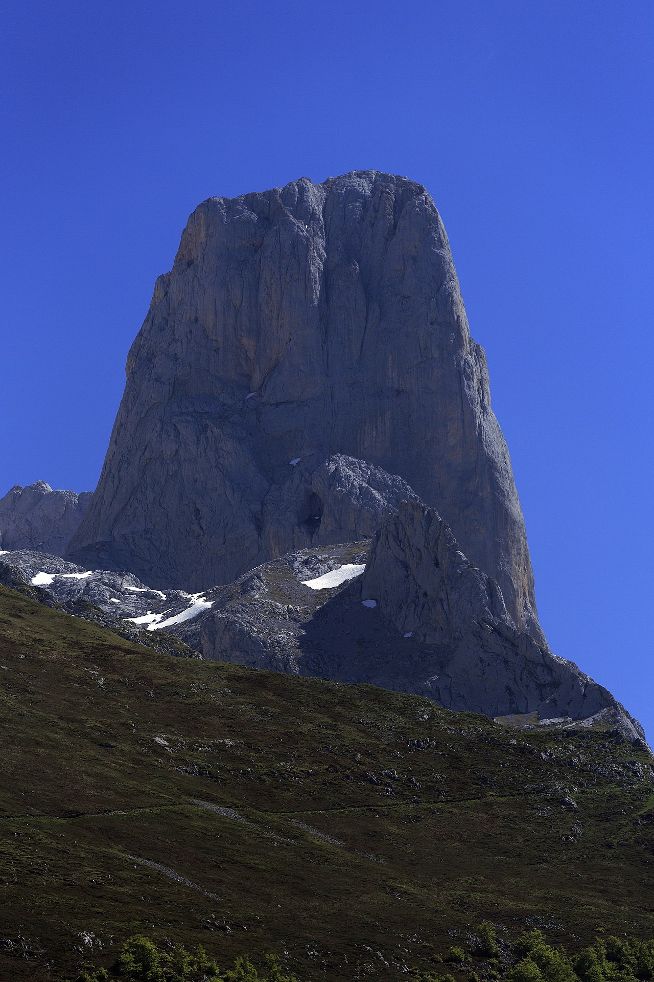
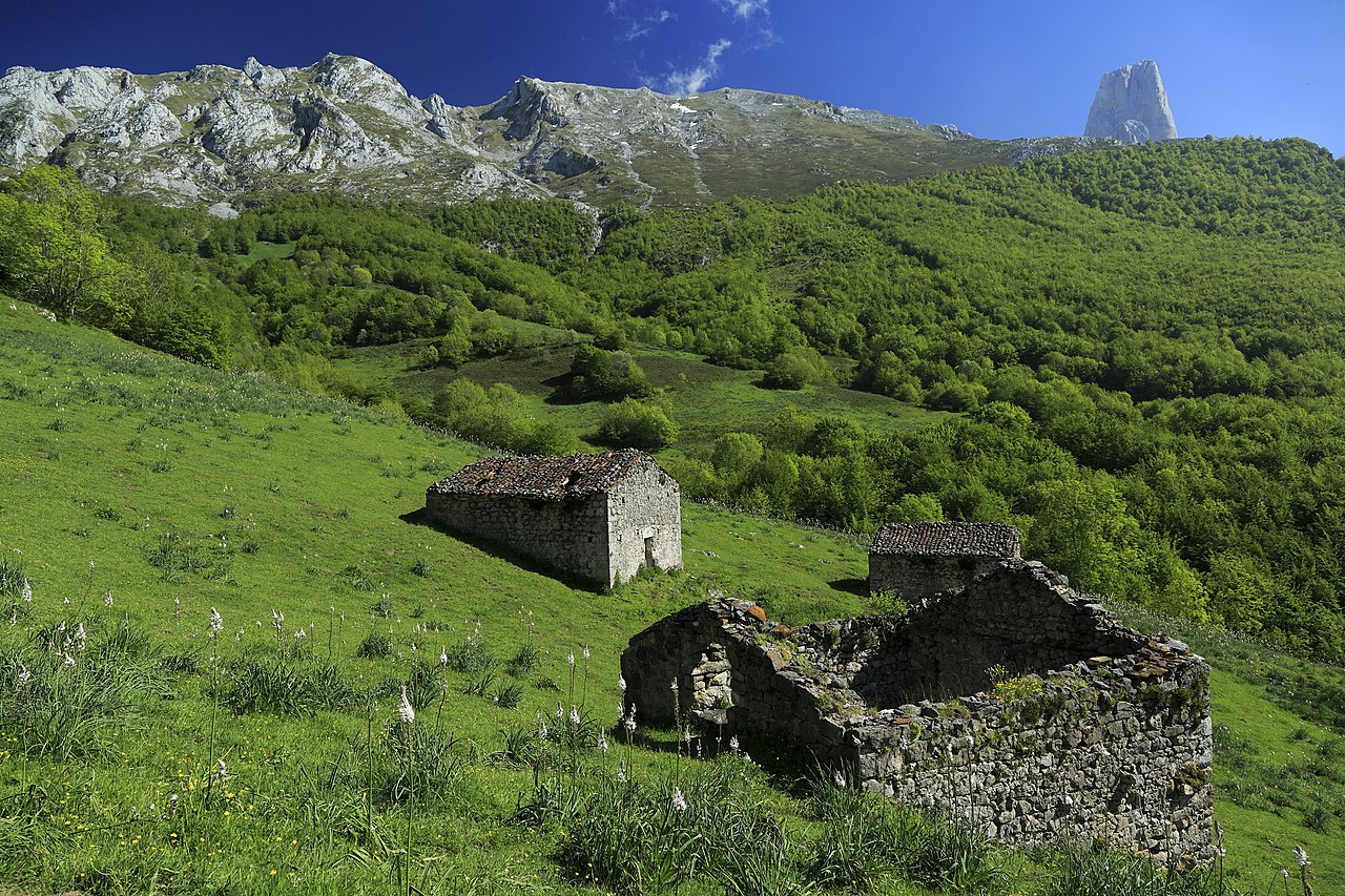
The Naranjo de Bulnes (known as Picu Urriellu in Asturian) is a limestone peak dating from the paleozoic era, located in the Macizo Central region of the Picos de Europa, Asturias (Spain). Its name Picu Urriellu is believed to be derived from the term Los Urrieles which is used to describe the Macizo Central. Naranjo de Bulnes is part of the Cabrales region of Asturias, and lies within the Picos de Europa National Park.
The first written reference to "Picu Urriellu" as "Naranjo de Bulnes" is credited to the German geologist and engineer, Wilhelm Schulz, who, in 1855, published the first topographic and geological map of Asturias. As far as is known the etymology of this name is not clear, because, historically, the local inhabitants always referred to the mountain as "Picu Urriellu". It has been suggested that the name can be attributed to the orange hue of the limestone from which the peak is formed. The local residents of Bulnes have a saying concerning the contentious name: "No me llameis Naranjo, pues fruto no puedo dar, llamadme Picu Urriellu que es mi nombre natural". (Don't call me Orange tree, because fruit I cannot bear, call me Picu Urriellu which is my natural name).
It has an altitude of 2,529 metres and although it is by no means the highest peak of the Cantabrian mountain range, it can be considered the best-known summit in the world of Spanish mountaineering, especially the 550m high vertical wall of the west face. At its foot lies Vega Urriellu, a glacial valley from the quaternary period.


![[node:title]](/sites/default/files/styles/640x320/public/default_images/default_0.JPG.webp?itok=aqV9zhFR)


Reactie toevoegen