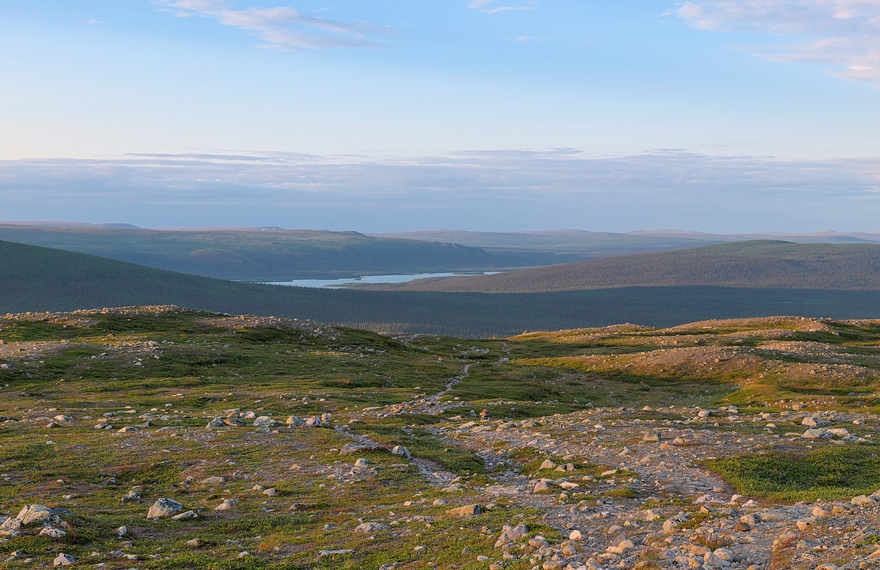
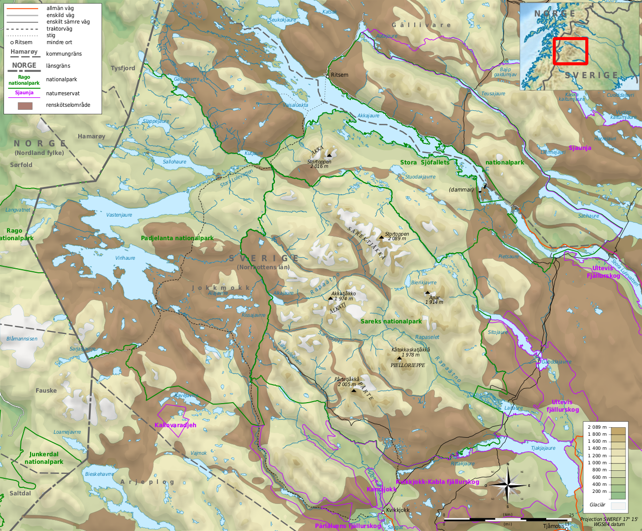
Sarek National Park (Swedish: Sareks nationalpark) is a national park in Jokkmokk Municipality, Lapland in northern Sweden. Established in 1909, the park is among the oldest national parks in Europe. It is adjacent to two other national parks, namely Stora Sjöfallet and Padjelanta. The shape of Sarek National Park is roughly circular with an average diameter of about 50 km (31.07 mi).
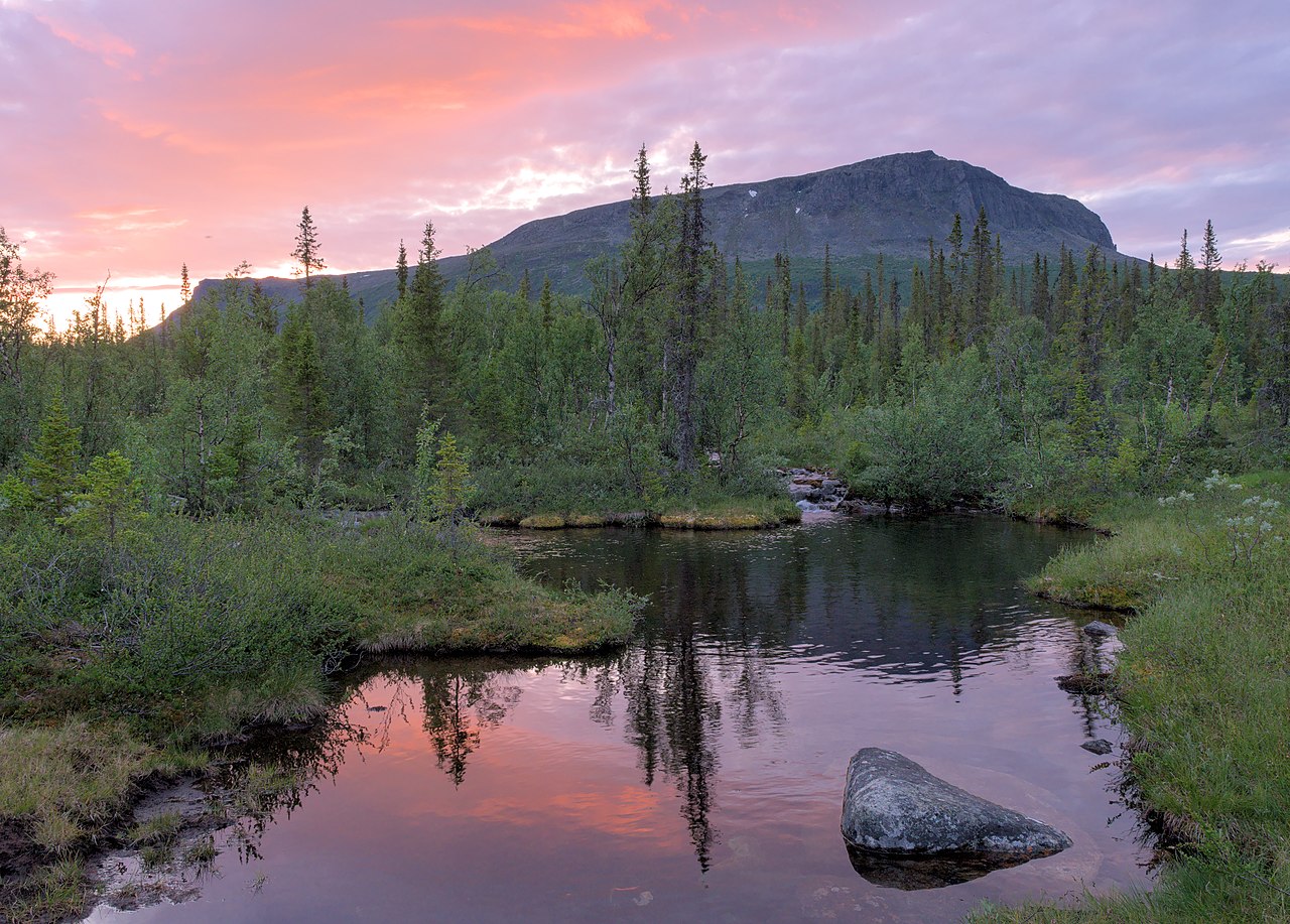
The most noted features of the national park are six of Sweden's thirteen peaks over 2,000 m (6,600 ft) located within the park's boundaries. Among these is the second highest mountain in Sweden, Sarektjåkkå,and Áhkká which is located just outside the park. The park has about 200 mountains over 1,800 m (5,900 ft), 82 of which have names. Sarek is also the name of a geographical area which the national park is part of. The Sarek mountain district includes a total of eight peaks over 2,000 m (6,600 ft). Due to the long trek, the mountains in the district are seldom climbed....Read more
Sarek National Park (Swedish: Sareks nationalpark) is a national park in Jokkmokk Municipality, Lapland in northern Sweden. Established in 1909, the park is among the oldest national parks in Europe. It is adjacent to two other national parks, namely Stora Sjöfallet and Padjelanta. The shape of Sarek National Park is roughly circular with an average diameter of about 50 km (31.07 mi).
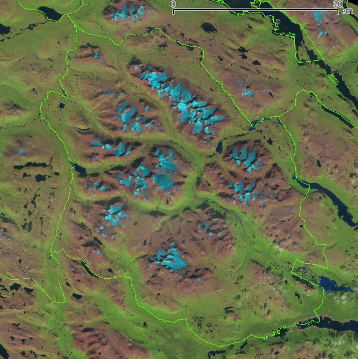
The most noted features of the national park are six of Sweden's thirteen peaks over 2,000 m (6,600 ft) located within the park's boundaries. Among these is the second highest mountain in Sweden, Sarektjåkkå,and Áhkká which is located just outside the park. The park has about 200 mountains over 1,800 m (5,900 ft), 82 of which have names. Sarek is also the name of a geographical area which the national park is part of. The Sarek mountain district includes a total of eight peaks over 2,000 m (6,600 ft). Due to the long trek, the mountains in the district are seldom climbed. There are approximately 100 glaciers in Sarek National Park.
Sarek is a popular area for hikers and mountaineers. Beginners in these disciplines are advised to accompany a guide since there are no marked trails or accommodations and only two bridges aside from those in the vicinity of its borders. The area is among those that receives the heaviest rainfall in Sweden, making hiking dependent on weather conditions. It is also intersected by turbulent streams that are hazardous to cross without proper training.
The delta of the Rapa River is considered one of Europe's most noted views and the summit of mount Skierfe offers an overlook of that ice-covered, glacial, through valley.
The Pårte Scientific Station in Sarek (also known as the Pårte observatory) was built in the early 1900s by Swedish mineralogist and geographer Axel Hamberg. All the building material for the huts had to be carried to the site by porters.


![[node:title]](/sites/default/files/styles/640x320/public/pla/images/2021-03/Stetinden_from_coastline_of_Stefjorden%2C_Nordland%2C_Norway%2C_2015_September_-_2.jpg.webp?itok=0l6DqTVL)


![[node:title]](/sites/default/files/styles/640x320/public/default_images/default_0.JPG.webp?itok=aqV9zhFR)


Add new comment