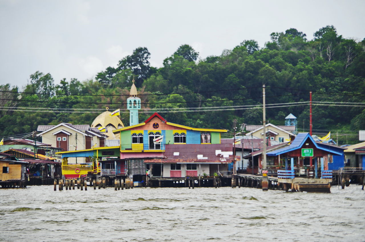
Kampung Ayer is a prominent traditional settlement in Bandar Seri Begawan, the capital of Brunei. It comprises neighbourhoods of traditional houses, schools and mosques built on stilts above the Brunei River near the capital's city centre. It has an area of about 10 square kilometres (3.9 sq mi); the total population was 10,250 in 2016. It has been historically nicknamed 'Venice of the East'. Kampung Ayer has been historically the principal settlement of Brunei; it was the de facto capital, in particular social and economic centre, of the Bruneian Empire for a few centuries, but also extending into the early period during British imperialism in Brunei.

Kampong Ayer is believed to have been inhabited for several centuries. There are several historical records, particularly foreign sources, which reported the existence of 'water settlements' on the Brunei River. The most well known is arguably the account by Antonio Pigafetta, an Italian explorer, on his visit to Brunei as part of the Magellan fleet in 1521,[1] in which he described the settlement as

entirely built in salt water... It contains twenty-five thousand hearths (families). The houses are all constructed of wood and built up from the ground on tall pillars.

— Antonio Pigafetta, European Sources for the History of the Sultanate of Brunei in the Sixteenth Century, p. 11

There is a possibility that the stilt settlement might not have always been where it is today, that Kampong Ayer might have undergone relocation throughout history. Olivier van Noort, a Dutch, on his stay in Brunei from December 1600 to January 1601, described the houses (of the nobles) as

made of wood, and built on such light piles that when there is a storm or some other untoward event these houses can be removed from one side of the river to the other.

— Olivier van Noort, European Sources for the History of the Sultanate of Brunei in the Sixteenth Century, p. 96

The stilt settlement of what we know today as Kampong Ayer had always been the primary settlement area of the de facto capital of the Bruneian Empire for centuries.[2] However, the role also extended into the time from the arrival, and subsequent imperial presence of the British even until the early 20th century. It was only during the Residential period that a programme which encouraged the Kampong Ayer residents to resettle on land began to be introduced, although it was initially unsuccessful but eventually took off, resulting in significant reduction to its population. Nevertheless, substantial number of residents still remain to live on water. Kampong Ayer also survived bombardments during World War II.[3]

^ Nicholl, Robert, ed. (2007). European sources for the history of the Sultanate of Brunei in the sixteenth century (Third ed.). [Bandar Seri Begawan]: Brunei Museums Department. p. 8. ISBN 978-9991730318. OCLC 930264554. ^ Yunos, Rozan (2009-01-18). "Retracing history of streets of Bandar". The Brunei Times. Archived from the original on 2016-08-21. Retrieved 2016-07-18. ^ S. C. Chi (1994). The changing socio-economic profile of Kampong Ayer, Negara Brunei Darussalam. Faculty of Arts and Social Sciences, Universiti Brunei Darussalam. p. 65.
Photographies by:
http://bn-international.com.ua/ - CC BY 4.0
Zones
Statistics: Position
3243
Statistics: Rank
35735

Add new comment

Esta pregunta es para comprobar si usted es un visitante humano y prevenir envíos de spam automatizado.

Security
145723986Click/tap this sequence: 7918

Google street view

Where can you sleep near Kampong Ayer ?

Booking.com
489.159 visits in total, 9.196 Points of interest, 404 Destinations, 65 visits today.