जैसलमेर
( Jaisalmer )
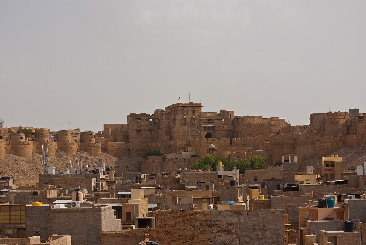
Jaisalmer , nicknamed The Golden city, is a city in the north-western Indian state of Rajasthan, located 575 kilometres (357 mi) west of the state capital Jaipur, in the heart of the Thar Desert. It serves as the administrative headquarters of Jaisalmer district. It is a former medieval trading center and the historic capital of the kingdom of Jaisalmer, founded in 1156 by Rawal Jaisal of the Bhati clan of Rajputs. Jaisalmer stands on a ridge of yellowish sandstone and is crowned by the World Heritage Site, Jaisalmer Fort, a sprawling hilltop citadel supported by 99 bastions. This fort contains a royal palace and several ornate Jain temples. Many of the houses and temples of both the fort and of the town below are built of finely sculptured yellow sandstone. The town has a population, including the residents of the fort, of about 78,000. Jaisalmer ranked 9th on Booking.com's Top 10 The Most Welcoming cities in the world. It ...Read more
Jaisalmer , nicknamed The Golden city, is a city in the north-western Indian state of Rajasthan, located 575 kilometres (357 mi) west of the state capital Jaipur, in the heart of the Thar Desert. It serves as the administrative headquarters of Jaisalmer district. It is a former medieval trading center and the historic capital of the kingdom of Jaisalmer, founded in 1156 by Rawal Jaisal of the Bhati clan of Rajputs. Jaisalmer stands on a ridge of yellowish sandstone and is crowned by the World Heritage Site, Jaisalmer Fort, a sprawling hilltop citadel supported by 99 bastions. This fort contains a royal palace and several ornate Jain temples. Many of the houses and temples of both the fort and of the town below are built of finely sculptured yellow sandstone. The town has a population, including the residents of the fort, of about 78,000. Jaisalmer ranked 9th on Booking.com's Top 10 The Most Welcoming cities in the world. It is the only Indian city on the list.


 were uploaded by Nomi887 at English Wikipedia. - Public domain")


![[node:title]](/sites/default/files/styles/640x320/public/default_images/default_0.JPG.webp?itok=aqV9zhFR)

Add new comment