Isle of Portland
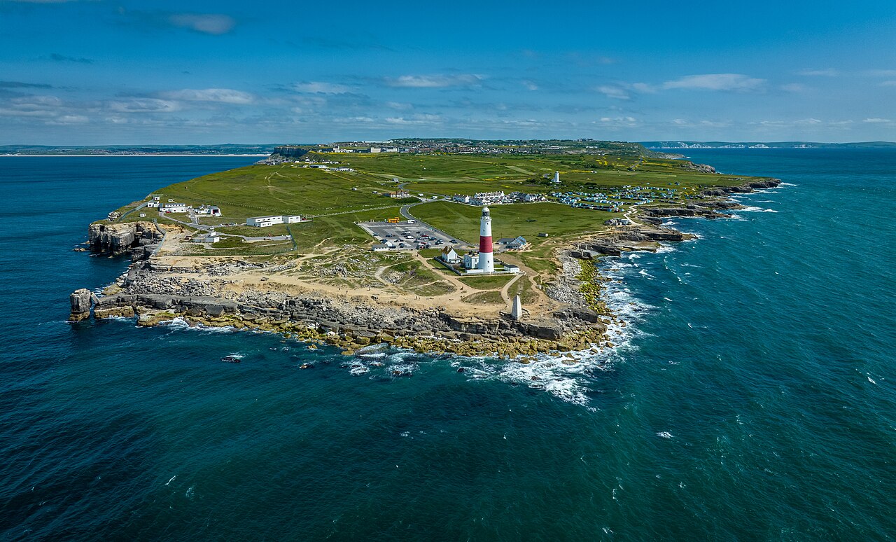
The Isle of Portland is a tied island, 6 kilometres (4 mi) long by 2.7 kilometres (1.7 mi) wide, in the English Channel. The southern tip, Portland Bill, lies 8 kilometres (5 mi) south of the resort of Weymouth, forming the southernmost point of the county of Dorset, England. A barrier beach called Chesil Beach joins Portland with mainland England. The A354 road passes down the Portland end of the beach and then over the Fleet Lagoon by bridge to the mainland. The population of Portland is 13,417.
Portland is a central part of the Jurassic Coast, a World Heritage Site on the Dorset and east Devon coast, important for its geology and landforms. Portland stone, a limestone famous for its use in British and world architecture, including St Paul's Cathedral and the United Nations Headquarters, continues to be quarried here.
Portland Harbour, in between Portland and Weymouth, is one of the largest man-made harbours in the world. The ha...Read more
The Isle of Portland is a tied island, 6 kilometres (4 mi) long by 2.7 kilometres (1.7 mi) wide, in the English Channel. The southern tip, Portland Bill, lies 8 kilometres (5 mi) south of the resort of Weymouth, forming the southernmost point of the county of Dorset, England. A barrier beach called Chesil Beach joins Portland with mainland England. The A354 road passes down the Portland end of the beach and then over the Fleet Lagoon by bridge to the mainland. The population of Portland is 13,417.
Portland is a central part of the Jurassic Coast, a World Heritage Site on the Dorset and east Devon coast, important for its geology and landforms. Portland stone, a limestone famous for its use in British and world architecture, including St Paul's Cathedral and the United Nations Headquarters, continues to be quarried here.
Portland Harbour, in between Portland and Weymouth, is one of the largest man-made harbours in the world. The harbour was made by the building of stone breakwaters between 1848 and 1905. From its inception it was a Royal Navy base, and played prominent roles during the First and Second World Wars; ships of the Royal Navy and NATO countries worked up and exercised in its waters until 1995. The harbour is now a civilian port and popular recreation area, and was used for the 2012 Olympic Games.
The name Portland is used for one of the British Sea Areas, and is the namesake of several cities, such as Portland, Victoria, and Portland, Maine, which in turn inspired the name of Portland, Oregon The name is also used for a street in Kowloon, Hong Kong, and a parish in Jamaica.


Add new comment