Pensford

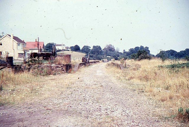
Pensford is the largest village in the civil parish of Publow in Somerset, England. It lies in the Chew Valley, approximately 7 miles (11 km) south of Bristol, 8 miles (13 km) west of Bath, and 14 miles (23 km) north of Wells. It is on the A37 road from Bristol to Shepton Mallet.

Pensford was identified as being of special architectural and historic interest and was designated as a Conservation Area in May 1988.

 High Street

The name Pensford is in all likelihood derived from Brythonic Penffordd, meaning roughly 'top of the road' or 'the highest or furthest point of the road'. Alternatively, it may mean 'The animal pens by the ford' from the Old English pens and ford.[1]

The parish of Pensford was part of the Keynsham Hundred,[2]

During the 14th to 16th centuries Pensford was a cloth centre based on local wool.[3]

On 24 June 1685 rebel forces camped at Pensford during the Monmouth Rebellion.[4]

During the 19th and 20th centuries the main industry was coal mining, with Pensford and the surrounding area forming a major part of the Somerset coalfield. Pensford colliery opened in 1909 and closed in 1955.[5]

The River Chew suffered a major flood in 1968 with serious damage to towns and villages along its route. The flood swept away the bridge over the A37 and damaged the railway viaduct so badly that it never reopened.[6] On 10–11 July, a storm brought heavy rainfall to the valley, with 175 millimetres (7 in) falling in 18 hours on Chew Stoke, double the area's average rainfall for the whole of July.[7]

In 2014 the Chew Valley Brewery, a microbrewery, was opened by local resident Dom Lowe and Matt Stalker, after training at Masters Brewery in Wellington.[8][9] First sales of their Pagan bitter were at the Stoke Inn in Chew Stoke,[10] and after a successful run with retirement looming, the owner closed it down in the summer of 2017.

^ Robinson, Stephen (1992). Somerset Place Names. Wimborne, Dorset: The Dovecote Press Ltd. ISBN 1-874336-03-2. ^ "Somerset Hundreds". GENUKI. Retrieved 15 October 2011. ^ Hare, J.N. (22 January 2003). "Growth and recession in the fifteenth-century economy: the Wiltshire textile industry and the countryside". The Economic History Review. 52 (1): 1–26. doi:10.1111/1468-0289.00116. Archived from the original on 6 January 2013. ^ Tincey, John (2005). Sedgemoor 1685: Marlborough's first victory. Barnsley: Pen and Sword Books. p. 61. ISBN 978-1844151479. ^ Down, C.G.; Warrington, A. J. (2005). The history of the Somerset coalfield. Radstock: Radstock Museum. ISBN 978-0-9551684-0-6. ^ "The great flood of 1968". Memories of Bristol. Archived from the original on 2 May 2006. Retrieved 4 January 2006. ^ Richley, Rob (June 2008). The Chew Valley floods of 1968. Exeter: Environment Agency. ^ Biddle, Pete (Summer 2014). "More breweries opening in local area!" (PDF). Pints West. No. 102. CAMRA. p. 3. Retrieved 27 September 2014. ^ "New brewery launched". Mendip Times. 10 (8): 18. October 2014. ^ "Chew Valley rolling out the barrel" (PDF). Pints West. No. 103. CAMRA. Autumn 2014. p. 7. Retrieved 27 September 2014.
Photographies by:
Statistics: Position
5737
Statistics: Rank
15315

Add new comment

CAPTCHA
Security
743519682Click/tap this sequence: 6289
Esta pregunta es para comprobar si usted es un visitante humano y prevenir envíos de spam automatizado.

Google street view

Where can you sleep near Pensford ?

Booking.com
491.447 visits in total, 9.211 Points of interest, 405 Destinations, 73 visits today.