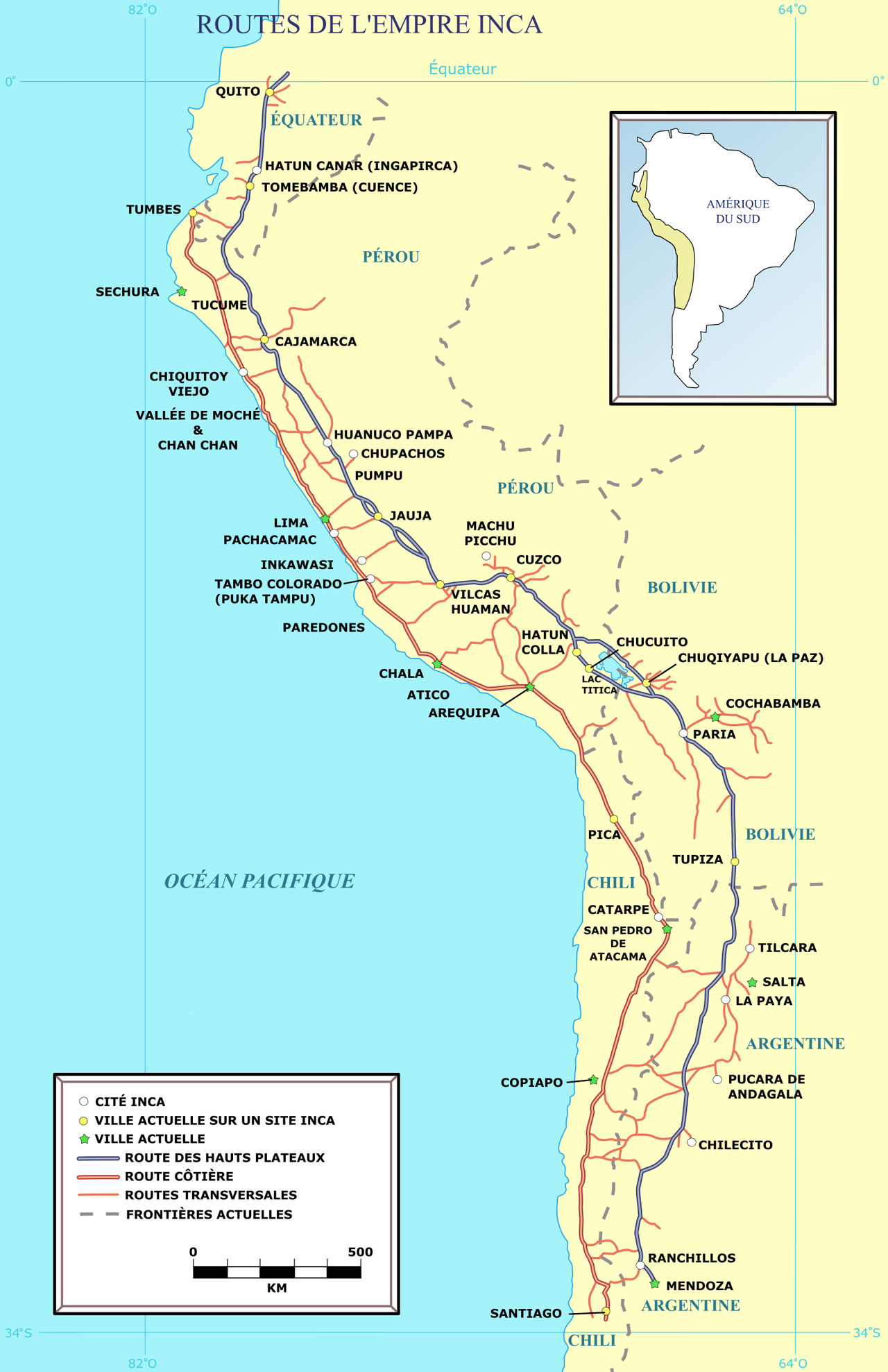
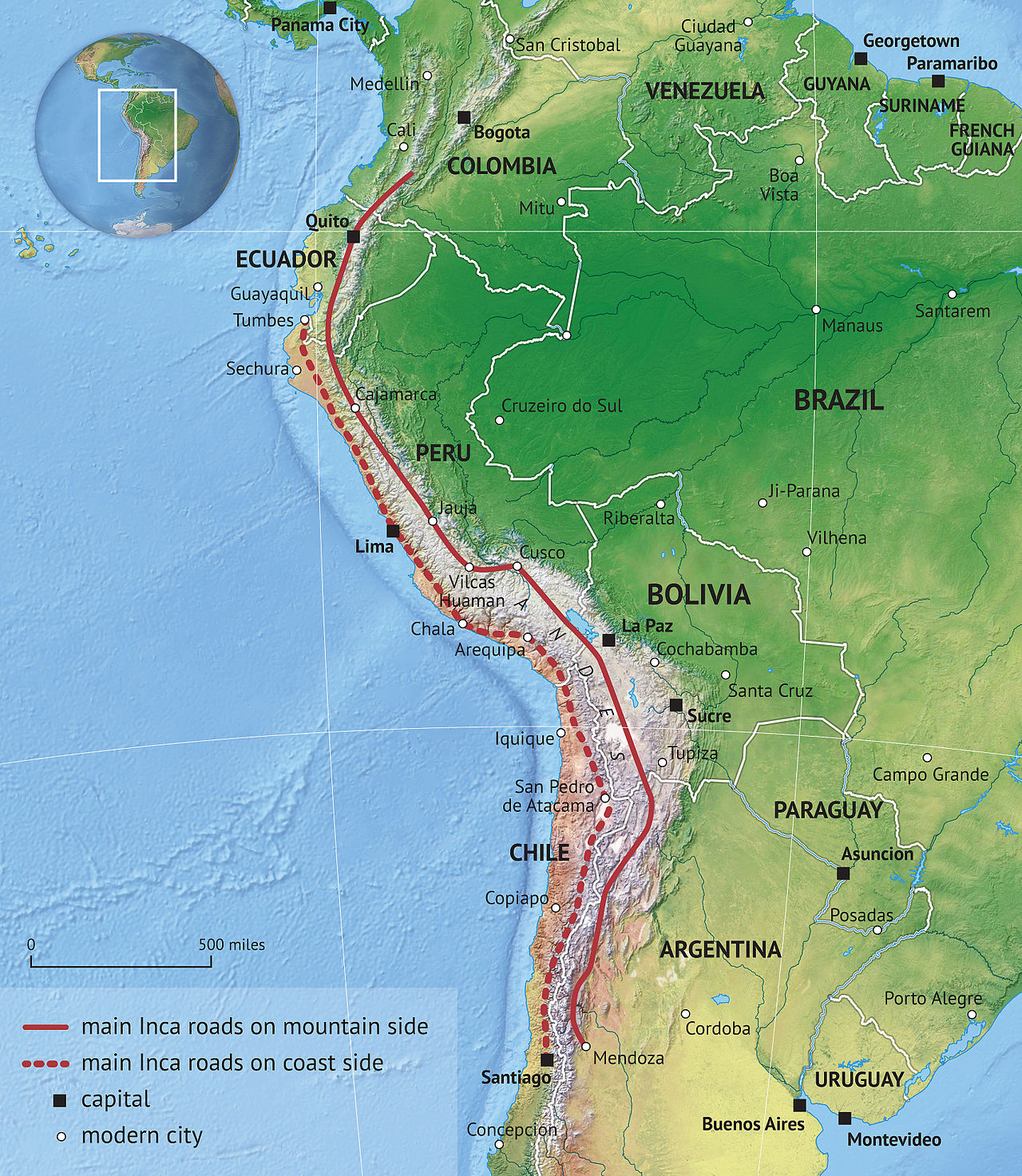
The Inca road system (also spelled Inka road system and known as Qhapaq Ñan meaning "royal road" in Quechua) was the most extensive and advanced transportation system in pre-Columbian South America. It was about 40,000 kilometres (25,000 mi) long.: 242 The construction of the roads required a large expenditure of time and effort.: 634
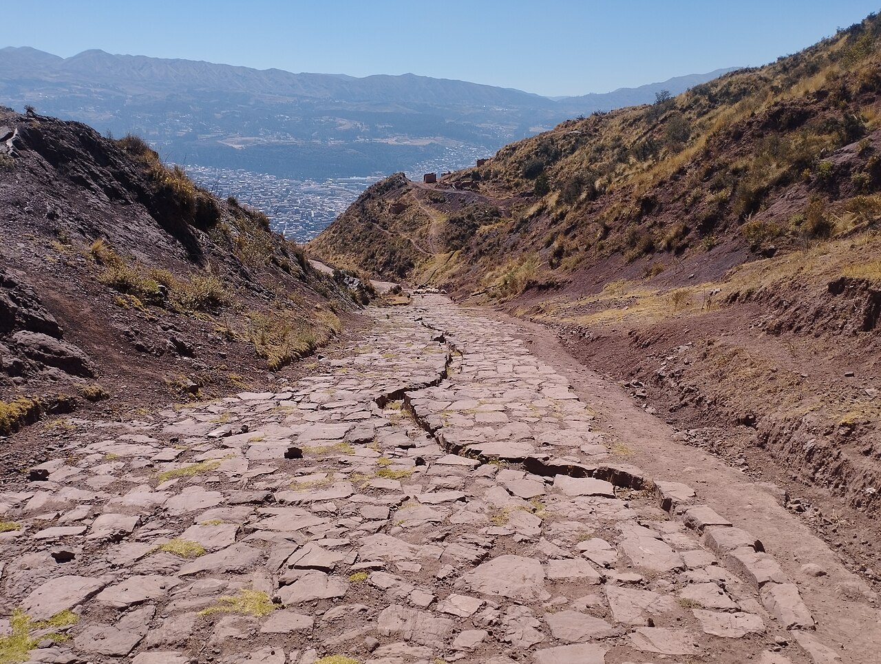
The network was composed of formal roads carefully planned, engineered, built, marked and maintained; paved where necessary, with stairways to gain elevation, bridges and accessory constructions such as retaining walls, and water drainage systems. It was based on two north–south roads: one along the coast and the second and most important inland and up the mountains, both with numerous branches. It can be directly compared with the road network built during the Roman Em...Read more
The Inca road system (also spelled Inka road system and known as Qhapaq Ñan meaning "royal road" in Quechua) was the most extensive and advanced transportation system in pre-Columbian South America. It was about 40,000 kilometres (25,000 mi) long.: 242 The construction of the roads required a large expenditure of time and effort.: 634
The network was composed of formal roads carefully planned, engineered, built, marked and maintained; paved where necessary, with stairways to gain elevation, bridges and accessory constructions such as retaining walls, and water drainage systems. It was based on two north–south roads: one along the coast and the second and most important inland and up the mountains, both with numerous branches. It can be directly compared with the road network built during the Roman Empire, although the Inca road system was built one thousand years later. The road system allowed for the transfer of information, goods, soldiers and persons, without the use of wheels, within the Tawantinsuyu or Inca Empire throughout a territory covering almost 2,000,000 km2 (770,000 sq mi) and inhabited by about 12 million people.
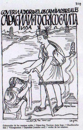
The roads were bordered, at intervals, with buildings to allow the most effective usage: at short distance there were relay stations for chasquis, the running messengers; at a one-day walking interval tambos allowed support to the road users and flocks of llama pack animals. Administrative centers with warehouses, called qullqas, for re-distribution of goods were found along the roads. Towards the boundaries of the Inca Empire and in newly conquered areas pukaras (fortresses) were found.
Part of the road network was built by cultures that precede the Inca Empire, notably the Wari culture in the northern central Peru and the Tiwanaku culture in Bolivia. Different organizations such as UNESCO and IUCN have been working to protect the network in collaboration with the governments and communities of the six countries (Colombia, Ecuador, Peru, Bolivia, Chile and Argentina) through which the Great Inca Road passes.
In modern times some remnant of the roads see heavy use from tourism, such as the Inca Trail to Machu Picchu, which is well known by trekkers.
A 2021 study found that its effects have lingered for over 500 years, with wages, nutrition and school levels higher in communities living within 20 kilometers of the Inca Road, compared to similar communities farther away.


![[node:title]](/sites/default/files/styles/640x320/public/default_images/default_0.JPG.webp?itok=aqV9zhFR)


. - Public domain")


Add new comment