Horseshoe Bend (Arizona)
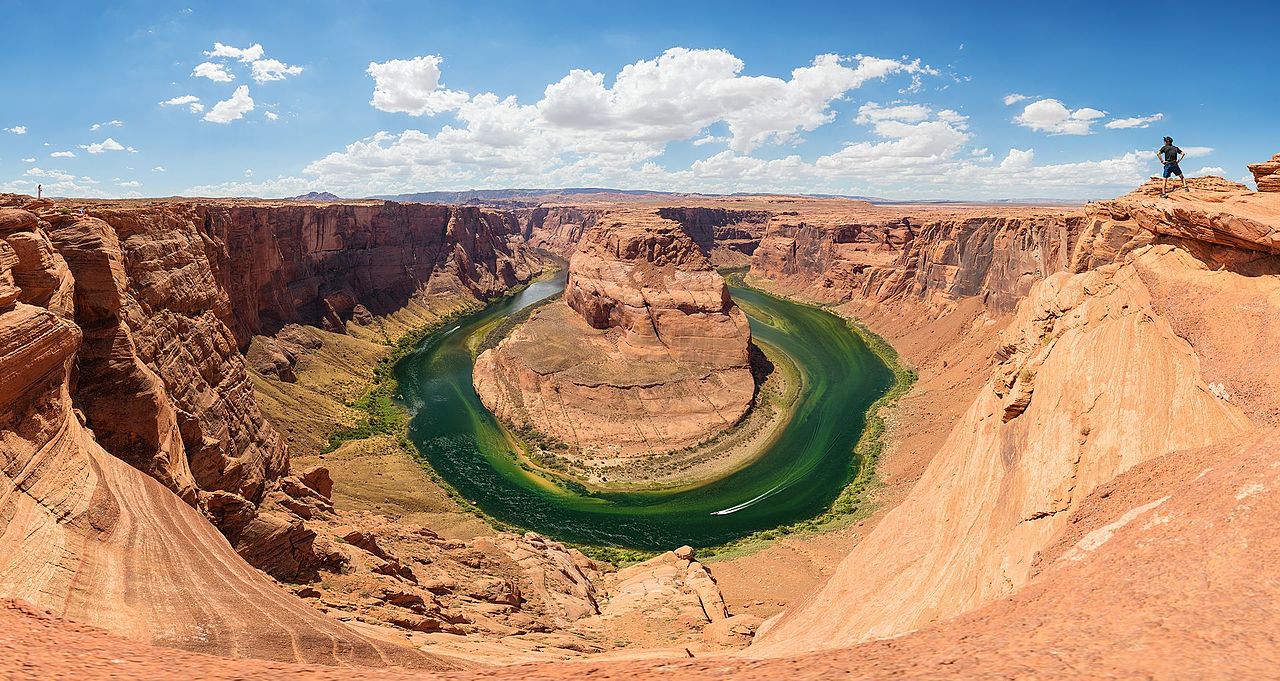
Horseshoe Bend is a horseshoe-shaped incised meander of the Colorado River located near the town of Page, Arizona, United States. It is also referred to as the "east rim of the Grand Canyon."
Horseshoe Bend is located 5 miles (8 km) downstream from the Glen Canyon Dam and Lake Powell within Glen Canyon National Recreation Area, about 4 miles (6 km) southwest of Page.
It is accessible via hiking a 1.5-mile (2.4 km) round trip from a parking area just off U.S. Route 89 within southwestern Page. The land south of the Bend's parking area, trail, and overlook are on the Navajo Nation territory.
Horseshoe Bend can be viewed from the steep cliff above.
The overlook is 4,200 feet (1,300 m) above sea level, and the Colorado River is at 3,200 feet (1,000 m) above sea level, making it a 1,000-foot (300 m) drop.


![[node:title]](/sites/default/files/styles/640x320/public/default_images/default_0.JPG.webp?itok=aqV9zhFR)


Add new comment