Hell's Half Acre (Wyoming)
Hell's Half Acre is a large scarp located about 40 miles (64 km) west of Casper, Wyoming on US 20/26. Encompassing 320 acres (1.3 km2), this geologic oddity is composed of deep ravines, caves, rock formations and hard-packed eroded earth. Hell's Half Acre was used as the location for the fictional planet of Klendathu in the movie Starship Troopers.
The location was known as "The Devil's Kitchen", "The Pits of Hades", and "The Baby Grand Canyon" until a cowhand appeared and thought he was at Hell's Half Acre, an area southwest of Casper full of alkali and bogs.
Native American tribes used the ravines to drive bison to their death during their hunts.
In 2005, the small restaurant and motel sitting atop the ravine were shut down by the property's leaseholders due to a lack of visitors and subsequently demolished. The area is fenced off and there is no public access to the cliff edge nor the valley itself, but there is an interpretive sign w...Read more
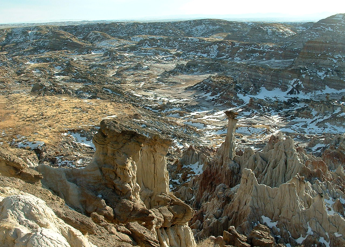
Hell's Half Acre is a large scarp located about 40 miles (64 km) west of Casper, Wyoming on US 20/26. Encompassing 320 acres (1.3 km2), this geologic oddity is composed of deep ravines, caves, rock formations and hard-packed eroded earth. Hell's Half Acre was used as the location for the fictional planet of Klendathu in the movie Starship Troopers.
The location was known as "The Devil's Kitchen", "The Pits of Hades", and "The Baby Grand Canyon" until a cowhand appeared and thought he was at Hell's Half Acre, an area southwest of Casper full of alkali and bogs.
Native American tribes used the ravines to drive bison to their death during their hunts.
In 2005, the small restaurant and motel sitting atop the ravine were shut down by the property's leaseholders due to a lack of visitors and subsequently demolished. The area is fenced off and there is no public access to the cliff edge nor the valley itself, but there is an interpretive sign west of where the former restaurant stood. As of July 2021, the fencing was still in place, but two gates in the fence were open, allowing vehicular access to a large gravel lot (with potholes) and a closer view of the topography.


Add new comment