Death Valley National Park
Death Valley National Park is a national park of the United States that straddles the California–Nevada border, east of the Sierra Nevada. The park boundaries include Death Valley, the northern section of Panamint Valley, the southern section of Eureka Valley and most of Saline Valley.
The park occupies an interface zone between the arid Great Basin and Mojave deserts, protecting the northwest corner of the Mojave Desert and its diverse environment of salt-flats, sand dunes, badlands, valleys, canyons and mountains.
Death Valley is the largest national park in the contiguous United States, as well as the hottest, driest and lowest of all the national parks in the United States. It contains Badwater Basin, the second-lowest point in the Western Hemisphere and lowest in North America at 282 feet (86 m) below sea level. More than 93% of the park is a designated wilderness area.
The park is home to many species of plants and an...Read more
Death Valley National Park is a national park of the United States that straddles the California–Nevada border, east of the Sierra Nevada. The park boundaries include Death Valley, the northern section of Panamint Valley, the southern section of Eureka Valley and most of Saline Valley.
The park occupies an interface zone between the arid Great Basin and Mojave deserts, protecting the northwest corner of the Mojave Desert and its diverse environment of salt-flats, sand dunes, badlands, valleys, canyons and mountains.
Death Valley is the largest national park in the contiguous United States, as well as the hottest, driest and lowest of all the national parks in the United States. It contains Badwater Basin, the second-lowest point in the Western Hemisphere and lowest in North America at 282 feet (86 m) below sea level. More than 93% of the park is a designated wilderness area.
The park is home to many species of plants and animals which have adapted to the harsh desert environment including creosote bush, Joshua tree, bighorn sheep, coyote, and the endangered Death Valley pupfish, a survivor from much wetter times. UNESCO included Death Valley as the principal feature of its Mojave and Colorado Deserts Biosphere Reserve in 1984.
A series of Native American groups inhabited the area from as early as 7000 BC, most recently the Timbisha around 1000 AD who migrated between winter camps in the valleys and summer grounds in the mountains. A group of European-Americans, lost in the valley in 1849 while looking for a shortcut to the gold fields of California, gave this valley its grim name, even though only one of their group died there.
Several short-lived boom towns sprang up during the late 19th and early 20th centuries to mine gold and silver. The only long-term profitable ore to be mined was borax, which was transported out of the valley with twenty-mule teams. The valley later became the subject of books, radio programs, television series, and movies. Tourism expanded in the 1920s when resorts were built around Stovepipe Wells and Furnace Creek. Death Valley National Monument was declared in 1933 and the park was substantially expanded and became a national park in 1994.
The natural environment of the area has been shaped largely by its geology. The valley is actually a graben with the oldest rocks being extensively metamorphosed and at least 1.7 billion years old. Ancient, warm, shallow seas deposited marine sediments until rifting opened the Pacific Ocean. Additional sedimentation occurred until a subduction zone formed off the coast. The subduction uplifted the region out of the sea and created a line of volcanoes. Later the crust started to pull apart, creating the current Basin and Range landform. Valleys filled with sediment and, during the wet times of glacial periods, with lakes, such as Lake Manly.
Death Valley is the fifth-largest American national park and the largest in the contiguous United States. It is also larger than the states of Rhode Island and Delaware combined, and nearly as large as Puerto Rico. In 2013, Death Valley National Park was designated as a dark sky park by the International Dark-Sky Association.

The park has a diverse and complex geologic history. Since its formation, the area that comprises the park has experienced at least four major periods of extensive volcanism, three or four periods of major sedimentation, and several intervals of major tectonic deformation where the crust has been reshaped. Two periods of glaciation (a series of ice ages) have also had effects on the area, although no glaciers ever existed in the ranges now in the park.[citation needed]
Basement and Pahrump GroupLittle is known about the history of the oldest exposed rocks in the area due to extensive metamorphism (alteration of rock by heat and pressure). Radiometric dating gives an age of 1,700 million years for the metamorphism during the Proterozoic.[1] About 1,400 million years ago a mass of granite now in the Panamint Range intruded this complex.[2] Uplift later exposed these rocks to nearly 500 million years of erosion.[2]
The Proterozoic sedimentary formations of the Pahrump Group were deposited on these basement rocks. This occurred following uplift and erosion of any earlier sediments from the Proterozoic basement rocks. The Pahrump is composed of arkose conglomerate (quartz clasts in a concrete-like matrix) and mudstone in its lower part, followed by dolomite from carbonate banks topped by algal mats as stromatolites, and finished with basin-filling sediment derived from the above, including possible glacial till from the hypothesized Snowball Earth glaciation.[3] The very youngest rocks in the Pahrump Group are basaltic lava flows.
Rifting and deposition
A rift opened and subsequently flooded the region as part of the breakup of the supercontinent Rodinia in the Neoproterozoic (by about 755 million years ago) and the creation of the Pacific Ocean. A shoreline similar to the present Atlantic Ocean margin of the United States lay to the east. An algal mat-covered carbonate bank was deposited, forming the Noonday Dolomite.[4] Subsidence of the region occurred as the continental crust thinned and the newly formed Pacific widened, forming the Ibex Formation. An angular unconformity (an uneven gap in the geologic record) followed.
A true ocean basin developed to the west, breaking all the earlier formations along a steep front. A wedge of clastic sediment then began to accumulate at the base of the two underwater precipices, starting the formation of opposing continental shelves.[5] Three formations developed from sediment that accumulated on the wedge. The region's first known fossils of complex life are found in the resulting formations.[5] Notable among these are the Ediacara fauna and trilobites, the evolution of the latter being part of the Cambrian Explosion of life.
The sandy mudflats gave way about 550 million years ago to a carbonate platform (similar to the one around the present-day Bahamas), which lasted for the next 300 million years of Paleozoic time (refer to the middle of the timescale image). Death Valley's position was then within ten or twenty degrees of the Paleozoic equator. Thick beds of carbonate-rich sediments were periodically interrupted by periods of emergence. Although details of geography varied during this immense interval of time, a north-northeastern coastline trend generally ran from Arizona up through Utah. The resulting eight formations and one group are 20,000 feet (6 km) thick and underlay much of the Cottonwood, Funeral, Grapevine, and Panamint ranges.[5]
Compression and uplift
In the early-to-mid- Mesozoic the western edge of the North American continent was pushed against the oceanic plate under the Pacific Ocean, creating a subduction zone.[5] A subduction zone is a type of contact between different crustal plates where heavier crust slides below lighter crust. Erupting volcanoes and uplifting mountains were created as a result, and the coastline was pushed to the west. The Sierran Arc started to form to the northwest from heat and pressure generated from subduction, and compressive forces caused thrust faults to develop.[citation needed]
A long period of uplift and erosion was concurrent with and followed the above events, creating a major unconformity, which is a large gap in the geologic record. Sediments worn off the Death Valley region were carried both east and west by wind and water.[7] No Jurassic- to Eocene-aged sedimentary formations exist in the area, except for some possibly Jurassic-age volcanic rocks (see the top of the timescale image).[7]
Stretching and lakes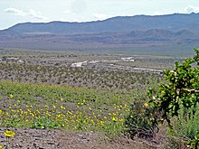
Basin and Range-associated stretching of large parts of crust below southwestern United States and northwestern Mexico started around 16 million years ago and the region is still spreading.[1] This stretching began to affect the Death and Panamint valleys area by 3 million years ago.[8] Before this, rocks now in the Panamint Range were on top of rocks that would become the Black Mountains and the Cottonwood Mountains. Lateral and vertical transport of these blocks was accomplished by movement on normal faults. Right-lateral movement along strike-slip faults that run parallel to and at the base of the ranges also helped to develop the area.[9] Torsional forces, probably associated with northwesterly movement of the Pacific Plate along the San Andreas Fault (west of the region), is responsible for the lateral movement.[8]
Igneous activity associated with this stretching occurred from 12 million to 4 million years ago.[9] Sedimentation is concentrated in valleys (basins) from material eroded from adjacent ranges. The amount of sediment deposited has roughly kept up with this subsidence, resulting in the retention of more or less the same valley floor elevation over time.[citation needed]
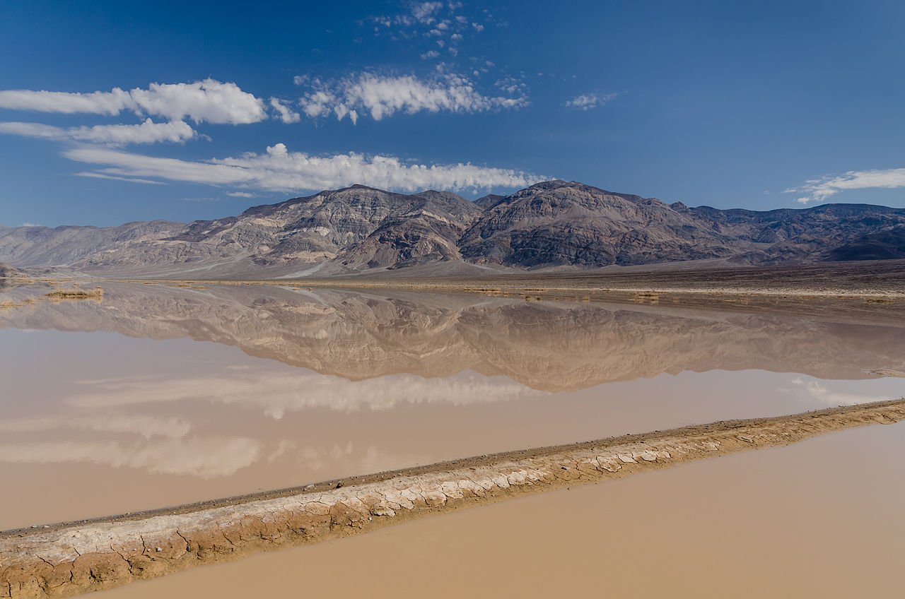
Pleistocene ice ages started 2 million years ago, and melt from alpine glaciers on the nearby Sierra Nevada Mountains fed a series of lakes that filled Death and Panamint valleys and surrounding basins (see the top of the timescale image). The lake that filled Death Valley was the last of a chain of lakes fed by the Amargosa and Mojave Rivers, and possibly also the Owens River. The large lake that covered much of Death Valley's floor, which geologists call Lake Manly, started to dry up 10,500 years ago.[10] Salt pans and playas were created as ice age glaciers retreated, thus drastically reducing the lakes' water source. Only faint shorelines are left.
Human history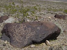
Four Native American cultures are known to have lived in the area during the last 10,000 years.[1] The first known group, the Nevares Spring People, were hunters and gatherers who arrived in the area perhaps 9,000 years ago (7000 BC) when there were still small lakes in Death Valley and neighboring Panamint Valley.[11] A much milder climate persisted at that time, and large game animals were still plentiful. By 5,000 years ago (3000 BC) the Mesquite Flat People displaced the Nevares Spring People.[11] Around 2,000 years ago the Saratoga Spring People moved into the area, which by then was probably already a hot, dry desert.[11][note 1] This culture was more advanced at hunting and gathering and was skillful at handcrafts. They also left mysterious stone patterns in the valley.
One thousand years ago, the nomadic Timbisha (formerly called Shoshone and also known as Panamint or Koso) moved into the area and hunted game and gathered mesquite beans along with pinyon pine nuts.[1][11] Because of the wide altitude differential between the valley bottom and the mountain ridges, especially on the west, the Timbisha practiced a vertical migration pattern.[1] Their winter camps were located near water sources in the valley bottoms. As the spring and summer progressed and the weather warmed, grasses and other plant food sources ripened at progressively higher altitudes. November found them at the very top of the mountain ridges where they harvested pine nuts before moving back to the valley bottom for winter.
The California Gold Rush brought the first people of European descent known to visit the immediate area. In December 1849 two groups of California Gold Country-bound travelers with perhaps 100 wagons total stumbled into Death Valley after getting lost on what they thought was a shortcut off the Old Spanish Trail.[12] Called the Bennett-Arcane Party, they were unable to find a pass out of the valley for weeks; they were able to find fresh water at various springs in the area, but were forced to eat several of their oxen to survive. They used the wood of their wagons to cook the meat and make jerky. The place where they did this is today referred to as "Burnt Wagons Camp" and is located near Stovepipe Wells.
After abandoning their wagons, they eventually were able to hike out of the valley. Just after leaving the valley, one of the women in the group turned and said, "Goodbye Death Valley," giving the valley they endured its name.[12] Included in the party was William Lewis Manly whose autobiographical book Death Valley in '49 detailed this trek and popularized the area (geologists later named the prehistoric lake that once filled the valley after him).
Boom and bust
The ores that are most famously associated with the area were also the easiest to collect and the most profitable: evaporite deposits such as salts, borate, and talc. Borax was found by Rosie and Aaron Winters near The Ranch at Death Valley (then called Greenland) in 1881.[13] Later that same year, the Eagle Borax Works became Death Valley's first commercial borax operation. William Tell Coleman built the Harmony Borax Works plant and began to process ore in late 1883 or early 1884, continuing until 1888.[14] This mining and smelting company produced borax to make soap and for industrial uses.[15] The end product was shipped out of the valley 165 miles (266 km) to the Mojave railhead in 10-ton-capacity wagons pulled by "twenty-mule teams" that were actually teams of 18 mules and two horses each.[15]

The teams averaged two miles (3 km) an hour and required about 30 days to complete a round trip.[13] The trade name 20-Mule Team Borax was established by Francis Marion Smith's Pacific Coast Borax Company after Smith acquired Coleman's borax holdings in 1890. A memorable advertising campaign used the wagon's image to promote the Boraxo brand of granular hand soap and the Death Valley Days radio and television programs. In 1914, the Death Valley Railroad was built to serve mining operations on the east side of the valley. Mining continued after the collapse of Coleman's empire, and by the late 1920s the area was the world's number one source of borax.[1] Some four to six million years old, the Furnace Creek Formation is the primary source of borate minerals gathered from Death Valley's playas.[13]
Other visitors stayed to prospect for and mine deposits of copper, gold, lead, and silver.[1] These sporadic mining ventures were hampered by their remote location and the harsh desert environment. In December 1903, two men from Ballarat were prospecting for silver.[16] One was an out-of-work Irish miner named Jack Keane and the other was a one-eyed Basque butcher named Domingo Etcharren. Quite by accident, Keane discovered an immense ledge of free-milling gold by the duo's work site and named the claim the Keane Wonder Mine. This started a minor and short-lived gold rush into the area.[16] The Keane Wonder Mine, along with mines at Rhyolite, Skidoo and Harrisburg, were the only ones to extract enough metal ore to make them worthwhile. Outright shams such as Leadfield also occurred, but most ventures quickly ended after a short series of prospecting mines failed to yield evidence of significant ore (these mines now dot the entire area and are a significant hazard to anyone who enters them). The boom towns which sprang up around these mines flourished during the first decade of the 1900s, but soon declined after the Panic of 1907.[14]
Early tourismThe first documented tourist facilities in Death Valley were a set of tent houses built in the 1920s where Stovepipe Wells is now located. People flocked to resorts built around natural springs thought to have curative and restorative properties. In 1927, Pacific Coast Borax turned the crew quarters of its Furnace Creek Ranch into a resort, creating the Furnace Creek Inn and resort.[17] The spring at Furnace Creek was harnessed to develop the resort, and as the water was diverted, the surrounding marshes and wetlands started to shrink.[18]

Soon the valley was a popular winter destination. Other facilities started off as private getaways but were later opened to the public. Most notable among these was Death Valley Ranch, better known as Scotty's Castle. This large ranch home built in the Spanish Revival style became a hotel in the late 1930s and, largely because of the fame of Death Valley Scotty, a tourist attraction. Death Valley Scotty, whose real name was Walter Scott, was a gold miner who pretended to be the owner of "his castle", which he claimed to have built with profits from his gold mine. Neither claim was true, but the real owner, Chicago millionaire Albert Mussey Johnson, encouraged the myth. When asked by reporters what his connection was to Walter Scott's castle, Johnson replied that he was Mr. Scott's banker.[19]
Protection and later historyPresident Herbert Hoover proclaimed a national monument in and around Death Valley on February 11, 1933, setting aside almost two million acres (8,000 km2) of southeastern California and small parts of Nevada.[20]

The Civilian Conservation Corps (CCC) developed infrastructure in Death Valley National Monument during the Great Depression and on into the early 1940s. The CCC built barracks, graded 500 miles (800 km) of roads, installed water and telephone lines, and a total of 76 buildings. Trails in the Panamint Range were built to points of scenic interest, and an adobe village, laundry and trading post were constructed for the Timbisha Shoshone Tribe. Five campgrounds, restrooms, an airplane landing field and picnic facilities were also built.[21]
The creation of the monument resulted in a temporary closing of the lands to prospecting and mining. However, Death Valley was quickly reopened to mining by Congressional action in June 1933. As improvements in mining technology allowed lower grades of ore to be processed, and new heavy equipment allowed greater amounts of rock to be moved, mining in Death Valley changed. Gone were the days of the "single-blanket, jackass prospector" long associated with the romantic west. Open pit and strip mines scarred the landscape as international mining corporations bought claims in highly visible areas of the national monument. The public outcry that ensued led to greater protection for all national park and monument areas in the United States.[14] In 1976, Congress passed the Mining in the Parks Act, which closed Death Valley National Monument to the filing of new mining claims, banned open-pit mining and required the National Park Service to examine the validity of tens of thousands of pre-1976 mining claims. Mining was allowed to resume on a limited basis in 1980 with stricter environmental standards.[14] The last mine in the park, Billie Mine, closed in 2005.[22]
Death Valley National Monument was designated a biosphere reserve in 1984.[23] On October 31, 1994, the monument was expanded by 1.3 million acres (5,300 km2) and re-designated as a national park, via congressional passage of the California Desert Protection Act (Public Law 103–433).[23] Consequently, the elevated status for Death Valley made it the largest national park in the contiguous United States. On March 12, 2019, the John D. Dingell, Jr. Conservation, Management, and Recreation Act added 35,292 acres (55 sq mi; 143 km2) to the park.[24]
Many of the larger cities and towns within the boundary of the regional groundwater flow system that the park and its plants and animals rely upon are experiencing some of the fastest growth rates of any place in the United States. Notable examples within a 100-mile (160 km) radius of Death Valley National Park include Las Vegas and Pahrump, Nevada. In the case of Las Vegas, the local Chamber of Commerce estimates that 6,000 people are moving to the city every month. Between 1985 and 1995, the population of the Las Vegas Valley increased from 550,700 to 1,138,800.[18]
In 1977, parts of Death Valley were used by director George Lucas as a filming location for Star Wars, providing the setting for the fictional planet Tatooine.[25][26]

Cite error: There are <ref group=note> tags on this page, but the references will not show without a {{reflist|group=note}} template (see the help page).


 - Public domain")


Add new comment