Zabriskie Point

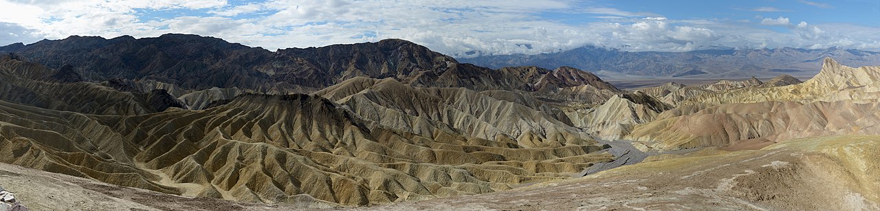
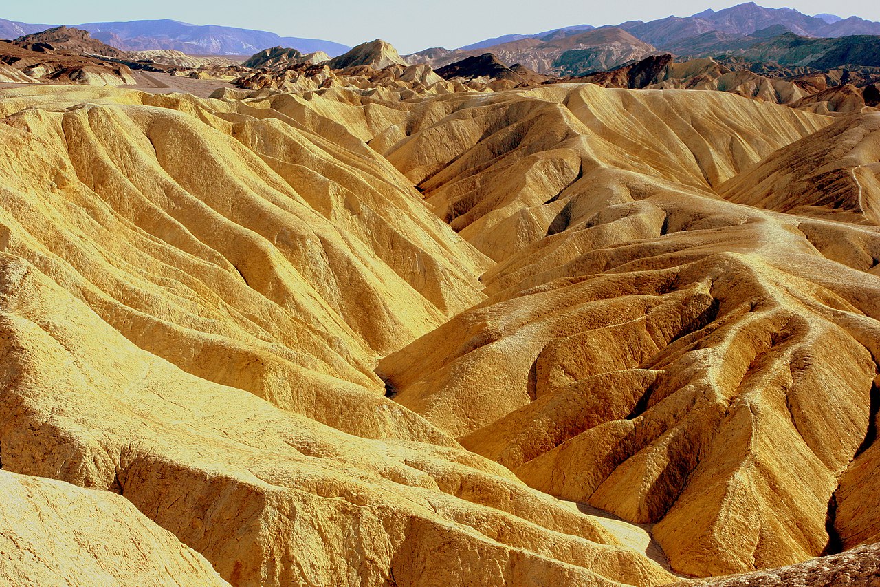
Zabriskie Point is a part of the Amargosa Range located east of Death Valley in Death Valley National Park in California, United States, noted for its erosional landscape. It is composed of sediments from Furnace Creek Lake, which dried up 5 million years ago—long before Death Valley came into existence.

Millions of years prior to the actual sinking and widening of Death Valley and the existence of Lake Manly (see Geology of the Death Valley area), another lake covered a large portion of Death Valley including the area around Zabriskie Point. This ancient lake began forming approximately nine million years ago. During several million years of the lake's existence, sediments were collecting at the bottom in the form of saline muds, gravels from nearby mountains, and ashfalls from the then-active Black Mountain volcanic field. These sediments combined to form what we today call the Furnace Creek Formation. The climate along Furnace Creek Lake was dry, but not nearly as dry as in the present. Camels, mastodons, horses, carnivores, and birds left tracks in the lakeshore muds, along with fossilized grass and reeds. Borates, which made up a large portion of Death Valley's historical past were concentrated in the lakebeds from hot spring waters and alteration of rhyolite in the nearby volcanic field. Weathering and alteration by thermal waters are also responsible for the variety of colors represented there.

 Close-up of Red Cathedral, to the right of Manly Beacon

Regional mountains building to the west influenced the climate to become more and more arid, causing the lake to dry up, and creating a dry lake. Subsequent widening and sinking of Death Valley and the additional uplift of today's Black Mountains tilted the area. This provided the necessary relief to accomplish the erosion that produced the badlands we see today. The dark-colored material capping the badland ridges (to the left in the panoramic photograph) is lava from eruptions that occurred three to five million years ago. This hard lava cap has retarded erosion in many places and possibly explains why Manly Beacon, the high outcrop to the right, is much higher than other portion of the badlands. (Manly Beacon was named in honor of William L. Manly, who along with John Rogers, guided members of the ill-fated party of Forty-niners out of Death Valley during the California Gold Rush of 1849.)

 View of Manly Beacon from Zabriskie Point, showing convolutions, texture, and color contrasts in the eroded rock

The primary source of borate minerals gathered from Death Valley's playas is Furnace Creek Formation.[1] The Formation is made up of over 5000 feet (1500 m) of mudstone, siltstone, and conglomerate. The borates were concentrated in these lakebeds from hot spring waters and altered rhyolite from nearby volcanic fields.

^ "Death Valley geology field trip: Harmony Borax Works". United States Geological Survey. 2016-12-13. Retrieved 2018-09-18.
Photographies by:
Dicklyon - CC BY-SA 4.0
Statistics: Position
4137
Statistics: Rank
26546

Add new comment

Esta pregunta es para comprobar si usted es un visitante humano y prevenir envíos de spam automatizado.

Security
843152967Click/tap this sequence: 5798

Google street view

Where can you sleep near Zabriskie Point ?

Booking.com
489.930 visits in total, 9.198 Points of interest, 404 Destinations, 95 visits today.