Cotopaxi

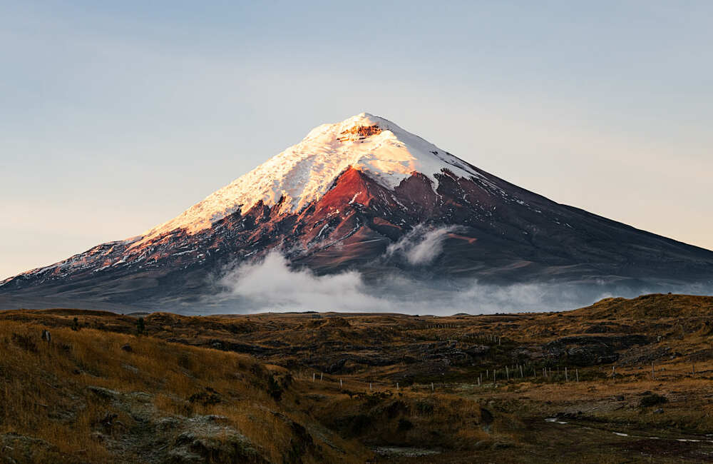
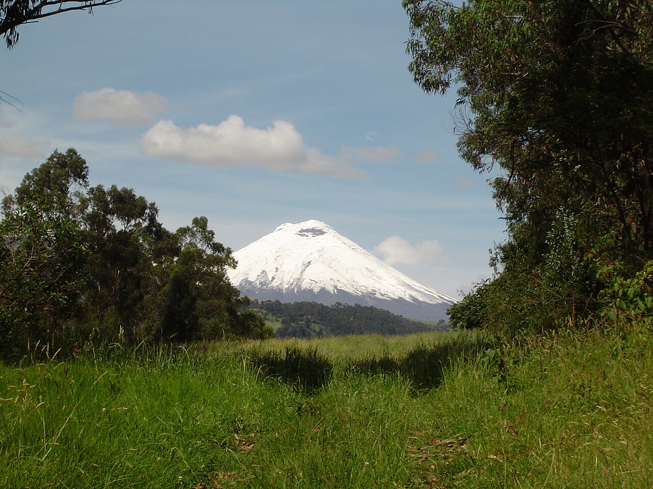
Cotopaxi (Spanish pronunciation: [kotoˈpaksi]) is an active stratovolcano in the Andes Mountains, located near Latacunga city of Cotopaxi Province, about 50 km (31 mi) south of Quito, and 31 km (19 mi) northeast of the city of Latacunga, Ecuador. It is the second highest summit in Ecuador, reaching a height of 5,897 m (19,347 ft). Cotopaxi is among the highest active volcanoes in the world.

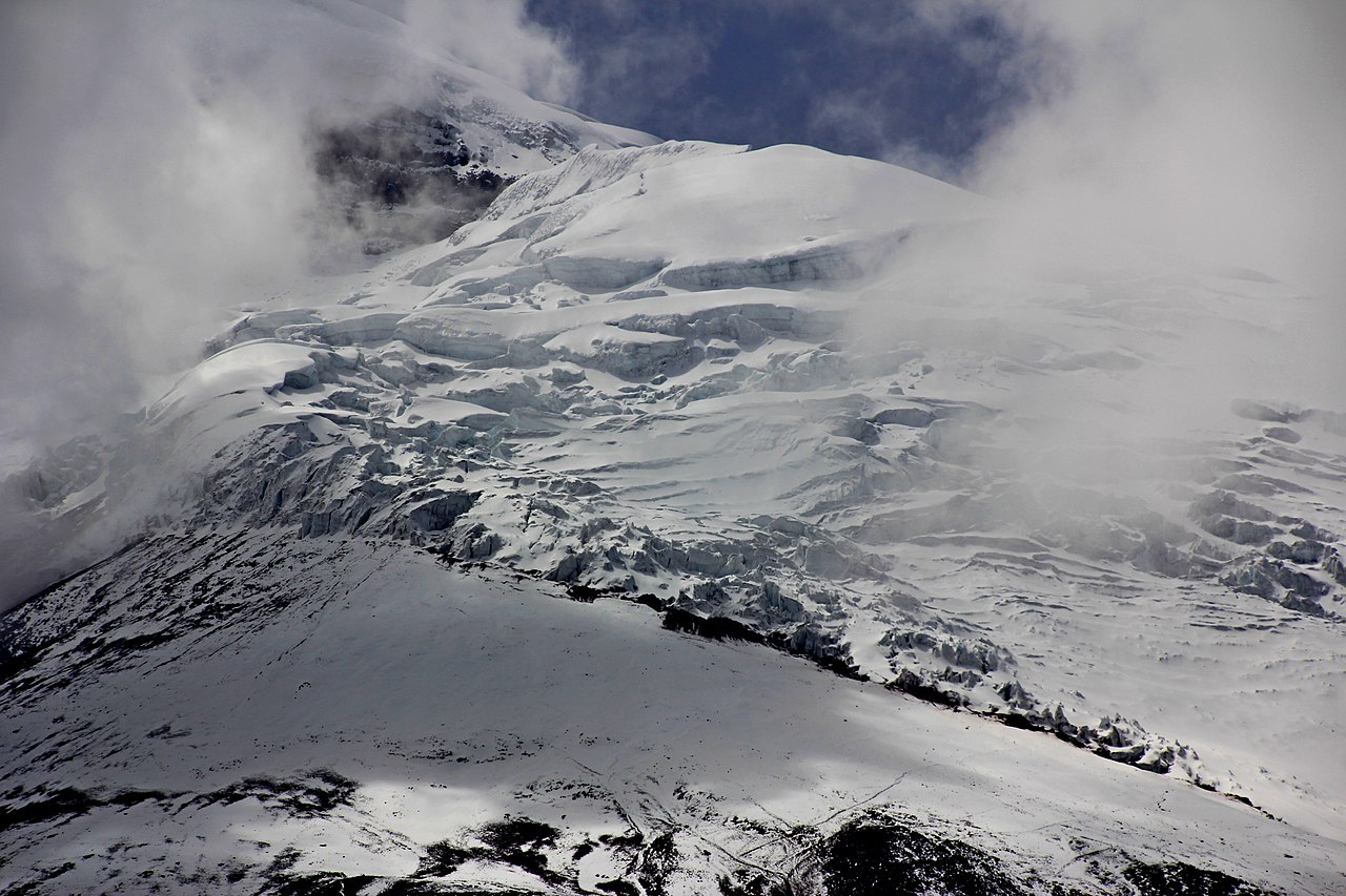
Cotopaxi is known to have erupted 87 times, resulting in the creation of numerous valleys formed by lahars (mudflows) around the volcano. An ongoing eruption began on 21 October 2022.

At the end of February 2023, the Geophysical Institute of Ecuador reported that Cotopaxi had produced around 8,000 earthquakes since October 21, 2022, amounting to 1,600 events per month.

Name

According to locals who speak Quechua, coto means 'neck' and paxi means 'moon' (Quechua q'oto 'throat' + Aymara phakhsi 'moon').[1][2] This refers to the crater of Cotopaxi that looks like a crescent moon. The mountain was honored as a sacred mountain by local Andean people, even before the Inca invasion in the 15th century. It was worshiped as rain sender, which served as the guarantor of the land's fertility, and at the same time its summit was revered as a place where gods lived.

Historic eruptions

With 87 known eruptions, Cotopaxi is one of Ecuador's most active volcanoes.[3] Its first recorded eruption was in 1534. This eruption appears to have deposited an ash layer in the lakes of El Cajas National Park that has been dated to 450±70 cal BP.[4]

Cotopaxi's most violent eruptions in historical times occurred in the years 1742, 1744, 1768, and 1877. The 1744 and 1768 events destroyed the colonial town of Latacunga. During the June 26, 1877 eruption, pyroclastic flows descended on all sides of the mountain melting the entire ice cap, with lahars traveling more than 100 km (62 mi) into the Pacific Ocean and western Amazon basin draining the valley.[3] The city of Latacunga was again leveled completely due to the mudslide deposits.

The eruption on 19 June 1742 was witnessed by the scientists Pierre Bouguer and Charles-Marie de La Condamine, members of the French Geodesic Mission, as they descended from nearby Guagua Pichincha.[5]

 Block of lava encased in tephra – products of different types of eruption at Cotopaxi

There was a major eruption from 1903 to 1904, and minor activity persisted until at least 1940 and possibly 1942.[3] (Note that direct observations of minor eruptions can be difficult because of bad weather, hence the uncertainty about the 1942 "eruption.") The same source also reported increased thermal/seismic, non-eruptive activity in 1975 and 2002. In the increased activity of 2002, fumarolic activity and sulfuric emissions increased and ice around the inside and on the southeastern side of the cone started to melt. However, no actual eruption was observed.[3]

In 2015, two large phreatic (steam) eruptions on the morning of August 14 marked a new phase of volcanic activity.[6][7] The volcano "remains in a very abnormal situation. In August, 2,100 earthquakes were recorded and emission rates of sulfur dioxide reach approximately 20,000 tonnes per day (19,700 long ton/d; 22,000 short ton/d). The government estimates some 300,000 people are at risk from the volcano in the provinces of Cotopaxi, Tungurahua, Napo and Pichincha.[8]

Climbing

The first non-Spanish European who tried to climb the mountain was Alexander von Humboldt in 1802; however, he only reached a height of about 4,500 m (14,760 ft). In 1858 Moritz Wagner investigated the mountain, but he could not reach the summit either.[citation needed]

On November 28, 1872, German geologist Wilhelm Reiss and his Colombian partner, Angel Escobar, finally reached the summit of Cotopaxi.[9]

In 1873 it was summitted by German Geologist Moritz Alphons Stübel and four Ecuadorians, Rafael Jantui, Melchor Páez, Vicente Ramón and Eusebio Rodriguez.[10][11]

In 1880 British mountaineer Edward Whymper and the Italian guides Jean-Antoine Carrel and Louis Carrel made the third recorded ascent of Cotopaxi and spent a night on the summit.[12]

Painters Rudolf Reschreiter [de] and Hans Meyer reached the summit in 1903, and many of Reschreiter's paintings feature a view of Cotopaxi.[13][better source needed]

In the late 20th century, summiting Cotopaxi became a major tourist draw. The José F. Ribas Refuge (Refugio José Félix Ribas) was built in 1971 at an elevation of 4,864 m (15,960 ft) and enlarged in 2005.

A tragedy occurred on Easter Sunday 1996 when an avalanche partially buried the Refuge and dozens of tourists. The glacier above the Refuge was probably weakened by an earthquake that had shaken the entire Province of Cotopaxi for several days prior to the avalanche. In the warm midday sun a huge portion of the ice wall broke loose. Being Easter, there were many day visitors on the mountain who were buried in the ice and snow. Those trapped in the Refuge broke windows on the downhill side to climb to safety, but 13 people died on the slope above. The Refuge itself is located in a valley and consequently vulnerable to future avalanches.[14]

^ "Cotopaxi: a story of legends, records and lovers". trenecuador.com. Retrieved 29 September 2019. ^ "How did Cotopaxi get its Quecha name?". cozine.com. 1 June 1998. Archived from the original on 31 March 2022. Retrieved 29 September 2019. ^ a b c d Cite error: The named reference si was invoked but never defined (see the help page). ^ Arcusa, Stéphanie H.; Schneider, Tobias; Mosquera, Pablo V.; Vogel, Hendrik; Kaufman, Darrell; Szidat, Sönke; Grosjean, Martin (2020). "Late Holocene tephrostratigraphy from Cajas National Park, southern Ecuador". Andean Geology. 47 (3): 508–528. doi:10.5027/andgeoV47n3-3301. ^ Cite error: The named reference Ferreiro2011 was invoked but never defined (see the help page). ^ "INFORME MENSUAL COTOPAXI AGOSTO 2015 - IGEPN". ^ Cite error: The named reference volcanodiscovery was invoked but never defined (see the help page). ^ "Diario la Hora, 7 de Agosto del 2015". Se registran lahares de poco alcance en el volcán Cotopaxi. Diario La Hora. Retrieved 2015-09-08. ^ Cite error: The named reference Greenspan2011 was invoked but never defined (see the help page). ^ Cite error: The named reference Rachowiecki1997 was invoked but never defined (see the help page). ^ "Cotopaxi, a short climbing history". Footsteps on the Mountain blog. 7 June 2018. ^ Whymper, Edward. Travels amongst the Great Andes of the Equator. John Murray, 1892, pp.136-156. ^ de:Rudolf Reschreiter ^ Cite error: The named reference Refuge was invoked but never defined (see the help page).
Photographies by:
Zones
Statistics: Position
561
Statistics: Rank
169486

Add new comment

Esta pregunta es para comprobar si usted es un visitante humano y prevenir envíos de spam automatizado.

Security
648327519Click/tap this sequence: 5248

Google street view

Where can you sleep near Cotopaxi ?

Booking.com
490.007 visits in total, 9.198 Points of interest, 404 Destinations, 56 visits today.