Cañón del Chicamocha
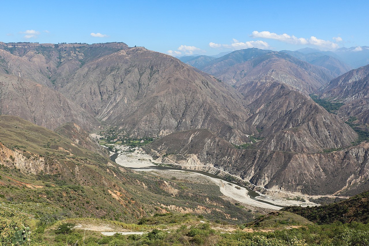
( Chicamocha Canyon )The Chicamocha Canyon ( CHEE-kə-MOH-chə, Spanish: Cañón del Chicamocha) is a steep sided canyon carved by the Chicamocha River in Colombia. With a maximum depth of 2,000 metres (6,600 ft), an area of 108,000 hectares (270,000 acres) and a length of 227 kilometres (141 mi), the canyon is the second-largest worldwide. The canyon is situated in the departments of Boyacá and Santander, stretching from Soatá in the southeast to Girón and Betulia in the northwest.
The canyon is a major tourist attraction at approximately 55 kilometres (34 mi) from the capital of Santander, Bucaramanga and close to backpacker destination San Gil. National Route 45A, connecting Bogotá with Bucaramanga, between San Gil and Piedecuesta crosses the canyon and offers spectacular sights on both sides of the Chicamocha River. The heavy truck traffic through the canyon, with frequent accidents and ...Read more
The Chicamocha Canyon ( CHEE-kə-MOH-chə, Spanish: Cañón del Chicamocha) is a steep sided canyon carved by the Chicamocha River in Colombia. With a maximum depth of 2,000 metres (6,600 ft), an area of 108,000 hectares (270,000 acres) and a length of 227 kilometres (141 mi), the canyon is the second-largest worldwide. The canyon is situated in the departments of Boyacá and Santander, stretching from Soatá in the southeast to Girón and Betulia in the northwest.
The canyon is a major tourist attraction at approximately 55 kilometres (34 mi) from the capital of Santander, Bucaramanga and close to backpacker destination San Gil. National Route 45A, connecting Bogotá with Bucaramanga, between San Gil and Piedecuesta crosses the canyon and offers spectacular sights on both sides of the Chicamocha River. The heavy truck traffic through the canyon, with frequent accidents and very restricted access can lead to long traffic jams. The canyon is currently administered by Chicamocha National Park (Spanish: Parque Nacional del Chicamocha, PANACHI). The Chicamocha Canyon started forming in the Early Oligocene, when Colombia was undergoing a tectonically active phase of the Andean orogeny. The Sierra Nevada de Santa Marta was emplaced during the Eocene and active subduction of the Caribbean and Coiba Plates caused uplift in the Eastern Ranges. The climatological changes of the Oligocene, with a general global cooling trend, strong uplift and changing and restricted weather patterns led to the formation of the early Chicamocha Canyon. Ongoing uplift in the Miocene brought about a larger and higher hinterland for the drainage basin of the Chicamocha River. In the Pleistocene, at the southern extension near Soatá, a paleolake, Lake Soatá formed, which was inhabited by the elephant-like Notiomastodon (described as Haplomastodon waringi found in the Soatá Formation in the canyon.
The canyon is one of the treasures of Colombia.
In 2009, the canyon was preselected for the election of the 7 natural wonders. The Chicamocha canyon was finally located in the Top 77 of the Natural Wonders.
Since 2013, a yearly set of running contests, the Chicamocha Canyon Race, are held around the canyon.


![[node:title]](/sites/default/files/styles/640x320/public/default_images/default_0.JPG.webp?itok=aqV9zhFR)


Add new comment