Ani (Armenian: Անի; Ancient Greek: Ἄνιον, romanized: Ánion; Latin: Abnicum) is a ruined medieval Armenian city now situated in Turkey's province of Kars, next to the closed border with Armenia.
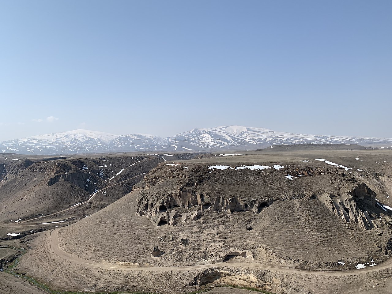
Between 961 and 1045, it was the capital of the Bagratid Armenian kingdom that covered much of present-day Armenia and eastern Turkey. The iconic city was often referred to as the "City of 1,001 Churches," though the number was significantly less. To date, 50 churches, 33 cave chapels and 20 chapels have been excavated by archaeologists and historians. Ani stood on various trade routes and its many religious buildings, palaces, and sophisticated fortifications distinguished it from other contemporary urban centers in the Armenian kingdom. Among its most notable buildings was the Cathedral of ...Read more
Ani (Armenian: Անի; Ancient Greek: Ἄνιον, romanized: Ánion; Latin: Abnicum) is a ruined medieval Armenian city now situated in Turkey's province of Kars, next to the closed border with Armenia.
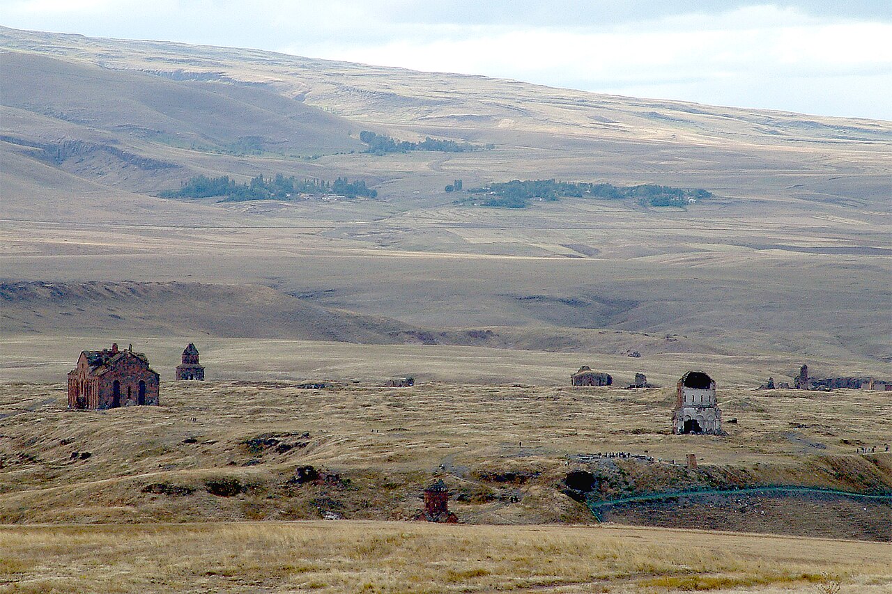
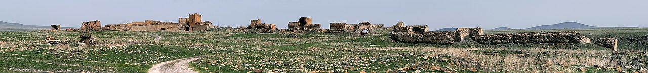
Between 961 and 1045, it was the capital of the Bagratid Armenian kingdom that covered much of present-day Armenia and eastern Turkey. The iconic city was often referred to as the "City of 1,001 Churches," though the number was significantly less. To date, 50 churches, 33 cave chapels and 20 chapels have been excavated by archaeologists and historians. Ani stood on various trade routes and its many religious buildings, palaces, and sophisticated fortifications distinguished it from other contemporary urban centers in the Armenian kingdom. Among its most notable buildings was the Cathedral of Ani, which is associated with early examples of Gothic architecture and that scholars argue influenced the great cathedrals of Europe in the early gothic and Romanesque styles; its ribbed vaulting would not be seen in European cathedrals for at least another two centuries. At its height, Ani was one of the world's largest cities, with a population of well over 100,000, though this seems highly optimistic given its limited area.
Renowned for its splendor, Ani was sacked by the Mongols in 1236. Ani never recovered from a devastating 1319 earthquake and, more significantly, from the shifting of regional trade routes, and was abandoned by the 17th century. Ani is a widely recognized cultural, religious, and national heritage symbol for Armenians. According to Razmik Panossian, Ani is one of the most visible and ‘tangible’ symbols of past Armenian greatness and hence a source of pride. In 2016, it was added onto the UNESCO World Heritage List. After two decades of continuous international efforts, Ani Archaeological Site has transformed from a seat of conflict and geopolitical instability to a center of cultural tourism that might foster cultural exchange and deepening historical understanding.


![[node:title]](/sites/default/files/styles/640x320/public/default_images/default_0.JPG.webp?itok=aqV9zhFR)


Add new comment