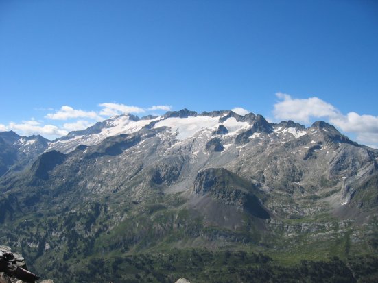
Pic d'Aneto
( Aneto )Aneto is the highest mountain in the Pyrenees and in Aragon, Spain's third-highest mountain, reaching a height of 3,404 metres (11,168 feet). It is in the Spanish province of Huesca, the northernmost of three Aragonese provinces, 6 kilometres (4 miles) south of the France–Spain border. It forms the southernmost part of the Maladeta massif.
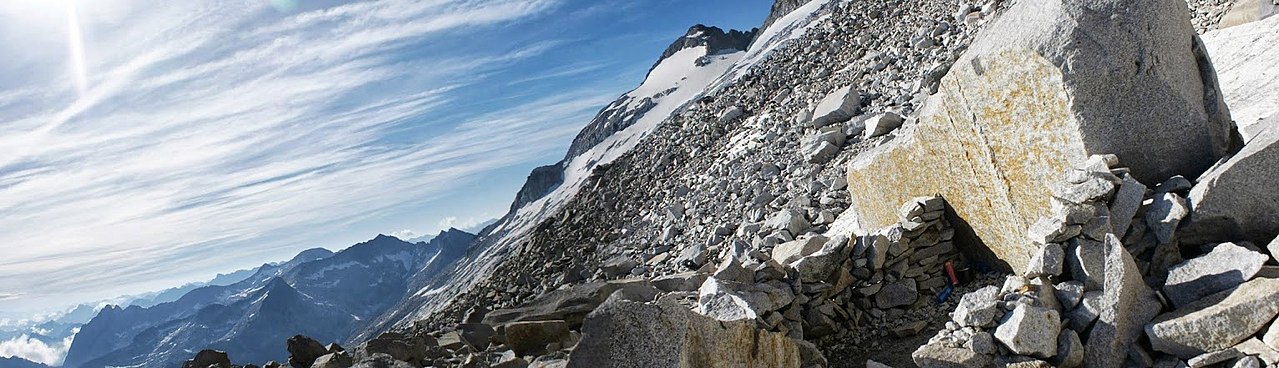
Aneto is located in the Posets-Maladeta Natural Park, in the municipality of Benasque, Huesca province, an autonomous community of Aragon, Spain. It is part of the Maladeta massif and is located in the Benasque valley. It consists of Paleozoic terrain of a granitic nature and Mesozoic materials. Its northern side holds the largest glacier in the Pyrenees, covering 79.6 hectares (196+3⁄4 acres) in 2005; it is shrinking rapidly due to warming summer temperatures and decreasing winter precipitations over the 20th century – it covered 106.7 ha in 1981, and over 200 ha in the 19th centu...Read more
Aneto is the highest mountain in the Pyrenees and in Aragon, Spain's third-highest mountain, reaching a height of 3,404 metres (11,168 feet). It is in the Spanish province of Huesca, the northernmost of three Aragonese provinces, 6 kilometres (4 miles) south of the France–Spain border. It forms the southernmost part of the Maladeta massif.
Aneto is located in the Posets-Maladeta Natural Park, in the municipality of Benasque, Huesca province, an autonomous community of Aragon, Spain. It is part of the Maladeta massif and is located in the Benasque valley. It consists of Paleozoic terrain of a granitic nature and Mesozoic materials. Its northern side holds the largest glacier in the Pyrenees, covering 79.6 hectares (196+3⁄4 acres) in 2005; it is shrinking rapidly due to warming summer temperatures and decreasing winter precipitations over the 20th century – it covered 106.7 ha in 1981, and over 200 ha in the 19th century. It is estimated that it has lost more than half of its surface in the last 100 years, and may disappear around 2050.


![[node:title]](/sites/default/files/styles/640x320/public/default_images/default_0.JPG.webp?itok=aqV9zhFR)


Add new comment