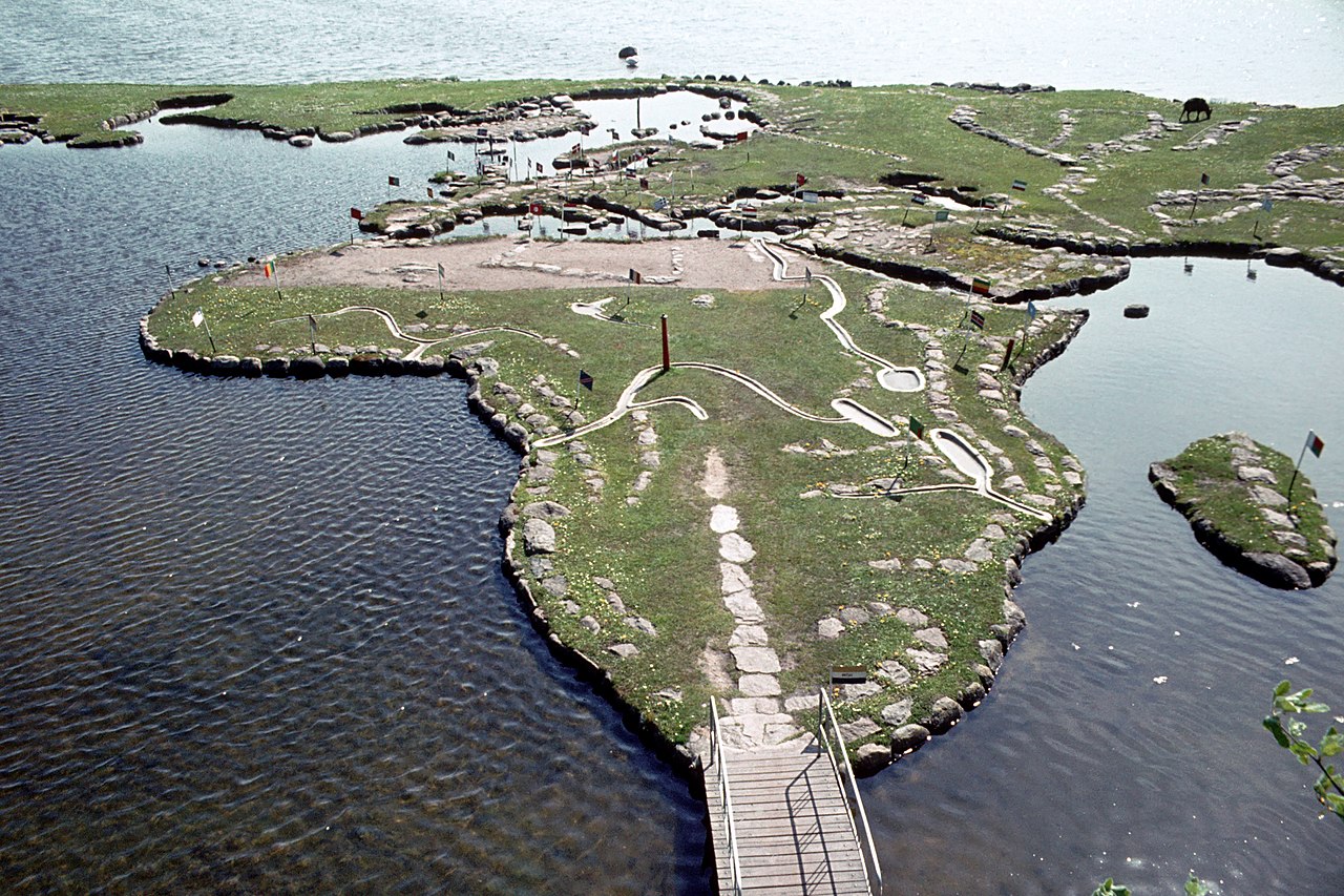
Verdenskortet ved Klejtrup Sø ( World Map at Lake Klejtrup ) Wikipedia body audio Shtëpia Danimarka Skandinavia World Map at Lake Klejtrup Description Harta botërore në liqenin Klejtrup (danisht: Verdenskortet ved Klejtrup Sø) është një hartë botërore në miniaturë e ndërtuar me gurë dhe bar në Klejtrup Sø afër fshati Klejtrup, Komuna Viborg, Danimarkë. 2 1 0 0 0 0 Dërgo Rifillo More information Photographies by: Zones Danimarka Skandinavia Statistics: Position 4668 Statistics: Rank 180717 Shto një koment të ri Komenti About text formats CAPTCHA Security Code 319672485Click/tap this sequence: 8964 Esta pregunta es para comprobar si usted es un visitante humano y prevenir envíos de spam automatizado. Ruaj Google street view Google street view Where can you sleep near World Map at Lake Klejtrup ? Booking.com What can you do near World Map at Lake Klejtrup ? Tollundmanden Tollund Man Aalborghus Lindholm Høje Den Gamle By ARoS Aarhus Kunstmuseum Aarhus Ø Aarhus Docklands Møllehøj Samsø Labyrinten Jellingstenene Jelling stones Jelling stone ship Rubjerg Knude Fyr Rubjerg Knude Lighthouse Legoland Billund Resort LEGO House Lego House (Billund) Slotved Skov Råbjerg Mile Den tilsandede kirke Sand-Covered Church Ladbyskibet Ladby ship Odense Grenen View more on the map 8.775.495 visits in total, 407.503 Points of interest, 405 Destinations, 6.959 visits today.
 12:19, 28 July 2009 (UTC) - CC BY-SA 3.0")


. - CC BY-SA 3.0")


![[node:title]](/sites/default/files/styles/640x320/public/default_images/default_0.JPG.webp?itok=aqV9zhFR)


Shto një koment të ri