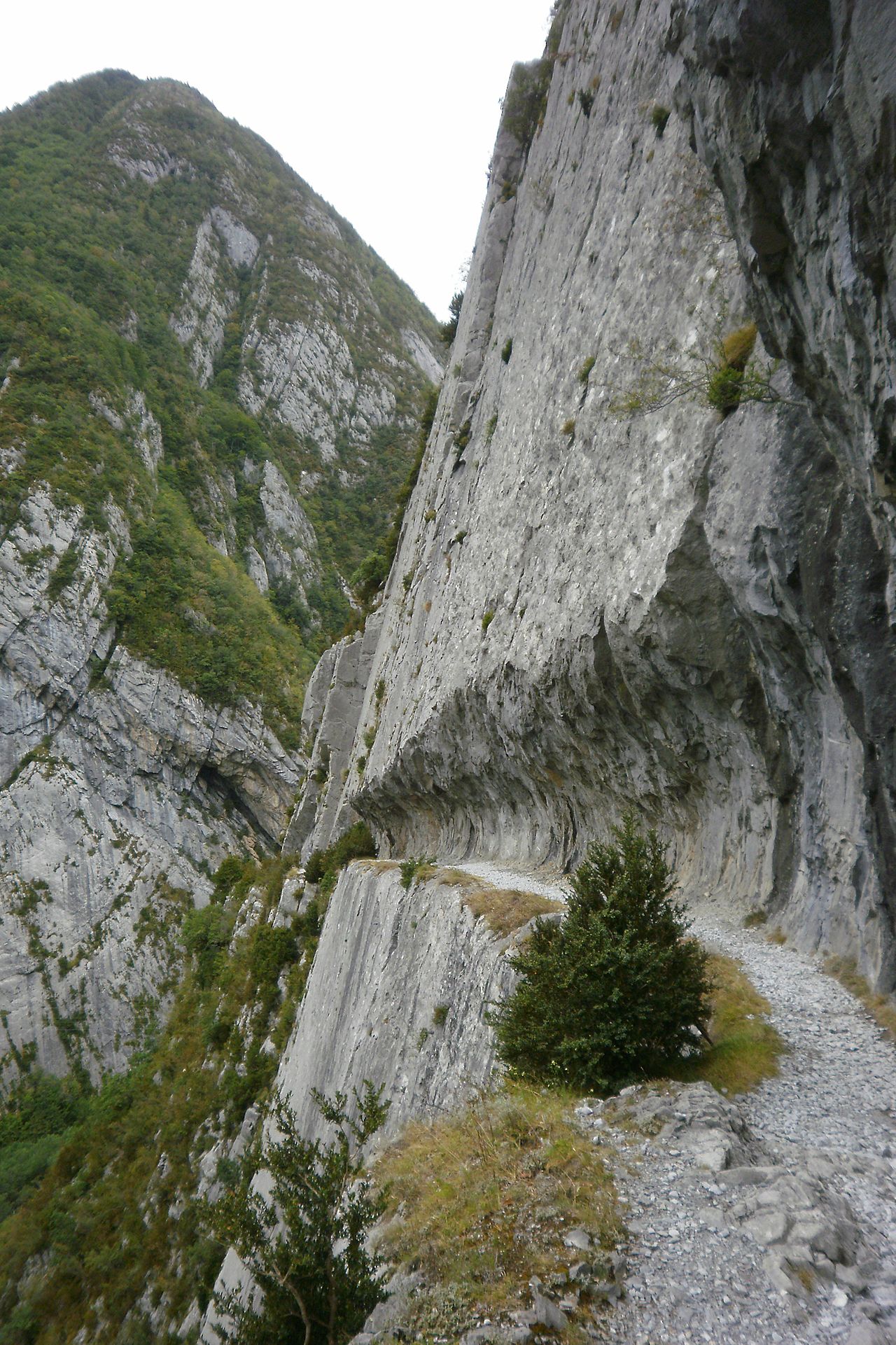
French Pyrenees တောင်တန်းများတွင် တည်ရှိသော Chemin de la Mâture သည် Gave d'Aspe မြစ်အထက် မီတာ 200 (660 ပေ) ကျော်မြင့်သော ကျောက်တုံးကြီးတစ်ခုအဖြစ် ထွင်းထုထားသည့် အရှည် 1,200 မီတာ (3,900 ပေ) ရှိသော လမ်းတစ်ခုဖြစ်သည်။ . အင်ဂျင်နီယာ Paul-Marie Leroy မှ 1772 ခုနှစ်တွင် အပြီးသတ်ခဲ့ပြီး၊ Chemin de la Mâture (စာသားအရ "The Mast Road") ကို ပြင်သစ်ရေတပ်သင်္ဘောများတည်ဆောက်ရာတွင် အသုံးပြုရန်အတွက် အနီးနားရှိ Pacq သစ်တောမှ သစ်များကို သယ်ယူပို့ဆောင်ရန်အတွက် မူလက ဖန်တီးခဲ့ခြင်းဖြစ်သည်။ ယင်းလမ်းကြောင်းကို အတ္တလန်တိတ်သမုဒ္ဒရာမှ မြေထဲပင်လယ်အထိ Pyrenees တစ်လျှောက် ပြေးဆွဲနေသည့် ခရီးဝေးခြေလျင်လမ်းဖြစ်သည့် GR 10 တွင် ထည့်သွင်းခဲ့သည်။
ရင့်ကျက်မှုလမ်းကြောင်းသည် Portalet ခံတပ်ကို အပေါ်စီးမှမြင်ရပြီး Pyrenees-Atlantic ဌာနရှိ Etsaut ရွာအနီးတွင် တည်ရှိသည်။ ထိုနေရာသည် ကျောက်တောင်တက်ရန် ရေပန်းစားသည်။


. - CC BY-SA 3.0")

မှတ်ချက်အသစ် ရေးရန်