


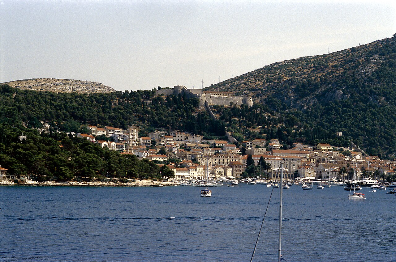
The earliest known settlement on the site of today's Hvar town was Illyrian,[1] lying on the hill slopes to the north side of the town square, which was then a small bay that came up to where the cathedral now stand, moreover (Ben) the cathedral is entirely surrounded by streets which resemble that of a block system common to American and Roman roads. On the site of the present Spanish Fortress stood a hillfort, the importance of which can be seen in the pottery from the site, indicating long-distance trade from the eighth century B.C. onwards.[2]
The ancient Greeks founded the settlement of Faros (384 BC) on the north of the island, from where they could control the fertile agricultural area, now known as the Stari Grad Plain. It has been proposed[3] that there was concurrently a second Greek settlement called Heraclea, on the site of today's Hvar town.
With the arrival of the Ancient Romans around 2nd century BC, settlement on the island was expanded. Colonisation was mainly rural, based around Roman villas (villae rusticae). During the 7th–8th centuries, the Slavs arrived on the island. At this time, life on the coast was not safe due to raiding pirates, and the inhabitants moved inland.[2] By the Medieval period, the population was gathered in villages well away from the coast for safety.[4]
Following this unsettled period, the islanders asked the Venetian Empire for protection (1278). As part of the agreement, the southern settlement of Hvar was to be expanded and fortified as a safe base for the Venetian fleet. As the new administrative centre, the town assumed the name of Lesina (Hvar), and the ancient Greek town became known as Cittavecchia (Stari Grad, literally Old Town). Hvar became the centre of the independent commune government, the residence of the prince, and the base of the new diocese (consisting of Hvar, and the neighbouring islands of Brač, and Vis). The Venetians commissioned the construction of a new fortress, town walls, public buildings, and with the new prosperity, villages were gradually established along the nearby coastline.
By the 15th century, the town had become too confined within the old walls, so settlement extended onto the hill to the south. The medieval town was bounded to the east by the cathedral and to the west by the Arsenal, the Governor's Palace and marina. During this time, Hvar was the centre of the economic, political and cultural life on the island, and played an important role in Venetian shipping.
The 16th century was a return to more unsettled times, with persistent conflicts between the nobles and citizens, and repeated attacks from the Ottoman Empire, now occupying the mainland. In 1571 Hvar was sacked by the Turkish fleet on its way to the Battle of Lepanto, and only the fortress saved the townspeople. Just as the town was being rebuilt, it suffered further damage in 1579 as lightning struck the gunpowder magazine in the fortress.[4] Many of today's public buildings in Hvar date from the reconstruction following the explosion.
In 1776, the Venetians moved their naval base to Kotor on the mainland, and the town of Hvar went into a decline.[5] In summary, Hvar was part of the dominion of the Republic of Venice from 1278 to 1358 and again from 1420 to 1797, the year in which Napoleon took control of Venice. After a brief period under the French Empire, Hvar came under the Austrian Habsburg Empire in the early part of the 19th century, a period of exceptional economic and cultural life for the town. In 1868, "The Hygienic Association of Hvar" was founded, to promote the development of tourist services.[4]

Schilderung einer Pilgerreise von Konstanz nach Jerusalem by Konrad von Grünenberg, in 1487.

Giovanni Francesco Camotio: Panorama of Hvar in 1571.


 - CC BY 2.0")


![[node:title]](/sites/default/files/styles/640x320/public/default_images/default_0.JPG.webp?itok=aqV9zhFR)


បន្ថែមមតិយោបល់ថ្មី