Khu phi quân sự vĩ tuyến 17

( Vietnamese Demilitarized Zone )

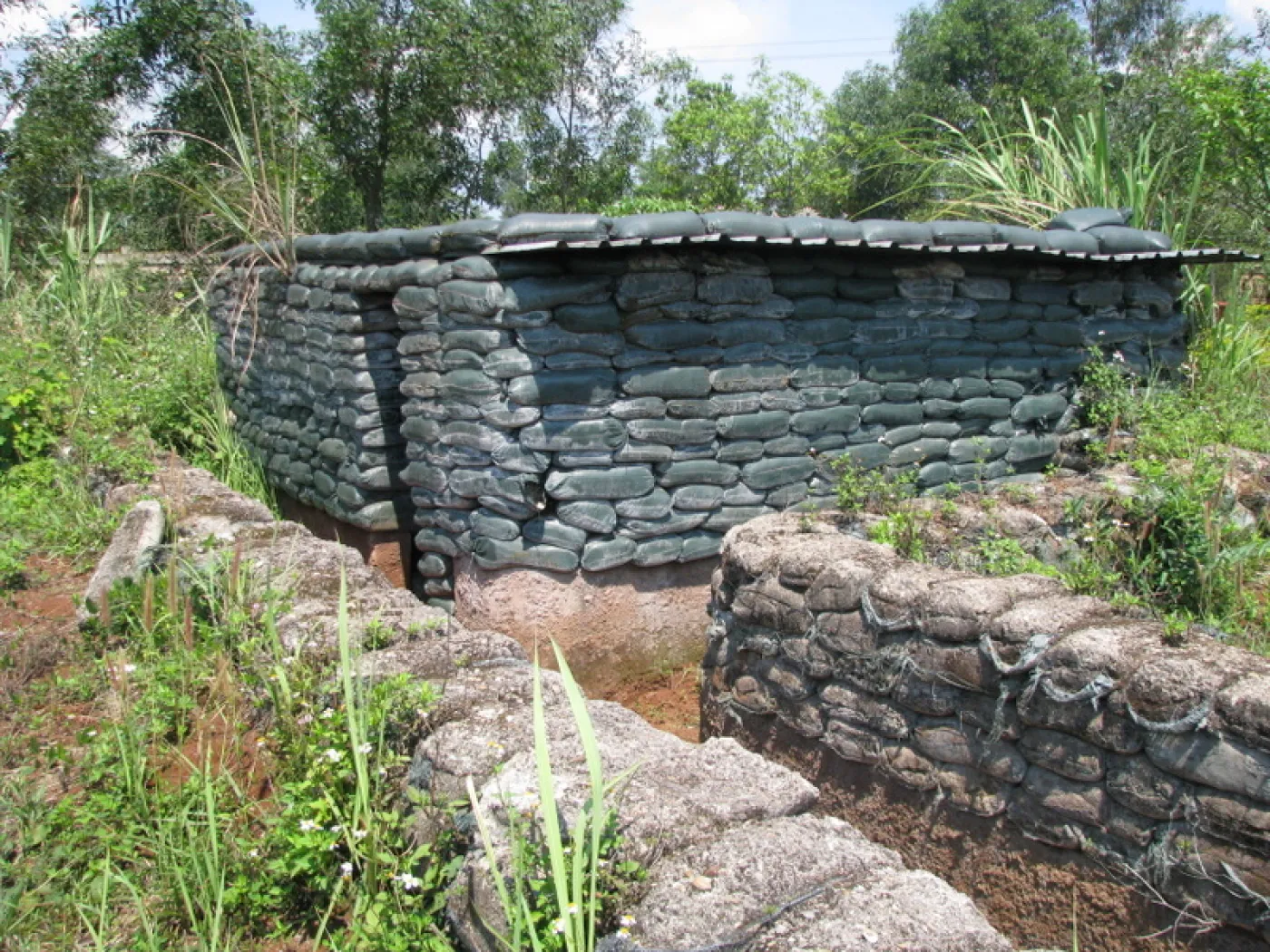
The Vietnamese Demilitarized Zone was a demilitarized zone in Quang Tri province and at the 17th parallel that was established as a dividing line between the two countries i.e. North and South Vietnam from 22 July 1954 to 2 July 1976 when Vietnam was officially divided into the two military gathering areas, which was intended to be sustained in the short term after the First Indochina War.

During the Vietnam War (1955-1975) it became important as the battleground demarcation between communist North Vietnam and anti-communist South Vietnam. The zone de jure ceased to exist with the reunification of Vietnam in 1976.

 
The Demilitarized Zone between North and South Vietnam, March 1968, looking west toward Laos.

The First Indochina War (also called the French Indochina War) was fought in French Indochina from 1946 to 1954 between the French Union (including the anti-communist State of Vietnam) on the one side, and the communist-dominated Viet Minh/Democratic Republic of Vietnam and allies (aided by China and the Soviet Union) on the other.[1] The Viet Minh won the war after their victory in Dien Bien Phu on 7 May 1954. On 22 July 1954, the French Union gave up its control of Vietnam, Vietnam was divided into two: North (Democratic Republic of Vietnam) and South (State of Vietnam).[1]

The postcolonial conditions of Vietnam were set at the Geneva Conference of 1954, and an agreement was signed between France and the Democratic Republic of Vietnam on 21 July 1954.[1] The agreement reflected the military situation on the ground: the northern part of Vietnam, which was almost entirely controlled by the Viet Minh, became the Democratic Republic of Vietnam, under the communist leader Ho Chi Minh. The southern part of Vietnam, where the Viet Minh controlled only relatively small and remote areas, became the independent State of Vietnam under Bảo Đại, the last scion of the old Vietnamese imperial house. The State of Vietnam later became the Republic of Vietnam. A temporary boundary, running primarily along the Bến Hải River was established pending elections, with the area on either side of the border declared a demilitarized zone. Troops of both governments were barred from that area.[2]

After war between North and South Vietnam broke out in 1955-one year after the division, the DMZ hardened into a de facto international boundary. The war itself evolved into a proxy conflict of the Cold War and milions of the United States as well as allied soliders being sent to the country to help anti-communist government of South Vietnam against communist North Vietnam from 1965 to 1973. Despite the DMZ's supposed status, 3rd Marine Division intelligence estimated that the combat strength of North Vietnamese Army and Viet Cong (a branch of North Vietnam) forces in the DMZ area in January 1968 was 40,943 troops.[3]

The North was ultimately victorious in the war with the fall of the Republic of Vietnam in 1975, and the DMZ ceased to exist after the reunification of Vietnam under a communist regime between North Vietnam and the North-controlled Republic of South Vietnam on 2 July 1976.

^ a b c Cite error: The named reference IBS was invoked but never defined (see the help page). ^ "17th parallel". Encyclopedia Britannica. Retrieved September 21, 2020. ^ Pike, COL Thomas F., Military Records, February 1968, 3rd Marine Division: The Tet Offensive, p. 115, ISBN 978-1-481219-46-4. NVA and VC Order of Battle information is located on pages 114-127
Photographies by:
Aine Hickey - CC BY 3.0
Zones
Statistics: Position (field_position)
6593
Statistics: Rank (field_order)
10210

Add new comment

Esta pregunta es para comprobar si usted es un visitante humano y prevenir envíos de spam automatizado.

Security
495726318Click/tap this sequence: 7429

Google street view

Where can you sleep near Vietnamese Demilitarized Zone ?

Booking.com
450.351 visits in total, 9.077 Points of interest, 403 Destinations, 52 visits today.