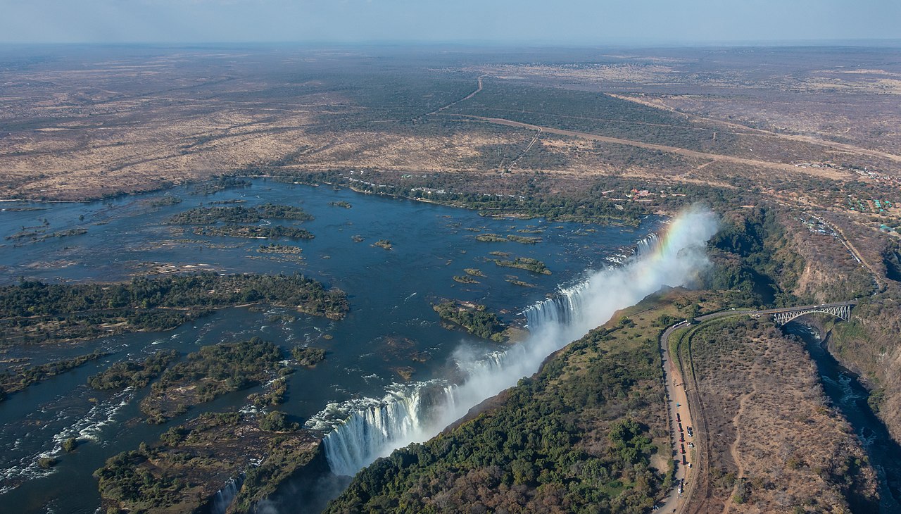
Victoria Falls (Lozi: Mosi-oa-Tunya, "Thundering Smoke/Smoke that Rises"; Tonga: Shungu Namutitima, "Boiling Water") is a waterfall on the Zambezi River, located on the border between Zambia and Zimbabwe. It is one of the world's largest waterfalls, with a width of 1,708 m (5,604 ft). The region around it has a high degree of biodiversity in both plants and animals.
Archaeology and oral history describe a long record of African knowledge of the site. Although known to some European geographers before the 19th century, Scottish missionary David Livingstone identified the falls in 1855, naming them Victoria Falls after Queen Victoria. Since the mid-20th century, the site has been a major tourist destination. Zambia and Zimbabwe both have national parks and tourism infrastructure at the site. Research in the late 2010s found that precipitation variability due to climate change is likely to alter the character of the falls.
...Read more
Victoria Falls (Lozi: Mosi-oa-Tunya, "Thundering Smoke/Smoke that Rises"; Tonga: Shungu Namutitima, "Boiling Water") is a waterfall on the Zambezi River, located on the border between Zambia and Zimbabwe. It is one of the world's largest waterfalls, with a width of 1,708 m (5,604 ft). The region around it has a high degree of biodiversity in both plants and animals.
Archaeology and oral history describe a long record of African knowledge of the site. Although known to some European geographers before the 19th century, Scottish missionary David Livingstone identified the falls in 1855, naming them Victoria Falls after Queen Victoria. Since the mid-20th century, the site has been a major tourist destination. Zambia and Zimbabwe both have national parks and tourism infrastructure at the site. Research in the late 2010s found that precipitation variability due to climate change is likely to alter the character of the falls.


Add new comment