Gorges du Verdon
( Verdon Gorge )
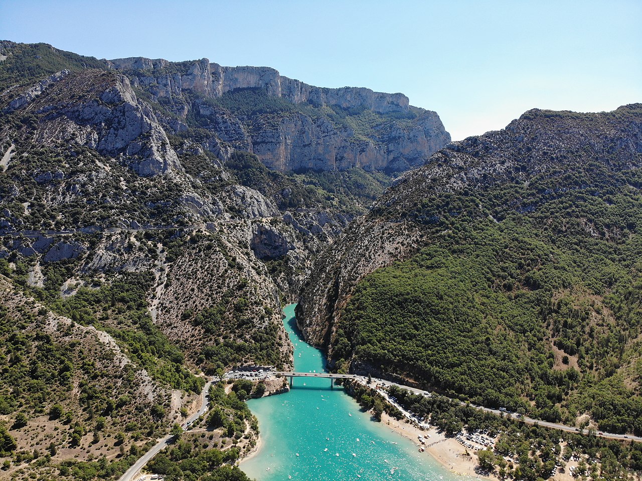
The Verdon Gorge (French: Gorges du Verdon Occitan: Gòrja de Verdon) is a river canyon located in the Provence-Alpes-Côte d'Azur region of Southeastern France. It is about 25 km (15.5 mi) long and up to 700 metres (0.4 mi) deep. It was formed by the Verdon River, which is named for its turquoise-green colour, one of the location's distinguishing characteristics. In between the towns of Castellane and Moustiers-Sainte-Marie, the river has cut a ravine to a depth of 700 meters through the limestone mass. At the end of the canyon, the Verdon flows into the artificial Lake of Sainte-Croix.
The gorge is very popular with tourists, who can drive around its rim, rent kayaks to travel on the river, or hike. The limestone walls, which are several hundreds of metres high, attract many rock climbers. It is considered an outstanding destination for multi-pitch climbing, with 1,500 routes available ranging from 20 metres (65 fe...Read more
The Verdon Gorge (French: Gorges du Verdon Occitan: Gòrja de Verdon) is a river canyon located in the Provence-Alpes-Côte d'Azur region of Southeastern France. It is about 25 km (15.5 mi) long and up to 700 metres (0.4 mi) deep. It was formed by the Verdon River, which is named for its turquoise-green colour, one of the location's distinguishing characteristics. In between the towns of Castellane and Moustiers-Sainte-Marie, the river has cut a ravine to a depth of 700 meters through the limestone mass. At the end of the canyon, the Verdon flows into the artificial Lake of Sainte-Croix.
The gorge is very popular with tourists, who can drive around its rim, rent kayaks to travel on the river, or hike. The limestone walls, which are several hundreds of metres high, attract many rock climbers. It is considered an outstanding destination for multi-pitch climbing, with 1,500 routes available ranging from 20 metres (65 feet) to over 400 metres (1,300 feet).


Add new comment