U.S. Route 163
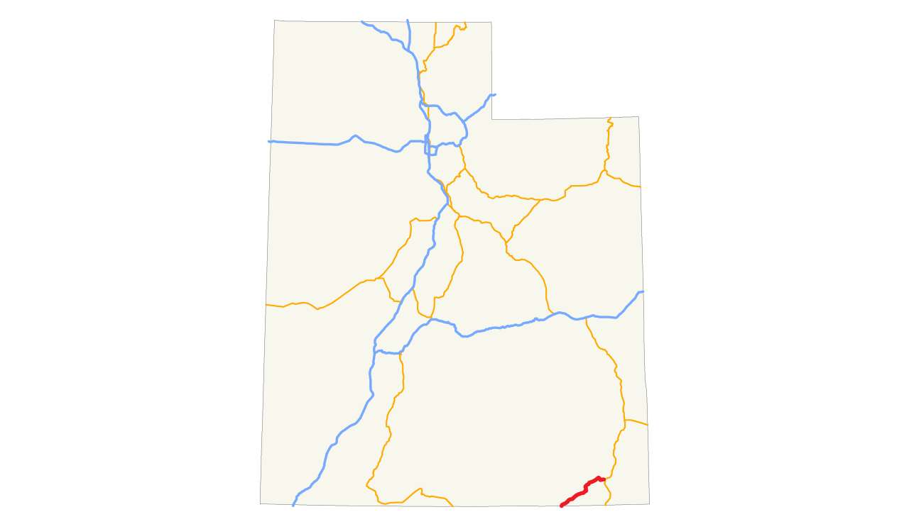
U.S. Route 163 (also U.S. Highway 163, US 163) is a 64-mile (103 km) U.S. Highway that runs from US 160 northward to US 191 in the U.S. states of Arizona and Utah. The southernmost 44 miles (71 km) of its length are within the Navajo Nation. The highway forms part of the Trail of the Ancients, a National Scenic Byway. The highway cuts through the heart of Monument Valley and has been featured in numerous movies and commercials (List of appearances of Monument Valley in the media).
The highway was designated in 1970, replacing Arizona State Route 464 and Utah State Route 47 as well as a portion of the old alignment of US 160 in Utah. In 1981, US 191 was routed over the northern section of US 163, effectively truncating the northern terminus to Bluff, Utah, from Crescent Junction. The state of Utah briefly had plans for a different routing of US 163 north of Bluff. These plans were rejected, resulting in discre...Read more
U.S. Route 163 (also U.S. Highway 163, US 163) is a 64-mile (103 km) U.S. Highway that runs from US 160 northward to US 191 in the U.S. states of Arizona and Utah. The southernmost 44 miles (71 km) of its length are within the Navajo Nation. The highway forms part of the Trail of the Ancients, a National Scenic Byway. The highway cuts through the heart of Monument Valley and has been featured in numerous movies and commercials (List of appearances of Monument Valley in the media).
The highway was designated in 1970, replacing Arizona State Route 464 and Utah State Route 47 as well as a portion of the old alignment of US 160 in Utah. In 1981, US 191 was routed over the northern section of US 163, effectively truncating the northern terminus to Bluff, Utah, from Crescent Junction. The state of Utah briefly had plans for a different routing of US 163 north of Bluff. These plans were rejected, resulting in discrepancies between the signed route and the official designation by the American Association of State Highway and Transportation Officials that were not resolved until 2008. The route number does not follow the numbering convention for U.S. Highways, as the number 163 would normally be used for a spur of US 63; however, these two highways have never connected.


![[node:title]](/sites/default/files/styles/640x320/public/default_images/default_0.JPG.webp?itok=aqV9zhFR)


 - CC BY-SA 2.0")

 - Public domain")


Add new comment