Uluṟu-Kata Tjuṯa National Park

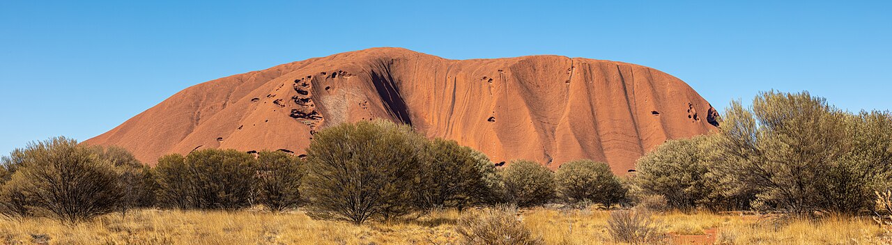
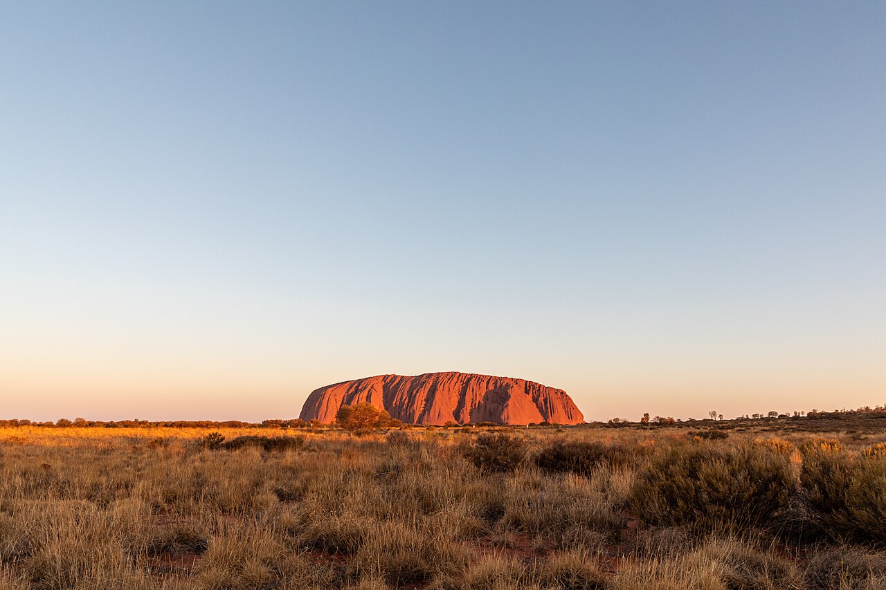
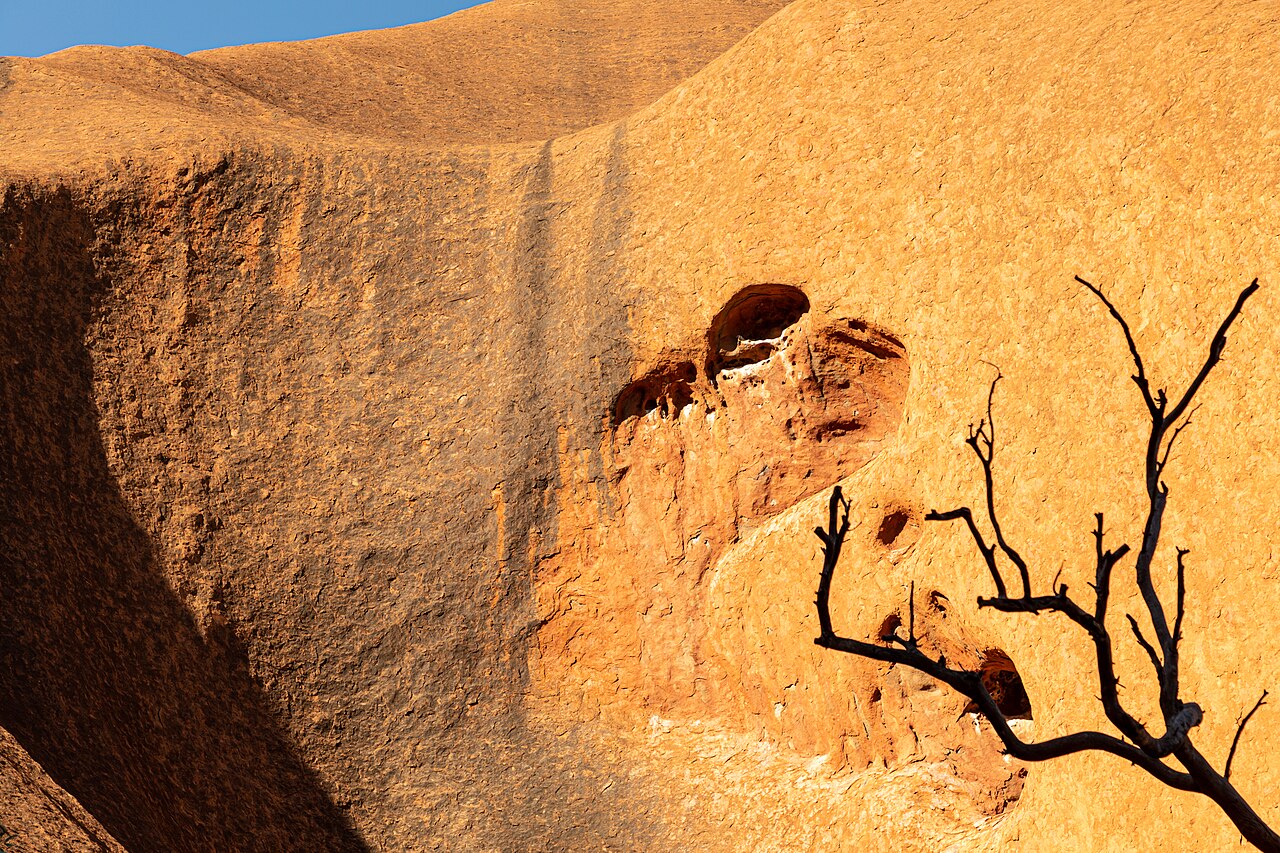
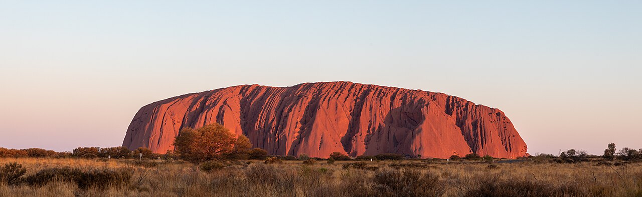
Uluṟu-Kata Tjuṯa National Park is a protected area in the Northern Territory of Australia. The park is home to both Uluru and Kata Tjuta. It is located 1,943 kilometres (1,207 mi) south of Darwin by road and 440 kilometres (270 mi) south-west of Alice Springs along the Stuart and Lasseter Highways. The park covers 1,326 square kilometres (512 sq mi) and includes the features it is named after: Uluru and, 40 kilometres (25 mi) to its west, Kata Tjuta. The location is listed as a UNESCO World Heritage Site for natural and cultural landscape.

Uluru and Kata Tjuta were formed about 350 million years ago during the Alice Springs Orogeny.

The Anangu have connected to the area for thousands of years and some records suggested that they may have lived there for more than 10,000 years.

Europeans came to the western desert area of Australia in the 1870s. Uluru and Kata Tjuta were first mapped by Europeans during the expeditionary period made possible by the construction of the Overland Telegraph Line in 1872.

In separate expeditions, William Ernest Powell Giles and William Christie Gosse were the first European explorers to this area. In 1872 while exploring the area, Ernest Giles sighted Kata Tjuta from near Kings Canyon and called it Mount Olga, while the following year Gosse saw Uluru and named it Ayers Rock after Sir Henry Ayers, the Chief Secretary of South Australia. Further explorations followed with the aim of establishing the possibilities of the area for pastoralism.

In the late 19th century, pastoralists attempted to re-establish themselves in areas adjoining the South-Western/Petermann Reserve and interaction between Anangu and white people became more frequent and more violent. Due to the effects of grazing and droughts, bush food stores were depleted. Competition for these resources created conflict between pastoralists and Anangu. As a result, police patrols became more frequent.

 Aboriginal rock art at Uluru

Between 1918 and 1921 large adjoining areas of South Australia, Western Australia and the Northern Territory were declared as Aboriginal reserves, as sanctuaries for a nomadic people who had virtually no contact with white people. In 1920, part of Uluru-Kata Tjuta National Park was declared an Aboriginal Reserve (commonly known as the South-Western or Petermann Reserve) by the Australian Government under the Aboriginals Ordinance 1918.

During the Depression in the 1930s, the Anangu became involved in dingo scalping with "doggers" who introduced Anangu to European foods and ways. The first tourists visited the Uluru area in 1936.

From the 1940s the two main reasons for permanent and substantial European settlement in the area were Aboriginal welfare policy and the promotion of tourism at Uluru.[1]

In 1948 the first vehicular track to Uluru was constructed, responding to increasing tourism interest in the region. Tour bus services began in the early 1950s.[1]

The Ayers Rock National Park was recognised in 1950, and in the same year an Alice Springs resident Len Tuit accompanied a group of schoolboys on a trip to Uluru. He recognised the enormous tourism potential of the rock and began offering regular tours in 1955, with guests camping in tents and drinking water carted in from Curtin Springs. Kata Tjuta was added to the national park to create the Ayers Rock-Mount Olga National Park in 1958. The first permanent accommodation was constructed the same year, while a new airstrip allowed the first fly-in, fly-out tour groups.[2]

In 1958, in response to pressures to support tourism enterprises, the area that is now the park was excised from the Petermann Aboriginal Reserve to be managed by the Northern Territory Reserves Board as the Ayers Rock – Mt Olga National Park. The first ranger was the legendary central Australian figure, Bill Harney[1]

The site came to attention on 17 August 1980 when two-month-old Azaria Chamberlain was found dead as a result of being taken by a dingo.

On 1 October 2015, traditional owners declared more than 50,000 square kilometres (19,000 sq mi) of Aboriginal freehold land surrounding the National Park an Indigenous Protected Area (IPA) named Katiti Petermann Indigenous Protected Area. As the fourth largest IPA on mainland Australia, it is larger than Switzerland, and completes a huge network of nine IPAs in Central Australia.[3]

^ a b c Uluru – Kata Tjuta Board of Management and Parks Australia (2000) Fourth Uluru – Kata Tjuta National Park Plan of Management. Commonwealth of Australia. Canberra. Page 7. ^ "History of Uluru-Kata Tjuta National Park". Parks Australia. ^ "Katiti Petermann Indigenous Protected Area Declared". The Central Land Council. 1 October 2015. Retrieved 5 February 2020.
Photographies by:
Corey Leopold - CC BY 2.0
Statistics: Position
1234
Statistics: Rank
94987

Add new comment

Esta pregunta es para comprobar si usted es un visitante humano y prevenir envíos de spam automatizado.

Security
641825379Click/tap this sequence: 3814

Google street view

Where can you sleep near Uluṟu-Kata Tjuṯa National Park ?

Booking.com
489.917 visits in total, 9.197 Points of interest, 404 Destinations, 82 visits today.