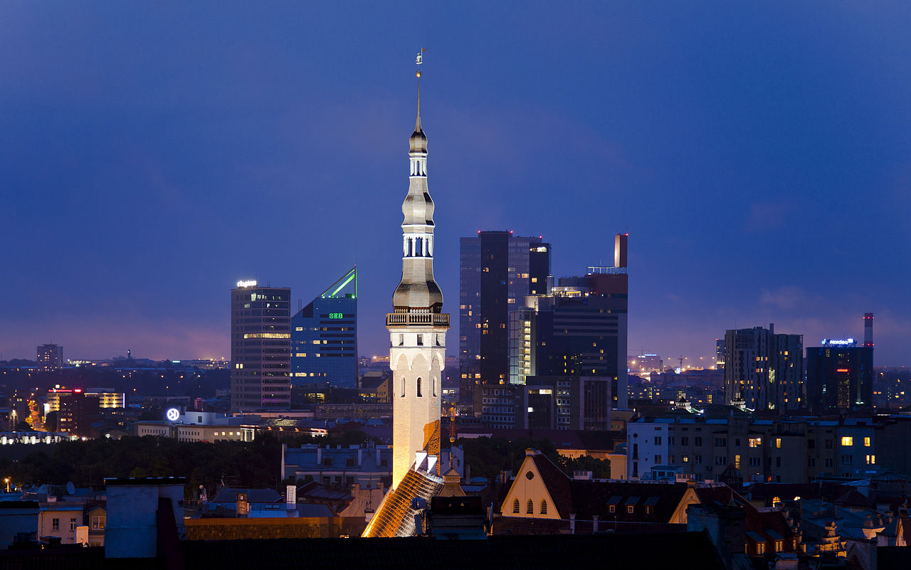
Toompea (from German: Domberg, "Cathedral Hill") is a limestone hill in the central part of the city of Tallinn, the capital of Estonia. The hill is an oblong tableland, which measures about 400 by 250 metres, has an area of 7 hectares (17 acres) and is about 20–30 metres higher than the surrounding areas. In folklore the hill is known as the tumulus mound over the grave of Kalev, erected in his memory by his grieving wife.

The history of Toompea is closely linked to the history of rulers and power in Estonia. Today Toompea is the center of the Government of Estonia and the Riigikogu (parliament), both of which are often simply referred to as Toompea. The location of the Riigikogu is the Toompea Castle, situated in the southwestern corner of the hill and topped by the Tall Hermann tower. The flag on the top of the tower is one of the best-known symbols in Estonia of the government in force.

Toompea is part of the Tallinn Old Town UNESCO Wo...Read more

Toompea (from German: Domberg, "Cathedral Hill") is a limestone hill in the central part of the city of Tallinn, the capital of Estonia. The hill is an oblong tableland, which measures about 400 by 250 metres, has an area of 7 hectares (17 acres) and is about 20–30 metres higher than the surrounding areas. In folklore the hill is known as the tumulus mound over the grave of Kalev, erected in his memory by his grieving wife.

The history of Toompea is closely linked to the history of rulers and power in Estonia. Today Toompea is the center of the Government of Estonia and the Riigikogu (parliament), both of which are often simply referred to as Toompea. The location of the Riigikogu is the Toompea Castle, situated in the southwestern corner of the hill and topped by the Tall Hermann tower. The flag on the top of the tower is one of the best-known symbols in Estonia of the government in force.

Toompea is part of the Tallinn Old Town UNESCO World Heritage Site.

Early history

The first stronghold is believed to have been built on the hill in either the 10th or 11th century by residents of the ancient Estonian county of Revala. The late Iron Age fortified settlement did not probably have permanent inhabitants, but was rather seasonally used for protecting the harbour and its adjacent marketplace.[1] The exact location of the stronghold is not known, but it is presumed that it occupied only a small portion of Toompea, either its then-highest point a bit southeast of today's cathedral[2] or the northern end of the hill.[3] Early archaeological evidence from the hill dates mainly to the second half of the 12th century and first half of the 13th century. Smaller amounts of older finds support the view that the stronghold might have been established already during the Viking Age.[3]

Middle Ages  Toompea Castle

The hill fort is mentioned in the Henry of Livonia's Chronicle of the Livonian Crusade by the name Lindanise.[3] As part of the crusade, in the summer of 1219 the King of Denmark Valdemar II launched an attack against Tallinn. His crusaders took over the deserted stronghold and at the same summer started building a new castle in its place, later referred to as the Castrum Danorum. After the Battle of Lindanise which was fought near the castle and resulted Danish victory over the Estonians, a cathedral was also built on the hill, though it was probably not located in the same place as today's cathedral.[4]

In the summer of 1227 the castle at Toompea was conquered by the order of the Brothers of the Sword, who immediately after conquest started to fortify the hill.[5] The plateau was divided into three parts: the Small Castle, the Great Castle and the outer ward (southernmost part of the plateau in front of the two castles). The first stone Castle of the Order (the Small Castle) was built in the southwestern corner of the plateau in 1227-1229. The original castle had roughly the same shape as the later expansions of the castle, but was slightly smaller.[6] The castle was returned to Denmark after the Treaty of Stensby in 1238 and remained its property (together with the rest of Northern Estonia – see Danish Estonia) for the next 138 years.[7] In 1240 building of the cathedral was completed in the place it stands today. In the second half of the 13th century Toompea (the Great Castle) was surrounded with a wall by the hill's perimeter, built mainly by vassals who owned the plots there.[8]

 An early 19th century map showing the border between the territories of Toompea and the Lower Town

Beginning from the same period Toompea started to develop into the centre of provincial authority, clergy and nobility in Northern Estonia.[9] Most of the vassals chose Toompea for their residence – living in their estates in the conquered countryside was deemed too dangerous; by the end of the 13th century the Great Castle was densely populated. The distinction between Toompea and the Lower Town (Tallinn) also developed at the time as Tallinn gained its own administration – at least in 1248, when the King of Denmark Eric IV granted the town Lübeck city rights, but possibly even earlier.[10] In 1265 the Lower Town was exempted from the rule of the castellan and in 1288 the commanders of the castle also lost judicial power over the citizens of the Lower Town.[10]

Construction and expansion works on both castles continued in the subsequent centuries. In the first half of the 14th century the southern wall of the Great Castle was renovated and its moat was joined with the eastern moat of the Small Castle. In this way the outer ward of the castles was built, after its southern and southeastern sides were surrounded with a wall. The castle as a whole had two exits at the time: the more important one was outer ward's southern gate, through which the road led to Tõnismägi, the second was the gate at its eastern, which connected Toompea with Lower Town via the Long and Short Legs.[11]

 The Long Leg, the main way connecting Toompea with the Lower Town

In the aftermath of the St. George's Night Uprising, in 1346 Denmark sold its possessions in Northern Estonia and followed 215 years under the rule of the Livonian Order. Tallinn (the Lower Town), which was still subjected to Lübeck city rights and only nominally depended on the feudal system, developed into a flourishing Hanseatic city, while Toompea remained politically and socially antithetical to the Lower Town.[12] The boundaries of the territory of Toompea and Tallinn were fixed with an agreement in 1348, when 220 hectares (540 acres) from the city's patrimony was given to Toompea. That area, located southwest of the hill and where the suburbs (Vorstadt) of Toompea (Tõnismäe, Kassisaba and Kelmiküla) were built during subsequent periods, was called "Dome territory" until the 20th century.

Soon after returning to Toompea, the Order started expanding the castle – the whole Castle of the Order (German: Ordensburg) was extended and developed into the strongest centre of its northerly realms, a symbol of their military and political power.[13] New higher outside walls were built, moats were widened and deepened. The first part of the Pikk Hermann ("Tall Hermann") tower, which tops the Toompea castle, was completed by 1371.[13] Pikk Hermann was the first tower in Tallinn adjusted for defence in the era of firearms.[14] Later in the 16th century the tower was rebuilt taller, from the original height of 35 m. The wall of the Great Castle was also fortified with new towers: altogether 14 defence towers (including a gate tower named Clock Tower – the only exit) had been built along its wall by the end of the 14th century.[15]

Swedish and Russian rule  The front façade of the Estonian Parliament, the Riigikogu, is a wing of Toompea Castle built in 1767-1773

The Swedish Empire conquered Northern Estonia during the Livonian War, in 1561, and held it until the Great Northern War, when Tallinn was conquered by Russia in 1710. When Tallinn capitulated to Eric XIV of Sweden in 1561, the king decided not to change the status quo in the relations between Toompea and Lower Town.[16] Toompea, as a separate town (Dom zu Reval) under its own administration was able to retain a variety of special rights and privileges, the last of which remained in the books until 1889. Toompea was joined with Tallinn (Lower Town) as late as in 1878, when during the period of Russification the previous laws governing the two towns were replaced with Russian administrative law.[17] The two parts of the town were also united for a brief period in 1785-1796.[18] Toompea and the Lower Town had been united into a single police district in 1805.[19] Particular private law was in force for Toompea until 1944.

In 1684 Toompea suffered the most devastating fire of its history. Toompea had been affected by earlier fires in 1288, 1433, 1553 and 1581, but the fire of 1684 was much larger in scale, destroying most of the buildings in the Great Castle, including the cathedral.[20] The Small Castle escaped of the fire intact. The fires are one cause why Toompea looks architecturally different and newer from the Lower Town.[21]

In the end of 17th century several plans were made to strengthen the fortifications of Toompea and Tallinn with earthworks and modern bastions. Although a design by Erik Dahlbergh was approved in 1686, construction was slow due to financial difficulties and by the start of the Great Northern War only two bastions had been completed around Toompea as intended - the Swedish Bastion and the Ingermanland Bastion, both protecting Toompea from the south.[22]

 View of Toompea from the north, end of 19th century

Following the Great Northern War and the conquest of Estonia by the Russian Empire, the first half of the 18th century was a period of general neglect for Toompea and also for the castle, which fell into disuse for several decades.[22] The situation changed in the second half of the 18th century: in 1767-1773 the east wing of the castle was completely rebuilt into an administrative building of the Governorate of Estonia by the orders of Catherine II.[23] For constructing the building the southeastern tower of the castle (Stür den Kerl) was demolished as were the moats filled in; together with it the outer ward of the castles was designed into a square (the Castle Square, Estonian: Lossi plats). The building resembled an aristocratic palace, which prompted the castle acquiring an alternate name: Toompea Palace.[24] The Stenbock House, one of the most remarkable buildings on the northern ledge of the Toompea, was also built in the same period - the intended court house was probably completed by 1792.[25]

 The Russian Orthodox Alexander Nevsky Cathedral

Tallinn was removed from the list of fortified towns of the Russian Empire in 1857.[26] This allowed three new roads to be built from the southern end of Toompea over the previous defence structures: the Falgi Road, built in 1856-1857, led to the west to Paldiski Highway, the Toompea Street (1860–1861) led south to Tõnismägi and the Komandandi Street led to the east, close to Harju Gate, where the Independence War Victory Column stands today.[27]

The general look of Toompea changed greatly when the architecturally completely different Russian Orthodox Alexander Nevsky Cathedral was built in 1894-1900.[28] The cathedral, situated on the Castle Square in front of the Toompea Palace, was erected during the period of Russification as a symbol of the czarist rule and Russian dominance. Due to its very prominent location and an immediately recognizable Russian style the cathedral garnered opposition already during the time it was built and in the end of the 1920s and 1930s, in the independent Republic of Estonia, there were even proposals to demolish it.[29]

In 1903, when the Patkuli stairs were built near the northern end of the hill, Toompea got a new access from the direction of the main railway station of Tallinn.[30]

^ Lang 2007, p. 242 ^ Zobel 2008, pp. 34–35 ^ a b c Tõnisson 2008, pp. 185–186 ^ Zobel 2008, p. 47 ^ Zobel 2008, p. 53 ^ Zobel 2008, p. 57 ^ Zobel 2008, p. 73 ^ Zobel 2008, p. 101 ^ Pullat 1976, p. 75 ^ a b Pullat 1976, p. 85 ^ Zobel 2008, p. 142 ^ Zobel 2008, p. 157 ^ a b Pullat 1976, pp. 168–169 ^ Zobel 2008, p. 172 ^ Zobel 2008, p. 178 ^ Maiste & Vohli 1996, pp. 70–71 ^ Miljan 2004, pp. 461–462 ^ Pullat 1976, p. 308 ^ Pullat 1976, p. 311 ^ Bruns 1993, p. 39 ^ Pullat 1976, p. 157 ^ a b Maiste & Vohli 1996, p. 73 ^ Pullat 1976, p. 171 ^ Cite error: The named reference riigikogu was invoked but never defined (see the help page). ^ Cite error: The named reference valitsus was invoked but never defined (see the help page). ^ Bruns 1993, p. 57 ^ Pullat 1976, p. 361 ^ Bruns 1993, p. 46 ^ Cite error: The named reference ulm was invoked but never defined (see the help page). ^ Cite error: The named reference epl was invoked but never defined (see the help page).
Photographies by:
Gsitnikov - CC BY 3.0
Zones
Statistics: Position
8613
Statistics: Rank
4084

Add new comment

Esta pregunta es para comprobar si usted es un visitante humano y prevenir envíos de spam automatizado.

Security
578621349Click/tap this sequence: 5142

Google street view

Where can you sleep near Toompea ?

Booking.com
489.961 visits in total, 9.198 Points of interest, 404 Destinations, 10 visits today.