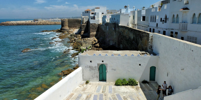
Tarifa (Spanish pronunciation: [taˈɾifa]) is a Spanish municipality in the province of Cádiz, Andalusia. Located at the southernmost end of the Iberian Peninsula, it is primarily known as one of the world's most popular destinations for windsports. Tarifa lies on the Costa de la Luz ("coast of light") and across the Strait of Gibraltar facing Morocco.
Besides the city proper, the municipality also comprises several villages, including Tahivilla, Facinas, and Bolonia.
 Ruins of Baelo Claudia near Bolonia Beach
 Castle of St Catalina.
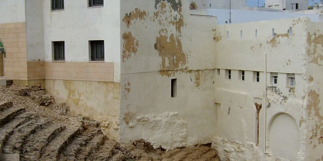
It was thought that Tarifa was once the site of the Roman settlement of Julia Transducta (also known as Julia Joza, or just Transducta). However, that settlement is now thought to have been where Algeciras now stands, while there is strong evidence that Casas de Porro, Valdevaqueros (Tarifa) was the site of the settlement of Mellaria.[1][2] Tarifa was given its present name after the Islamic conquest of Tarif ibn Malik in 710, a military commander of Musa bin Nusayr.[3] The village of Bolonia near Tarifa was also populated in Roman times (called Baelo Claudia). Roman ruins still exist near the village today.
After the Islamic conquest of southern Spain, the city was fortified starting from the 10th century. Later Tarifa was held by the taifa of Algeciras (1031) and by that of Seville (1057), and subsequently by the Almoravids. After the latter's fall, it lived a short period under another taifa of Algeciras (1231), until becoming part of the Kingdom of Granada. In 1292 it was conquered by Sancho IV of Castile, and two years later it resisted a siege by North African Islamic troops. The town resisted another siege in 1340 from Marinid, eventually leading to the Battle of Río Salado.
Despite its formidable defenses, Tarifa remained sparsely populated for the rest of the middle ages.[4] The destruction of Algeciras after the 1369 Nasrid conquest turned Tarifa into the sole power base for the Castilian navy in the Strait area, and the influence of the Admiralcy of Castile increased thereafter.[5] Tarifa enjoyed a great deal of privileges confirmed by the Castilian monarchs, while being simultaneously threatened by Muslim raids that resulted into frequent killings and kidnappings.[6]
Owing to its largely military function after 1292, military activity weighted heavily in the place's social structure in the early 15th century.[7] The town was donated to Fadrique Enríquez, Admiral of Castile, in 1447.[8] The seigneuralization was fiercely opposed by the inhabitants.[9] Occupied by Gonzalo de Saavedra, Tarifa returned to the nominal status of realengo, while largely controlled by the former.[10] The mid-15th century saw the fostering of positive collaboration with the Portuguese across the strait.[11]
After 1492, Tarifa lost part of its military value.[12] Owing to its good pastures, husbandry played a notable role in the economy.[13] It however lacked land dedicated to cereal crops.[14] Already since the conquest and increasingly in the late middle ages, fishing activity provided riches to Tarifa, and an industry of the almadraba around tuna had developed in the early 16th century.[15] In the early 16th century, the city became part of the seigneurial land of the Adelantado Mayor de Andalucía.[16] Population increased in the 16th century, with around 3,500–4,000 inhabitants by 1587.[4]
In 1514 it became the seat of a marquisate (Marquiss of Tarifa), including also Bornos, Espera and Alcalá de los Gazules.
In the course of the Peninsular War, Tarifa was besieged by French troops on 20 December 1810, and again on 18 December 1811. In both of these cases the town was defended by British troops from Gibraltar as the Spanish and British were allies against the French. During the 1811–12 Siege of Tarifa there were 3,000 defending troops with 1,200 of those British, including Colonel Charles Holloway who as commanding Royal Engineer made improvements to Tarifa's defences.
On 19 December the town was attacked again by General Laval, who bombarded the town over Christmas to the point where surrender was demanded on 30 December. Both the British and Spanish commanders refused to comply and their defiance was rewarded by rain that started the next day. By 5 January the attacking force realised that their powder was wet and their guns were bogged down in mud, and retreated.[17]


Add new comment