Signal de Botrange
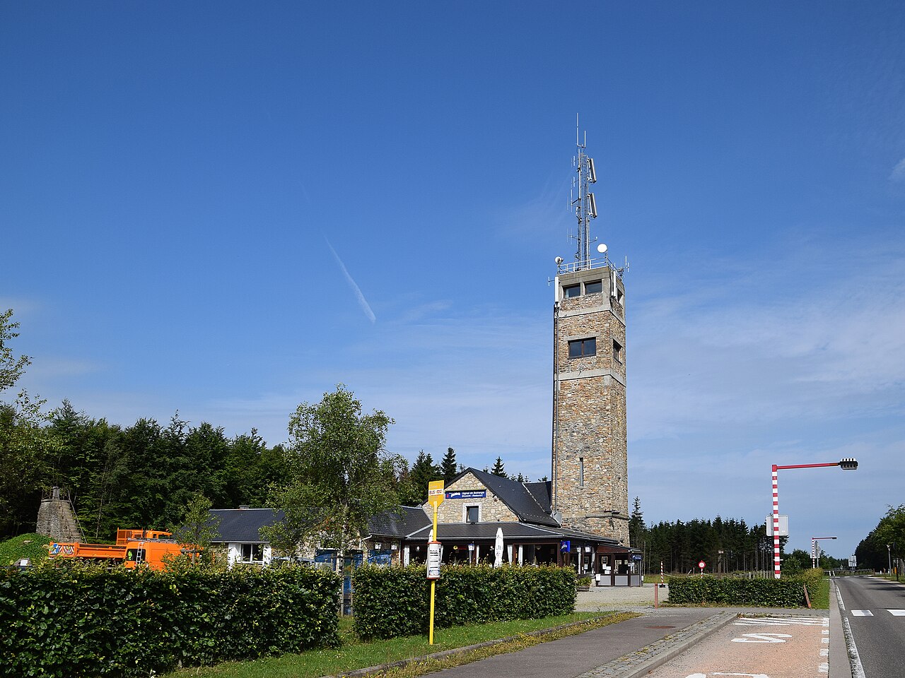
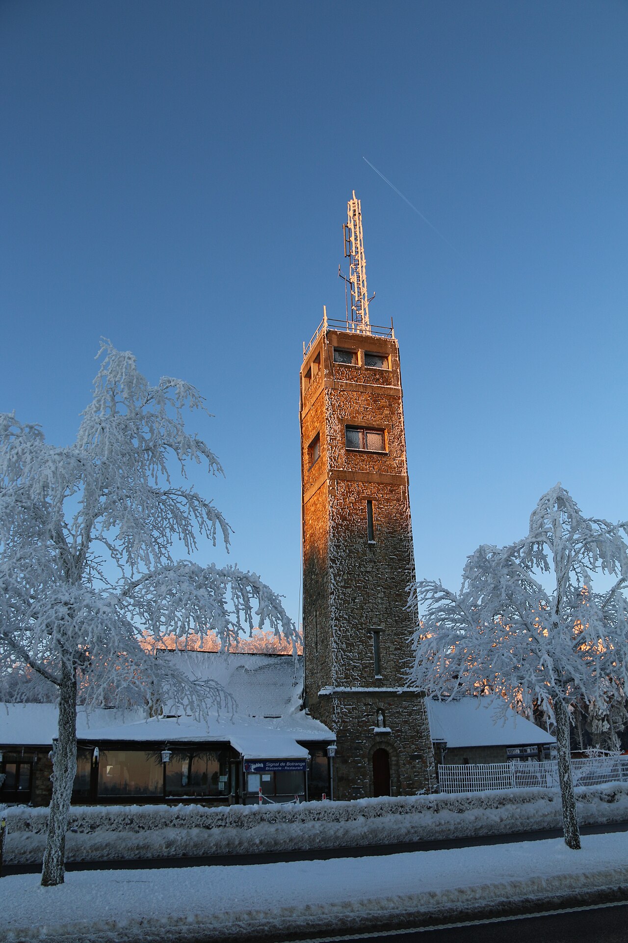
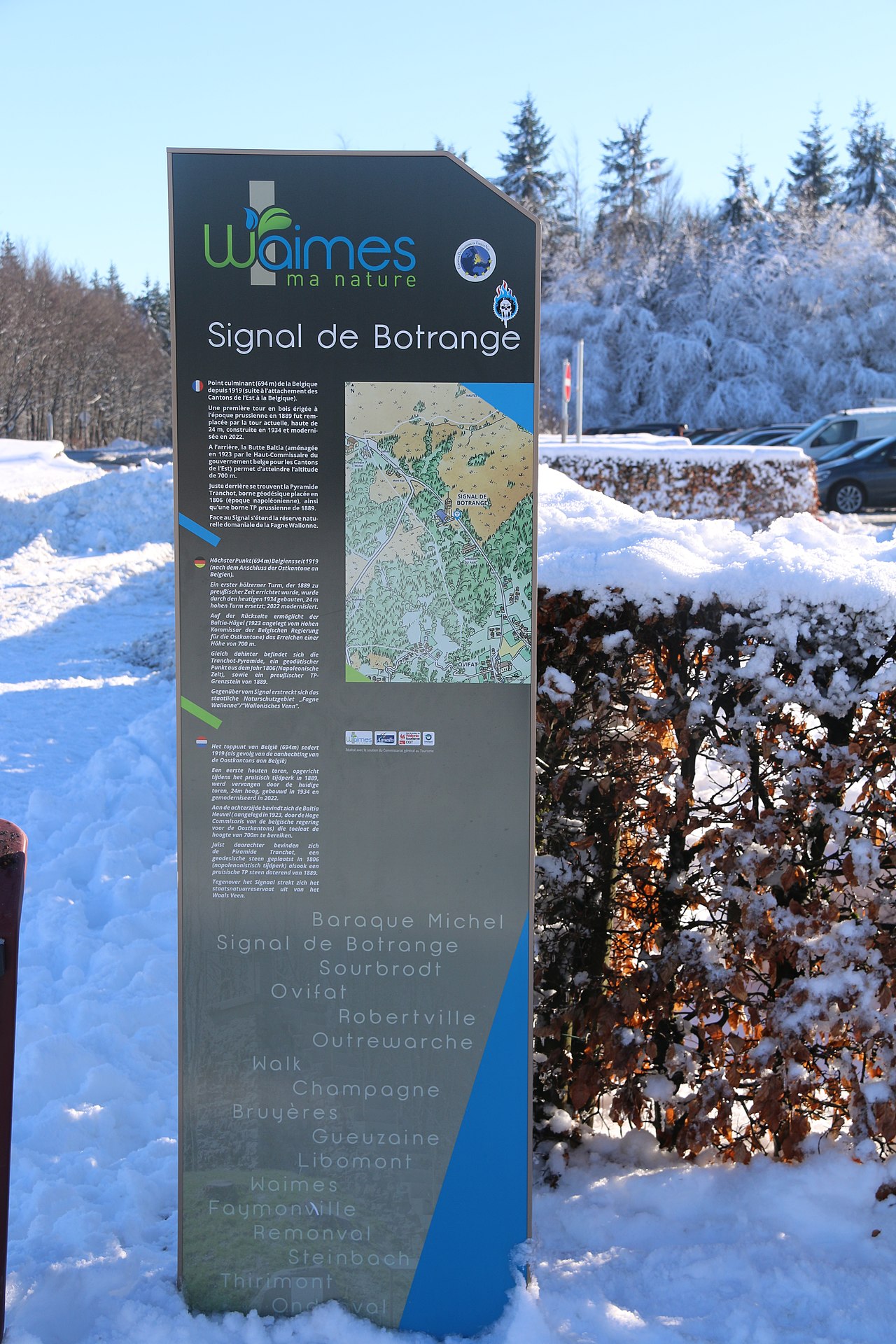
Signal de Botrange is the highest point in Wallonia and in Belgium, located in the High Fens (Hautes Fagnes in French, Hohes Venn in German, Hoge Venen in Dutch), at 694 metres (2,277 feet). It is the top of a broad plateau and a road crosses the summit, passing an adjacent café. It is also the highest point in the Ardennes and in the European part of the Benelux.
For several decades a meteorological station was installed at signal de Botrange. Since 1999, it was replaced by an automatic station of the Royal Meteorological Institute of Belgium installed on Mount Rigi (scientific station of the High Fens - University of Liège), which is between the Signal and Baraque Michel which was formerly the highest point in Belgium prior to the annexation of the Eastern Cantons in 1919.
Signal de Botrange experiences stronger winds than the centre of Belgium. Average and extreme temperatures are usually lower than at any other place in Belgium: t...Read more
Signal de Botrange is the highest point in Wallonia and in Belgium, located in the High Fens (Hautes Fagnes in French, Hohes Venn in German, Hoge Venen in Dutch), at 694 metres (2,277 feet). It is the top of a broad plateau and a road crosses the summit, passing an adjacent café. It is also the highest point in the Ardennes and in the European part of the Benelux.
For several decades a meteorological station was installed at signal de Botrange. Since 1999, it was replaced by an automatic station of the Royal Meteorological Institute of Belgium installed on Mount Rigi (scientific station of the High Fens - University of Liège), which is between the Signal and Baraque Michel which was formerly the highest point in Belgium prior to the annexation of the Eastern Cantons in 1919.
Signal de Botrange experiences stronger winds than the centre of Belgium. Average and extreme temperatures are usually lower than at any other place in Belgium: the minimum temperature recorded (−25.6 °C [−14.1 °F]) does not, however, exceed the absolute record (−30.1 °C [−22.2 °F]), observed in the valley of the Lomme, at Rochefort during a temperature inversion. In winter, for three months, on average, the average temperature remains below 0 °C (32 °F).
Rainfall is much greater than most of the rest of the country, at an annual average of 1,450 mm (57 in) compared with 800 mm (31 in) in Uccle: there are over 200 days of precipitation per year (against just over 170 in Uccle). Maximum temperatures in summer rarely exceed 30 °C (86 °F). The number of days of frost is over 130 days per year and the number of days of snowfall exceeds 35 days. The maximum thickness of snow was measured on 9 February 1953, at 115 cm (45 in) of snow. Frost and early snowfall can occur in late September, but that is exceptional. Late snow may sometimes occur until mid-May.
At the height of winter the site is used as the start of a number of cross-country skiing routes.


Add new comment