Nahanni National Park Reserve
The Nahanni National Park Reserve, sometimes known as "Headless Valley" or "Valley of The Headless Men" (after a series of unsolved historical deaths in the park), in the Dehcho Region of the Northwest Territories, Canada (approximately 500 km (311 mi) west of Yellowknife), protects a portion of the Mackenzie Mountains Natural Region. The centrepiece of the park is the South Nahanni River (Naha Dehé). Four noteworthy canyons, called First, Second, Third and Fourth Canyon, line the whitewater river. Each canyon has walls reaching some 1,000 m (3,300 ft) in height. The word nahanni comes from the local Dene name for the area, Nahʔa Dehé, which means "river of the land of the Nahʔa people".: 87 The park was one of the earliest locations to be inscribed as World Heritage Sites by UNESCO; this designation was given in 1978 due to the area's picturesque wilderness, its v...Read more
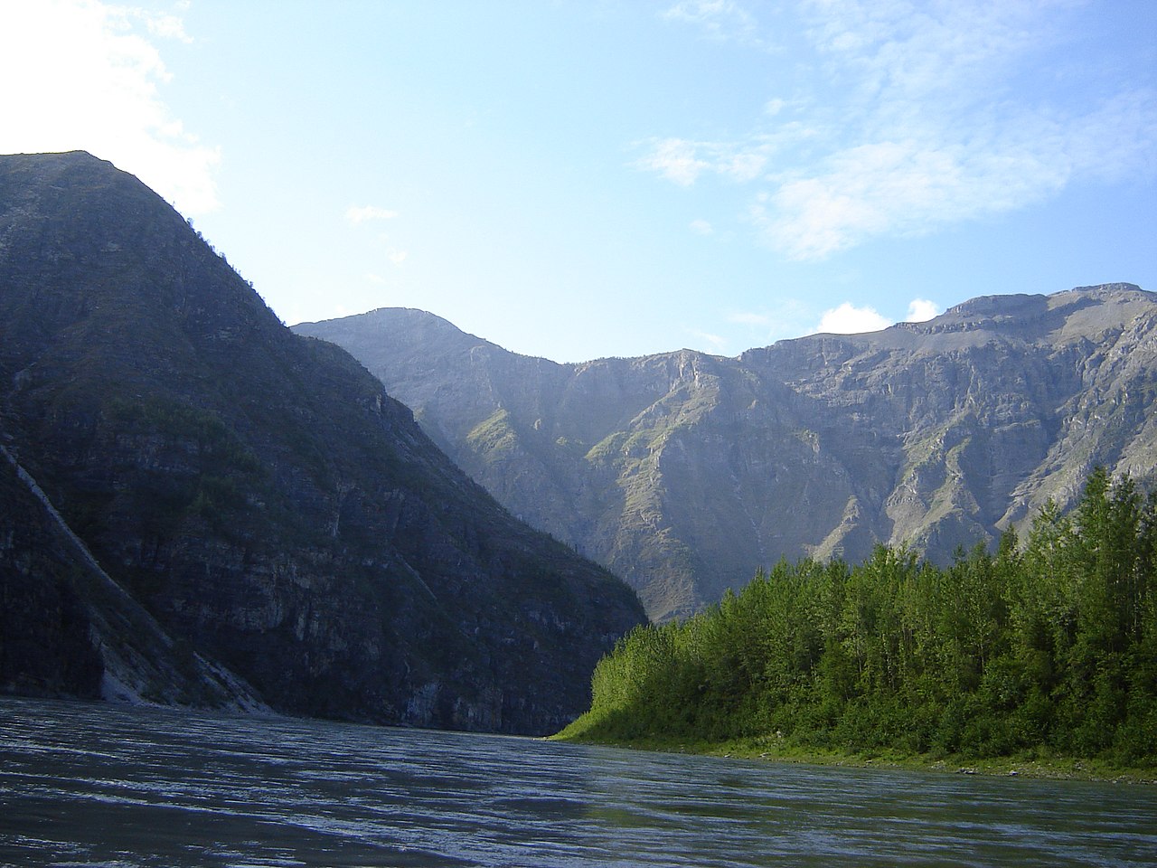
The Nahanni National Park Reserve, sometimes known as "Headless Valley" or "Valley of The Headless Men" (after a series of unsolved historical deaths in the park), in the Dehcho Region of the Northwest Territories, Canada (approximately 500 km (311 mi) west of Yellowknife), protects a portion of the Mackenzie Mountains Natural Region. The centrepiece of the park is the South Nahanni River (Naha Dehé). Four noteworthy canyons, called First, Second, Third and Fourth Canyon, line the whitewater river. Each canyon has walls reaching some 1,000 m (3,300 ft) in height. The word nahanni comes from the local Dene name for the area, Nahʔa Dehé, which means "river of the land of the Nahʔa people".: 87 The park was one of the earliest locations to be inscribed as World Heritage Sites by UNESCO; this designation was given in 1978 due to the area's picturesque wilderness, its various waterways and giant falls, and its 1,000 meter-deep limestone canyons, among other features.


![[node:title]](/sites/default/files/styles/640x320/public/default_images/default_0.JPG.webp?itok=aqV9zhFR)


Add new comment