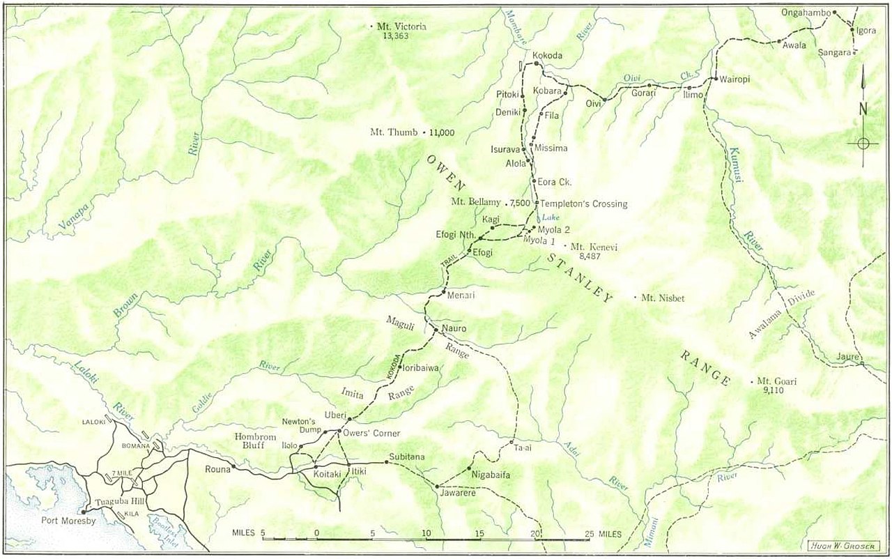
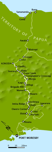
The Kokoda Track or Trail is a single-file foot thoroughfare that runs 96 kilometres (60 mi) overland – 60 kilometres (37 mi) in a straight line – through the Owen Stanley Range in Papua New Guinea (PNG). The track was the location of the 1942 World War II battle between Japanese and Allied – primarily Australian – forces in what was then the Australian territory of Papua.
The track runs from Owers' Corner in Central Province, 50 kilometres (31 mi) east of Port Moresby, across rugged and isolated terrain which is only passable on foot, to the village of Kokoda in Oro Province. It reaches a height of 2,490 metres (8,169 ft) as it passes around the peak of Mount Bellamy. The track travels primarily through the land of the Mountain Koiari people.
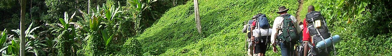
Hot, humid days with intensely cold nights, torrential rainfall and the risk of endemic tropical diseases such as malaria make it a challenging trek. Hiking the trail normally takes...Read more
The Kokoda Track or Trail is a single-file foot thoroughfare that runs 96 kilometres (60 mi) overland – 60 kilometres (37 mi) in a straight line – through the Owen Stanley Range in Papua New Guinea (PNG). The track was the location of the 1942 World War II battle between Japanese and Allied – primarily Australian – forces in what was then the Australian territory of Papua.
The track runs from Owers' Corner in Central Province, 50 kilometres (31 mi) east of Port Moresby, across rugged and isolated terrain which is only passable on foot, to the village of Kokoda in Oro Province. It reaches a height of 2,490 metres (8,169 ft) as it passes around the peak of Mount Bellamy. The track travels primarily through the land of the Mountain Koiari people.
Hot, humid days with intensely cold nights, torrential rainfall and the risk of endemic tropical diseases such as malaria make it a challenging trek. Hiking the trail normally takes between four and twelve days; the fastest recorded time is 16 hours 34 minutes.


 - CC BY-SA 3.0")
![[node:title]](/sites/default/files/styles/640x320/public/default_images/default_0.JPG.webp?itok=aqV9zhFR)


Add new comment