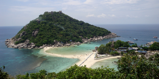
เกาะสมุย
( Ko Samui )Ko Samui (or Koh Samui, also often locally shortened to Samui; Thai: เกาะสมุย, pronounced [kɔ̀ʔ sā.mǔj]) is an island off the east coast of Thailand. Geographically in the Chumphon Archipelago, it is part of Surat Thani Province, though as of 2012, Ko Samui was granted municipal status and thus is now locally self-governing. Ko Samui, with an area of 228.7 square kilometres (88.3 sq mi), is Thailand's second largest island after Phuket. In 2018, it was visited by 2.7 million tourists.
The island was probably first inhabited about 15 centuries ago, settled by fishermen from the Malay Peninsula[1] and southern China. It appears on Chinese maps dating back to 1687, under the name Pulo Cornam.[2]
The origin of the name samui is unknown. It may come from the Sanskrit-Tamil word สมวย, meaning 'sea weather'. Or it may derive from the name of a tree known locally in southern Thailand as ต้นหมุย (full name ต้นสมุย). A third possibility is that it originated from early Hainanese traders to Samui. In Hainanese Chinese, เซ่าบ่วย means 'first island', 'barrier', or 'gate', or literally 'beautiful beach'.[2] As it was their first port of call in Thailand, it became its name and evolved over time to สมุย. Some people believe that the word "samui" derives from the Malay word saboey, or 'safe haven'. There is no firm corroboration of any of these theories.[3] Ko is the Thai word for "island".
Until the late-20th century, Ko Samui was an isolated self-sufficient community, having little connection with the mainland of Thailand. The island was without roads until the early 1970s, and the 15 kilometres (9.3 mi) journey from one side of the island to the other could involve a whole-day trek through the mountainous central jungles.
Ko Samui's economy now is based primarily on a successful tourist industry, as well as exports of coconut and rubber.
Economic growth has brought not only prosperity, but also major changes to the island's environment and culture.[4]
GovernanceThe first local government on Samui island was established in 1956 with the sanitary district Ko Samui, which however only covered the area around the settlement.[5] In 1963 it was enlarged to cover the entirety of Samui and Pha-Nga islands, which at that time were still in the same district.[6] In 1973, the area of the Ko Pha-Ngan District became a separate sanitary district.[7] Since 1981, the sanitary district covers the area of the whole district.[8]
Like all sanitary districts, Ko Samui became a subdistrict municipality (thesaban tambon) in 1999.[9] In 2008, the subdistrict municipality was upgraded to a town municipality (thesaban mueang),[10] and in 2012, the town was upgraded to a city municipality.[11]
The conversion of the municipality into a special administrative area with greater powers of self-governance similar to Pattaya has been discussed since 2008, but as of 2018 no action has been taken.


Add new comment