Kīlauea
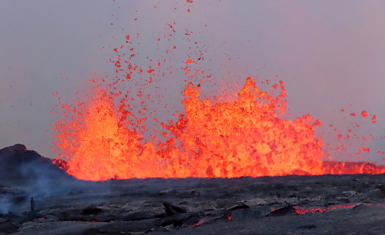
Kīlauea (US: KIL-ə-WAY-ə, Hawaiian: [kiːlɐwˈwɛjə]) is an active shield volcano in the Hawaiian Islands. It is located along the southeastern shore of Hawaii Island. The volcano is between 210,000 and 280,000 years old and grew above sea level about 100,000 years ago. Since the islands were settled, it has been the most active of the five volcanoes that together form the island and among the most active volcanoes on Earth. The most recent eruption began in December 2024, with episodic lava fountains and flows continuing into 2025.
Kīlauea is the second-youngest product of the Hawaiian hotspot and the current eruptive center of the Hawaiian–Emperor seamount chain. Because it lacks topographic prominence and its activities historically coincided with those of Mauna Loa, Kīlauea w...Read more
Kīlauea (US: KIL-ə-WAY-ə, Hawaiian: [kiːlɐwˈwɛjə]) is an active shield volcano in the Hawaiian Islands. It is located along the southeastern shore of Hawaii Island. The volcano is between 210,000 and 280,000 years old and grew above sea level about 100,000 years ago. Since the islands were settled, it has been the most active of the five volcanoes that together form the island and among the most active volcanoes on Earth. The most recent eruption began in December 2024, with episodic lava fountains and flows continuing into 2025.
Kīlauea is the second-youngest product of the Hawaiian hotspot and the current eruptive center of the Hawaiian–Emperor seamount chain. Because it lacks topographic prominence and its activities historically coincided with those of Mauna Loa, Kīlauea was once thought to be a satellite of its much larger neighbor. Kīlauea has a large, fairly recently formed caldera at its summit and two active rift zones, one extending 125 km (78 mi) east and the other 35 km (22 mi) west. An active fault of unknown depth moves vertically an average of 2 to 20 mm (0.1 to 0.8 in) per year.
Between 2008 and 2018, Halemaʻumaʻu, a pit crater located within Kīlauea's summit caldera, hosted an active lava lake. Kīlauea erupted nearly continuously from vents on its eastern rift zone between January 1983 and April 2018, causing major property damage, including the destruction in 1990 of the towns of Kalapana and Kaimū along with the community's renowned black sand beach.
Beginning in May 2018, activity shifted further downrift from the summit to the lower Puna district, during which lava erupted from two dozen vents with eruptive fountains that sent rivers of lava into the ocean in three places. The eruption destroyed Hawaii's largest natural freshwater lake, covered substantial portions of Leilani Estates and Lanipuna Gardens, and destroyed the communities of Kapoho, Vacationland Hawaii, and most of the Kapoho Beach Lots. The County of Hawaii reported that 716 dwellings were destroyed. Concurrent with the activity downrift in lower Puna, the lava lake within Halemaʻumaʻu drained and a series of explosive collapse events occurred at the volcano's summit, with at least one explosion emitting ash 30,000 feet (9,100 m) into the air. This activity prompted a months-long closure of the Kīlauea section of Hawaii Volcanoes National Park. The eruption ended in September 2018. Since 2020, several eruptions have occurred within the enlarged Halemaʻumaʻu crater from the 2018 collapse events as well as along the volcano's southwest and east rift zones.


![[node:title]](/sites/default/files/styles/640x320/public/default_images/default_0.JPG.webp?itok=aqV9zhFR)


Add new comment