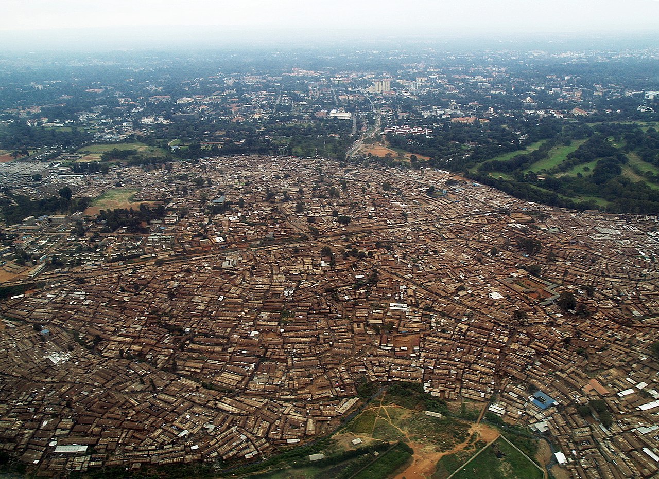
Kibera (Kinubi: Forest or Jungle) is a division and neighbourhood of Nairobi, Kenya, 6.6 kilometres (4.1 mi) from the city centre. Kibera is the largest slum in Nairobi, and also the largest urban slum in all of Africa. The 2009 Kenya Population and Housing Census reports Kibera's population as 170,070, contrary to previous estimates of one or two million people. Other sources suggest the total Kibera population may be 500,000 to well over 1,000,000 depending on which slums are included in defining Kibera.
In 2009, a survey conducted by the French Institute for Research in Africa found that the average Kibera slum resident lives in extreme poverty, earning less than US$2 per day. Unemployment rates are high. 12% of the population are living with HIV. Cases of assault and rape are common. There are few schools, and most people cannot afford education for their children. Clean water is scarce. Diseases caused by poor hygien...Read more
Kibera (Kinubi: Forest or Jungle) is a division and neighbourhood of Nairobi, Kenya, 6.6 kilometres (4.1 mi) from the city centre. Kibera is the largest slum in Nairobi, and also the largest urban slum in all of Africa. The 2009 Kenya Population and Housing Census reports Kibera's population as 170,070, contrary to previous estimates of one or two million people. Other sources suggest the total Kibera population may be 500,000 to well over 1,000,000 depending on which slums are included in defining Kibera.
In 2009, a survey conducted by the French Institute for Research in Africa found that the average Kibera slum resident lives in extreme poverty, earning less than US$2 per day. Unemployment rates are high. 12% of the population are living with HIV. Cases of assault and rape are common. There are few schools, and most people cannot afford education for their children. Clean water is scarce. Diseases caused by poor hygiene are prevalent. A great majority living in the slum lack access to basic services, including electricity, running water, and medical care.
The government initiated a clearance programme to replace the slum with a residential district of high-rise apartments, and to relocate the residents to these new buildings upon completion.
The neighbourhood is divided into a number of villages, including Kianda, Soweto East, Gatwekera, Kisumu Ndogo, Lindi, Laini Saba, Silanga, Makina, Salama, Ayany, and Mashimoni.


Add new comment