
El Cóporo
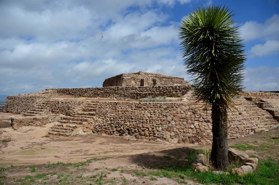
El Cóporo is a prehispanic archaeological site at the northern frontiers of the Mesoamerican cultural area, located at an elevation of 150 meters on the western slopes of the Santa Bárbara range (Sierra de Santa Bárbara), near the San José del Torreón community, and lies some 15 kilometres (9 mi) due south of its municipal seat and largest township, on the northwestern corner of Guanajuato state, Mexico.
The site is considered as one of the four most important archaeological sites in the state.
Cóporo is a Purépecha word meaning 'over the big road'. The site is named after the Cóporo hill, where it is located and the site is located at its peak, 156 meters high. The ceremonial and government center has been completed about 80 percent; around the center 29 smaller settlements were established on the slopes, the main occupation period occurred between 500-900 CE.
The site's main occupation dates to the Late Classic and Early Postclassic eras of Me...Read more
El Cóporo is a prehispanic archaeological site at the northern frontiers of the Mesoamerican cultural area, located at an elevation of 150 meters on the western slopes of the Santa Bárbara range (Sierra de Santa Bárbara), near the San José del Torreón community, and lies some 15 kilometres (9 mi) due south of its municipal seat and largest township, on the northwestern corner of Guanajuato state, Mexico.
The site is considered as one of the four most important archaeological sites in the state.
Cóporo is a Purépecha word meaning 'over the big road'. The site is named after the Cóporo hill, where it is located and the site is located at its peak, 156 meters high. The ceremonial and government center has been completed about 80 percent; around the center 29 smaller settlements were established on the slopes, the main occupation period occurred between 500-900 CE.
The site's main occupation dates to the Late Classic and Early Postclassic eras of Mesoamerican chronology, and shows affinities with the Tunal Grande culture.
El Cóporo covers an area of approximately 84 hectares (210 acres) spread across the slopes and summit of Cerro del Cóporo, the hill after which the site is named. As of 2009 an estimated five percent of this area has been archaeologically excavated or investigated.
The ethnic groups that lived in this region are associated with cultures that developed in the San Luís Potosí, Jalisco, Zacatecas and Guanajuato States, and that a point in time, migrated to central México, where they joined other groups and participated in the development of the multi-ethnic Toltec society.”


![[node:title]](/sites/default/files/styles/640x320/public/default_images/default_0.JPG.webp?itok=aqV9zhFR)

















Add new comment