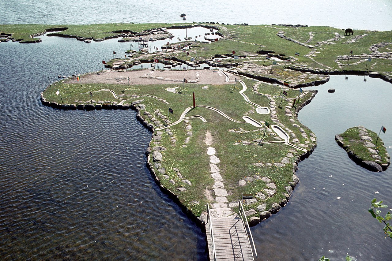
Verdenskortet ved Klejtrup Sø ( World Map at Lake Klejtrup ) Wikipedia body audio Domů Skandinávie Dánsko World Map at Lake Klejtrup Description Mapa světa u jezera Klejtrup (dánsky: Verdenskortet ved Klejtrup Sø) je miniaturní mapa světa postavená z kamenů a trávy v Klejtrup Sø poblíž vesnice Klejtrup, obec Viborg, Dánsko. 2 1 0 0 0 0 Odeslat Reset More information Photographies by: Zones Dánsko Skandinávie Statistics: Position 4668 Statistics: Rank 180717 Přidat komentář Komentář O formátech textu CAPTCHA Bezpečnost Code 642317859Click/tap this sequence: 2947 Esta pregunta es para comprobar si usted es un visitante humano y prevenir envíos de spam automatizado. Uložit Google street view Google street view Where can you sleep near World Map at Lake Klejtrup ? Booking.com What can you do near World Map at Lake Klejtrup ? Tollundmanden Tollundský muž Aalborghus Lindholm Høje Den Gamle By ARoS Aarhus Kunstmuseum Aarhus Ø Aarhus Docklands Møllehøj Samsø Labyrinten Jellingstenene Runové kameny v Jelling Jelling stone ship Rubjerg Knude Fyr Legoland Billund Resort Legoland Billund LEGO House Lego House (Billund) Slotved Skov Råbjerg Mile Den tilsandede kirke Sand-Covered Church Ladbyskibet Ladby ship Odense Grenen View more on the map 8.809.689 visits in total, 407.503 Points of interest, 405 Destinations, 1.247 visits today.
 12:19, 28 July 2009 (UTC) - CC BY-SA 3.0")


. - CC BY-SA 3.0")


![[node:title]](/sites/default/files/styles/640x320/public/default_images/default_0.JPG.webp?itok=aqV9zhFR)


Přidat komentář