Malé (en dhivehi މާލެ) és la capital de la República de les Maldives. Amb una població de 252.768 incloent altres districtes i una superfície de 8,30 km², també és una de les ciutats més densament poblades del món. La ciutat està geogràficament situada a l'extrem sud de l'atol de Malé Nord (atol de Kaafu).
Administrativament, la ciutat està formada per una illa central, una illa aeroport i quatre illes més presidides per l'Ajuntament de Malé.
Tradicionalment, era l'illa del Rei, des d'on governaven les antigues dinasties reials i on es trobava el palau. Aleshores la ciutat es va anomenar Mahal. Antigament, era una ciutat emmurallada envoltada de fortificacions i portes (doroshi). El Palau Reial (Gan'duvaru) va ser destruït juntament amb els pintorescs forts (koshi) i bastions (buruzu) quan la ciutat va ser remodelada sota el govern del president Ibrahim Nasir després de l'abolició de la monarquia el 1968. No obstant això, van q...Llegeix més
Malé (en dhivehi މާލެ) és la capital de la República de les Maldives. Amb una població de 252.768 incloent altres districtes i una superfície de 8,30 km², també és una de les ciutats més densament poblades del món. La ciutat està geogràficament situada a l'extrem sud de l'atol de Malé Nord (atol de Kaafu).
Administrativament, la ciutat està formada per una illa central, una illa aeroport i quatre illes més presidides per l'Ajuntament de Malé.
Tradicionalment, era l'illa del Rei, des d'on governaven les antigues dinasties reials i on es trobava el palau. Aleshores la ciutat es va anomenar Mahal. Antigament, era una ciutat emmurallada envoltada de fortificacions i portes (doroshi). El Palau Reial (Gan'duvaru) va ser destruït juntament amb els pintorescs forts (koshi) i bastions (buruzu) quan la ciutat va ser remodelada sota el govern del president Ibrahim Nasir després de l'abolició de la monarquia el 1968. No obstant això, van quedar uns quants edificis, a saber, la mesquita del divendres de Malé. En les últimes dècades, l'illa s'ha ampliat considerablement en grandària gràcies a la recuperació de terres. Al llarg dels anys, Malé ha estat el centre de protestes polítiques i esdeveniments importants.
Malé és el centre del comerç de cocos, fibra d'escorça de coco, palmeres, copra i petxines. La ciutat es troba a l'illa de Malé, dins l'atol de Malé.
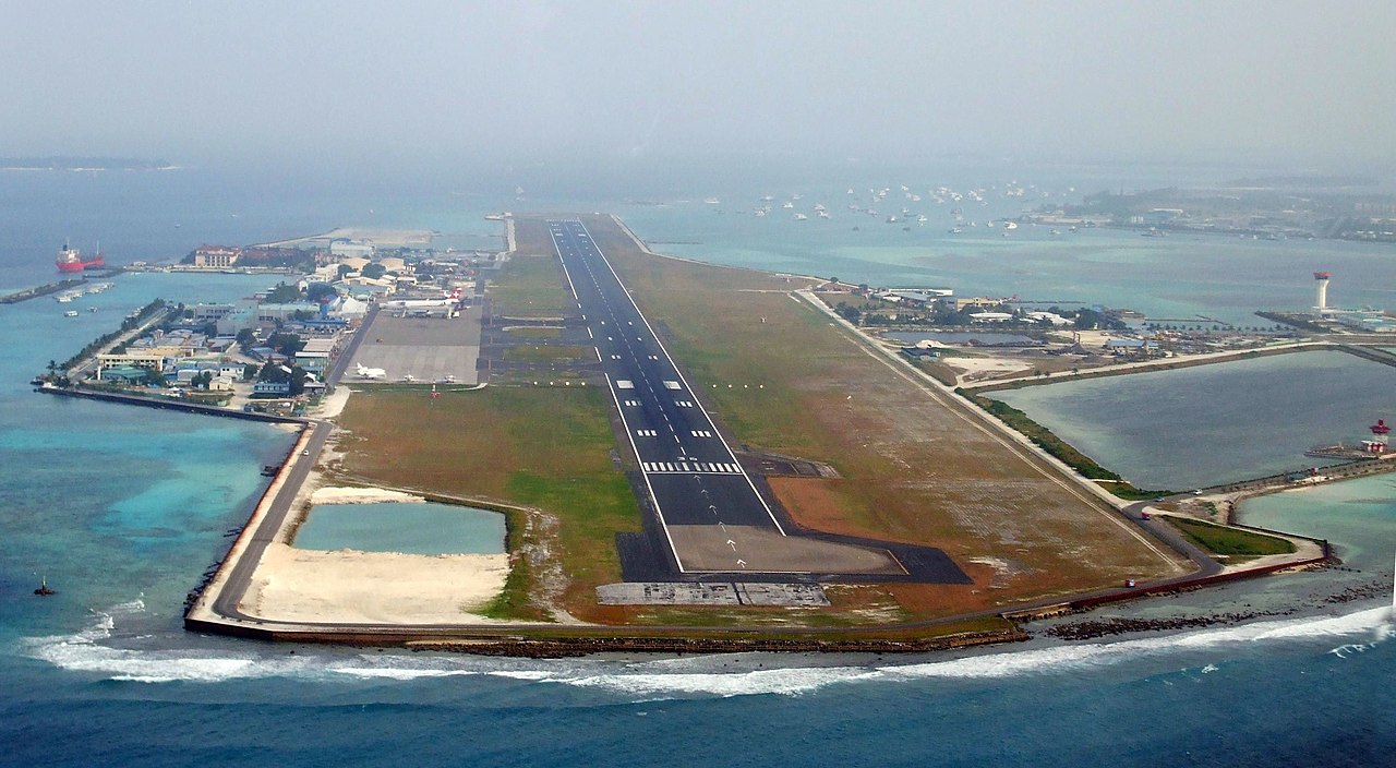
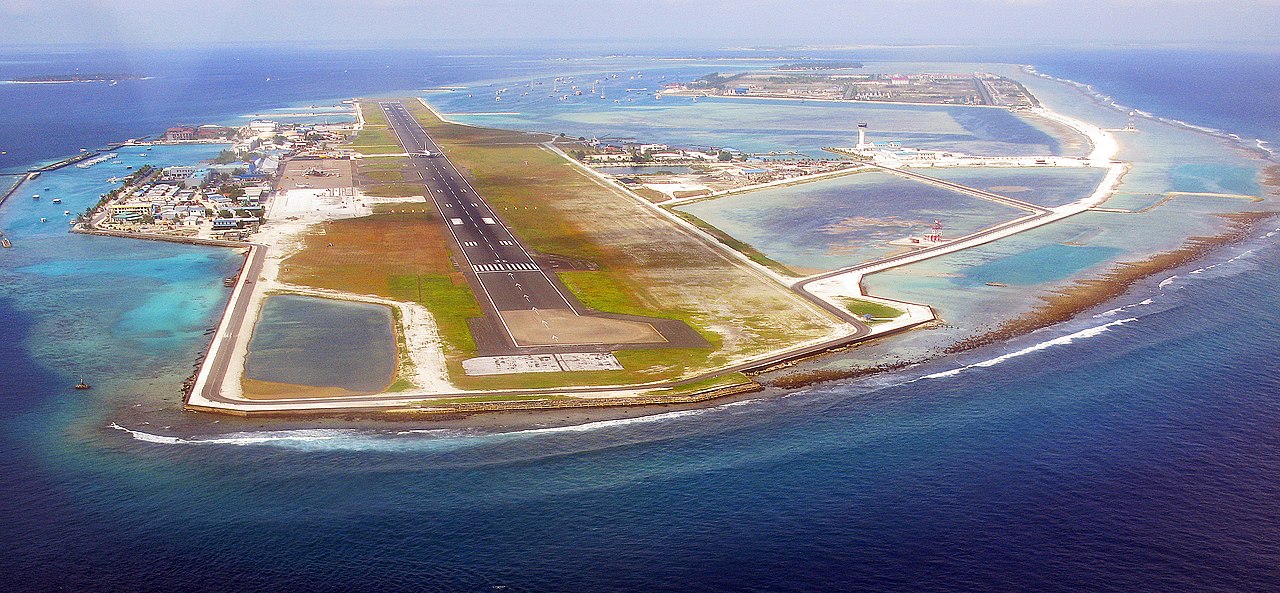
Té una base d'hidroavions i un ancoratge de vaixells. L'Aeroport Internacional de Malé és a l'illa veïna de Hulhule. El port s'ha expandit guanyant terra al mar. L'illa està totalment urbanitzada: la ciutat n'ocupa gairebé tota la superfície.
El 26 de desembre de 2004, va ocórrer un devastador terratrèmol a Sumatra que va provocar un tsunami a l'oceà Índic. Malé va ser afectada pel tsunami, que va inundar dues terceres parts de la ciutat.


Afegeix un nou comentari