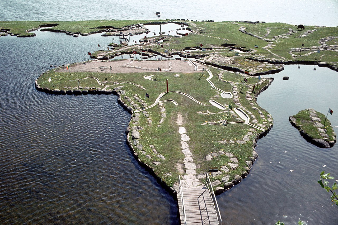
Verdenskortet ved Klejtrup Sø ( World Map at Lake Klejtrup ) หน้าแรก สแกนดิเนเวีย ประเทศเดนมาร์ก World Map at Lake Klejtrup Description แผนที่โลกที่ทะเลสาบ Klejtrup (เดนมาร์ก: Verdenskortet ved Klejtrup Sø) เป็นแผนที่โลกขนาดเล็กที่สร้างจากหินและหญ้าใน Klejtrup Sø ใกล้ หมู่บ้าน Klejtrup เทศบาล Viborg ประเทศเดนมาร์ก 2 1 0 0 0 0 ส่งข้อมูล Reset More information Photographies by: Zones ประเทศเดนมาร์ก สแกนดิเนเวีย Statistics: Position 4668 Statistics: Rank 180717 แสดงความเห็น Comment เกี่ยวกับรูปแบบข้อความ CAPTCHA Security Code 852739146Click/tap this sequence: 5663 Esta pregunta es para comprobar si usted es un visitante humano y prevenir envíos de spam automatizado. บันทึก Google street view Google street view Where can you sleep near World Map at Lake Klejtrup ? Booking.com What can you do near World Map at Lake Klejtrup ? Tollundmanden มนุษย์โทลลุนด์ Aalborghus Lindholm Høje Den Gamle By ARoS Aarhus Kunstmuseum Aarhus Ø Aarhus Docklands Møllehøj Samsø Labyrinten Jellingstenene Jelling stones Jelling stone ship Rubjerg Knude Fyr Rubjerg Knude Lighthouse Legoland Billund Resort LEGO House Lego House (Billund) Slotved Skov Råbjerg Mile Den tilsandede kirke Sand-Covered Church Ladbyskibet Ladby ship Odense โอเดนเซ Grenen View more on the map 8.736.069 visits in total, 407.503 Points of interest, 405 Destinations, 8.962 visits today.
 12:19, 28 July 2009 (UTC) - CC BY-SA 3.0")


. - CC BY-SA 3.0")


![[node:title]](/sites/default/files/styles/640x320/public/default_images/default_0.JPG.webp?itok=aqV9zhFR)


แสดงความเห็น