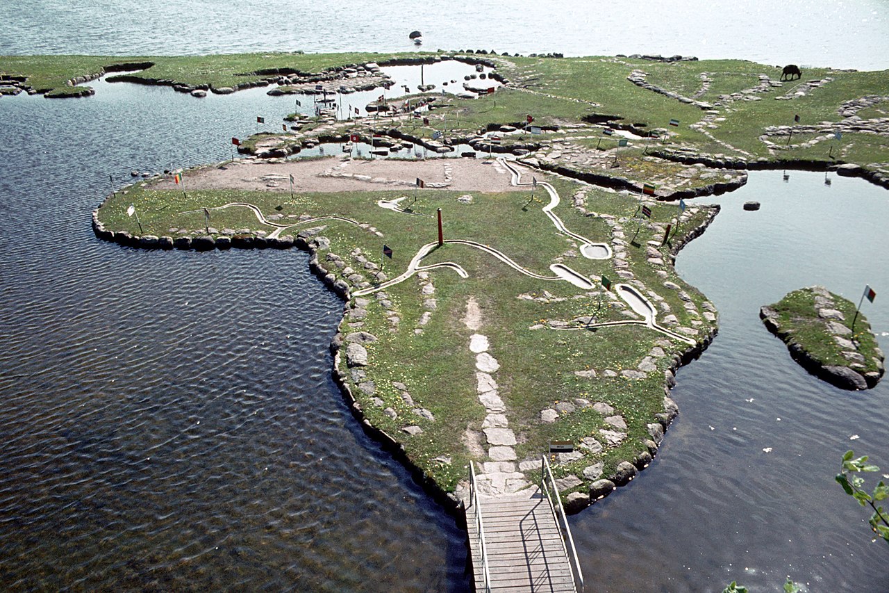
Verdenskortet ved Klejtrup Sø ( World Map at Lake Klejtrup ) 홈 스칸디나비아 덴마크 World Map at Lake Klejtrup Description Klejtrup 호수의 세계 지도(덴마크어: Verdenskortet ved Klejtrup Sø)는 인근 Klejtrup Sø에 있는 돌과 풀로 만든 미니어처 세계 지도입니다. 덴마크 Viborg Municipality Klejtrup 마을. 2 1 0 0 0 0 전송 재설정 More information Photographies by: Zones 덴마크 스칸디나비아 Statistics: Position 4668 Statistics: Rank 180717 댓글 달기 댓글 텍스트 형식 정보 보안 문자 보안 Code 158492367Click/tap this sequence: 9229 이 질문은 당신이 사람인지 로봇인지를 구분하기 위한 것입니다. 저장 Google street view Google street view Where can you sleep near World Map at Lake Klejtrup ? Booking.com What can you do near World Map at Lake Klejtrup ? Tollundmanden Tollund Man Aalborghus Lindholm Høje 린드홀름 구릉지 Den Gamle By ARoS Aarhus Kunstmuseum ARoS 오르후스 미술관 Aarhus Ø Aarhus Docklands Møllehøj Samsø Labyrinten Jellingstenene Jelling stones Jelling stone ship Rubjerg Knude Fyr Rubjerg Knude Lighthouse Legoland Billund Resort 레고랜드 빌룬 리조트 LEGO House Lego House (Billund) Slotved Skov Råbjerg Mile Den tilsandede kirke Sand-Covered Church Ladbyskibet Ladby ship Odense 오덴세 Grenen View more on the map 9.086.067 visits in total, 407.503 Points of interest, 405 목적지, 408 visits today.
 12:19, 28 July 2009 (UTC) - CC BY-SA 3.0")


. - CC BY-SA 3.0")


![[node:title]](/sites/default/files/styles/640x320/public/default_images/default_0.JPG.webp?itok=aqV9zhFR)


댓글 달기