주요 콘텐츠로 건너뛰기
Hola
Mon.cat
Toggle navigation
Main navigation
세계지도!
Map of the world!
Map of destinations
Great routes of the world!
Map of wonders of the world
UNESCO World Heritage Site
Map of Nature
Map of beaches
목적지
지도
알파벳순
Where to start?
달력
Planet
추가하다
User account menu
Create an account
로그인
Search a Plan
Search in this area
Search
Category
Destinations
Wonderfuls
Great routes of the world!
Nature
Roads
UNESCO
Beaches
Art
Geolocation » Top Bounding
Geolocation » Bottom Bounding
Geolocation » Left Bounding
Geolocation » Right Bounding
Geolocation » Centroid Latitude
최소
Max
Geolocation » Centroid Longitude
최소
Max
Apply
Covent Garden
코번트가든
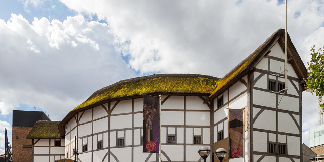
Shakespeare's Globe
Chinatown, London
Portobello Road
포토벨로로드
1854 Broad Street cholera outbreak
1854년 브로드 스트리트의 콜레라 유행
Millennium Bridge, London
밀레니엄 교
Camden Town
캠던타운
Notting Hill Gate
노팅힐게이트
Leadenhall Market
레든홀 마켓
Hampstead Heath
햄프스티드 히스
Brick Lane Market
Abbey Road, London
애비 로드 (런던)
Tranquil Vale
Harrods
해러즈
Electric Avenue
Drinking Fountain In South East Corner Of Tanner Street Recreation Ground
Drinking Fountain Outside Entrance Gates To Dulwich Old College
Christ Church Gardens Drinking Fountain
Drinking Fountain, Approximately 45 Metres South South East Of Church Of St Mary Magdalene
Drinking Fountain And Horse Trough
페이지 지정
첫 번째 페이지
« First
이전 페이지
‹‹
쪽
1
쪽
2
현재 페이지
3
쪽
4
쪽
5
쪽
6
쪽
7
쪽
8
쪽
9
…
다음 페이지
››
마지막 페이지
Last »


![[node:title]](/sites/default/files/styles/640x320/public/default_images/default_0.JPG?itok=nAKl_DR1)


