Grazer Schloßberg

( Schlossberg (Graz) )

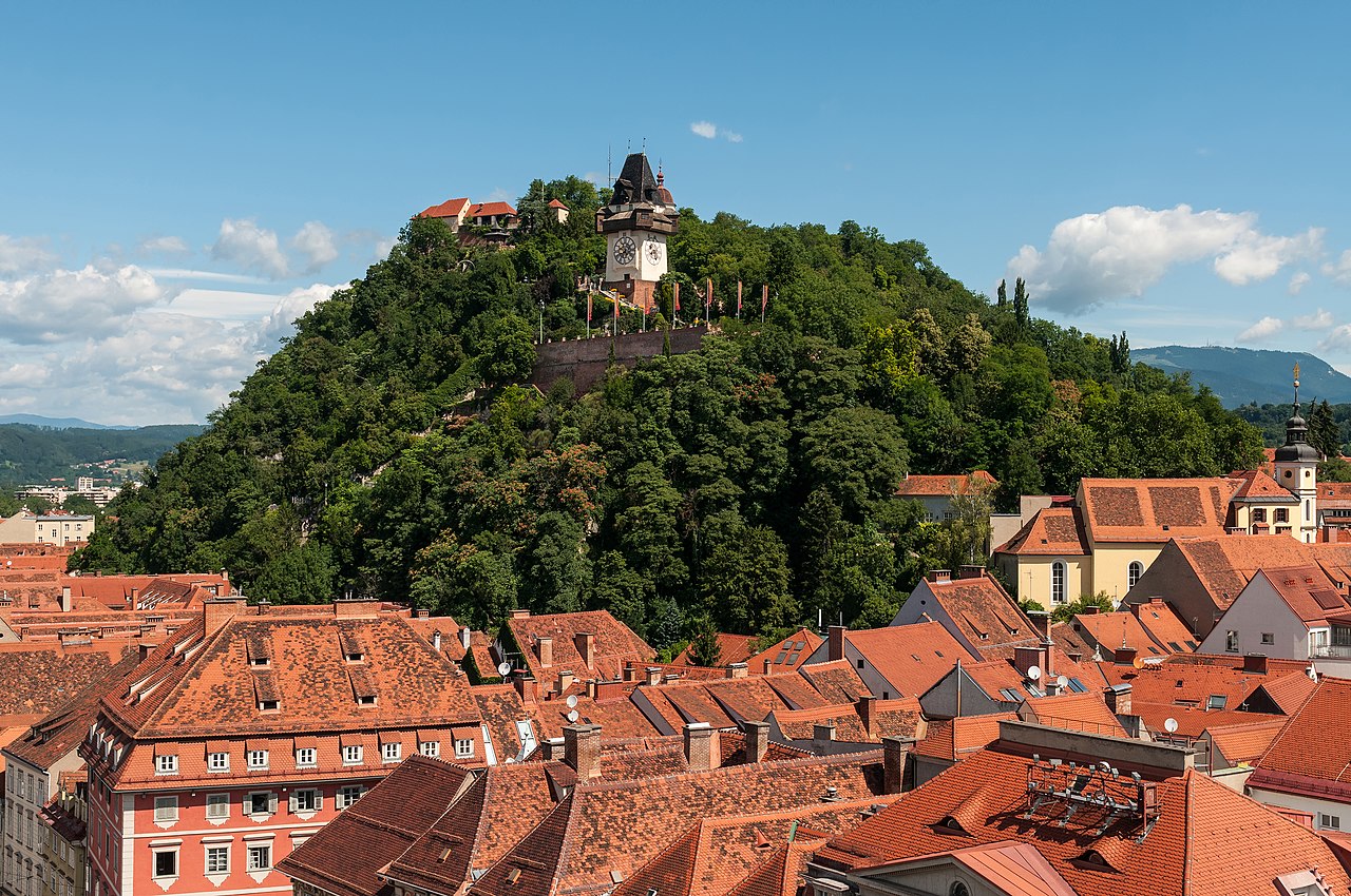
The Schlossberg (German: Schloßberg, lit. 'Castle Mountain') is a tree-clad hill and the site of a fortress in the centre of the city of Graz, Austria. The hill, at 473 metres (1,552 ft) above sea level, is now a public park and affords extensive views of the city. It is the site of several entertainment venues, cafés, and restaurants, and is managed by Holding Graz, the city-owned utility company.

 Schloßberg castle depicted in 1679.

The fortification of the Schlossberg goes back to at least the 10th century. In the mid-16th century, a 400 m (1,300 ft) long fortress was constructed by architects from the north of Italy. There are records of a cable-hauled lift being in use between 1528 and 1595 to move construction materials for the fortifications. The castle was never conquered, but it was largely demolished by Napoleonic forces under the Treaty of Schönbrunn of 1809. The clock tower (the Uhrturm) and bell tower (the Glockenturm) were spared after the people of Graz paid a ransom for their preservation.[1][2][3][4]

The remains of the castle were turned into a public park by Ludwig von Welden in 1839. The park contains the Uhrturm, the Glockenturm, a cistern (the Türkenbrunnen) and two bastions from the old castle. The Uhrturm is a recognisable icon for the city, and is unusual in that the clock's hands have opposite roles to the common notion, with the larger one marking hours while the smaller is for minutes. The Glockenturm contains Liesl, the heaviest bell in Graz.[1][2][5]

Near the Uhrturm is a café with views over the old town. Additionally, on the western side of the Schlossberg, there are two small cafés, one with table service and another with self-service. Next to the terminus of the funicular railway there is a hilltop restaurant with views of western Graz. In what was once the cellar of one of the ruined bastions is the Kasemattenbühne, an open-air stage for concerts and performances.[6][7]

Below the Schlossberg hill is an extensive system of tunnels, which were created during the Second World War to protect the civilian population of Graz from aerial bombing. Some of these tunnels, including a passage from Schlossbergplatz to Karmeliterplatz, are still accessible, but many are closed to the public.

^ a b Cite error: The named reference hgsbbh was invoked but never defined (see the help page). ^ a b Cite error: The named reference gts was invoked but never defined (see the help page). ^ "Schlossbergbahn Graz". seilbahngeschichte.de (in German). Archived from the original on 2010-08-22. Retrieved 2003-06-26. ^ Strobl, Alexander (8 July 2008). "A Short History of the City". Graz: Stadt Graz - Magistratsdirektion, Abteilung für Öffentlichkeitsarbeit. Archived from the original on 22 May 2010. Retrieved 2 July 2013. ^ "Grazer Uhrturm". Graz-Reise.de. Retrieved 2003-06-26. ^ "Die Gastronomie am Schlossberg" (in German). Holding Graz. Retrieved 2003-06-26. ^ "Die Kasemattenbühne" (in German). Holding Graz. Retrieved 2003-06-26.
Photographies by:
Statistics: Position
4188
Statistics: Rank
25525

Add new comment

Esta pregunta es para comprobar si usted es un visitante humano y prevenir envíos de spam automatizado.

Security
694875321Click/tap this sequence: 6817

Google street view

Where can you sleep near Schlossberg (Graz) ?

Booking.com
487.381 visits in total, 9.187 Points of interest, 404 Destinations, 7 visits today.